Vače - Zasavska Sveta gora (on the ridge)
Starting point: Vače (523 m)
| Latitude/Longitude: | 46,1194°N 14,8372°E |
| |
Route name: on the ridge
Walking time: 2 h 35 min
Difficulty: easy marked way
Elevation gain: 329 m
Elevation difference along the route: 470 m
Map:
Recommended equipment (summer):
Recommended equipment (winter): ice axe, crampons
Views: 4.150
 | 1 person like this post |
Access to starting point:
A) From the road Moravče - Zagorje ob Savi, in the settlement Kandrše we turn right (from the direction of Zagorje left) in the direction of Vače and GEOSS. There follows a few kilometers of ascent, on a smaller saddle, where a road towards GEOSS branches off to the right, we continue straight and descend to the settlement Vače, where we park by the cemetery or the parish church of St. Andrew.
B) From the road Ljubljana - Litija, in the settlement Spodnji Hotič we turn onto the road in the direction of the settlement Vače. There follows a few kilometers of ascent, where we follow the signs for Vače, when we arrive in the mentioned place we park by the parish church or a little further on a larger parking lot by the cemetery.
Route description:
From the parish church in Vače along the main road, we first descend towards the west, after a few dozen steps we arrive at a crossroads, where we continue left in the direction of the settlement Klenik. The easy descent ends a little further on, and the road with a view of the hill Slemik leads along the edge of a meadow, where we go past several sculptures. At the sign for the beginning or end of the settlement Klenik, the marking directs us left upwards onto a path that ascends to the nearby house, which we bypass on the left side.
Above the house, we step onto a cart track, which we follow slightly to the left, from it we soon go right onto a marked footpath. The path after a few minutes crosses a cart track, we continue on the marked path, which continues ascending through the forest. There follows a somewhat steeper ascent and in a few minutes of further walking we arrive at the church of the Holy Cross on Slemik.
From the top, we follow the signs for Sveta gora and begin descending along a cart track, where the path leads us past a larger chapel. There follows some more descent, where we follow the markings, along the path we notice some information boards of the archaeological path Vače. There follows crossing a meadow, then through the forest along a marked path we descend to a macadam road. We follow the road towards the east, along it we mostly ascend gently to moderately. During the ascent we go past a quarry, a few minutes further the road levels out and brings us to the settlement Vovše, where we go past a few houses, behind the houses we gradually begin descending. When we begin ascending again we go past two older houses, behind which there follows some steeper ascent through the forest. When the forest ends we arrive at the ecological farm and cheese dairy Vovše.
At the farm we go slightly left onto a marked footpath in the direction of Zasavska Sveta gora. There follows a shorter transverse ascent and we arrive at a marked junction, where the path splits.
We continue along the upper path (path along the ridge), which is somewhat longer (slightly right path along the slope), which transversely ascends to the ridge of Zasavska gora. Along the ridge we walk without major changes in elevation, when we approach the indistinct summit the path turns left onto the northern slopes, across which we gradually begin descending. During the descent the path leads us somewhat to the right, the shorter descent ends on a saddle, where the previously mentioned somewhat shorter path and an unmarked path along a cart track join us, which starts from the settlement Kostrevnica.
The path ahead ascends along a cart track, from it we temporarily go right onto a marked path, which soon returns to the cart track. We walk along the cart track for a short time, when it begins descending we continue slightly right onto a marked path, which splits a few steps further.
We continue right in the direction of the church on Zasavska Sveta gora (straight to Koča na Zasavski Sveti gori) and after a shorter steep ascent we step onto the summit, from which a beautiful view opens up, reaching all the way to the Alps.
Vače - Slemšek 0:30, Slemšek - Zasavska Sveta gora 2:05.
Description and pictures refer to the condition in March 2020.

Along the route: Sveti Križ (Slemšek) (680m), Vovše (685m)
Photos:
 1
1 2
2 3
3 4
4 5
5 6
6 7
7 8
8 9
9 10
10 11
11 12
12 13
13 14
14 15
15 16
16 17
17 18
18 19
19 20
20 21
21 22
22 23
23 24
24 25
25 26
26 27
27 28
28 29
29 30
30 31
31 32
32 33
33 34
34 35
35 36
36 37
37 38
38 39
39 40
40 41
41 42
42 43
43 44
44 45
45 46
46 47
47 48
48 49
49 50
50 51
51 52
52 53
53 54
54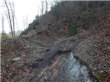 55
55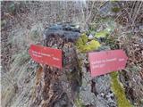 56
56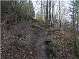 57
57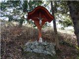 58
58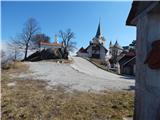 59
59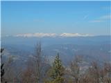 60
60 61
61
Discussion about the trip Vače - Zasavska Sveta gora (on the ridge)
|
| plaNinaPirsMajcen17. 03. 2025 20:37:39 |
Hi!
Yesterday I walked and filmed this trail:
https://youtu.be/SsCRIpkPCHY?si=yezLN0MEcDJkGTa9
I skipped the first part of the trail over the hill Slemik and went past Vaška situla. Above the Vovše dairy I chose the "slope" trail, but returned via this ridge trail. In the video I show that on the ridge, in case of return, keep to the left direction, I was first drawn to the more visible right path, where the markers quickly ran out.
Rhododendron is currently wonderful, I recommend 🌸🌸🌸
Best, Nina
|
|
|
To post a comment you must log in:
If you do not yet have a username, you must first
register.