V Koncu - Grintovec (via Streha)
Starting point: V Koncu (900 m)
| Latitude/Longitude: | 46,342°N 14,5682°E |
| |
Route name: via Streha
Walking time: 4 h 30 min
Difficulty: easy marked way
Elevation gain: 1658 m
Elevation difference along the route: 1658 m
Map: Kamniške in Savinjske Alpe 1:50.000
Recommended equipment (summer):
Recommended equipment (winter): ice axe, crampons
Views: 486.409
 | 21 people like this post |
Access to starting point:
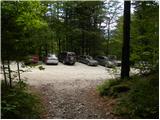
We drive to Kamnik and follow the road ahead towards the valley of Kamniška Bistrica. From the hut in Kamniška Bistrica, we continue driving on the forest road, which brings us higher up to a crossroad, where we continue straight (right Jermanca, starting point for Kamniško sedlo). The road then past Žagana peč brings us to the parking lot at the lower station of the cargo cableway to Kokrsko sedlo.
Driving from the mountain hut in Kamniška Bistrica to the parking lot V Koncu is now forbidden (traffic sign); this extends the path by less than an hour.
Route description:
From the parking lot at the cargo cableway, we head onto the initially gentle footpath towards Kokrsko sedlo. The path first crosses a belt of bushes, then enters a dense forest, where it begins to ascend more steeply. Higher up, the forest becomes somewhat sparser, opening up some views of the surrounding peaks. The path, which continues steeply ascending, brings us higher to two successive steel cables (entirely undemanding in the dry), after which we reach a pleasant rest area with a bench.
The path ahead returns to the dense forest, then begins turning to the right, where the steepness eases for a short while. A little further on, the path exits the forest, crosses an indistinct gully, and brings us to the avalanche-prone slopes below Kokrsko sedlo. Here the path turns slightly left and begins steeply ascending a mostly rocky slope. This quite strenuous path (due to the scree), running below the walls of Kalška gora to the left and the lesser-known Mali vrh to the right, finally brings us to Cojzova koča on Kokrsko sedlo amid ever finer views.
From the saddle, we continue right towards Grintovec and Kočna (left Kalški greben, straight down Kokra) along a path that steeply ascends briefly. The steepness soon eases, and after a few minutes of further walking, the path brings us to a marked junction, where we go straight towards Grintovec (slightly right Skuta). This is followed by a few minutes of traversing the slopes along a path turning increasingly to the left. After a slight descent, the path leads to more level terrain (lower part of Jam), then begins traversing up towards Streha of Grintovec. At the top of the traverse, we reach a marked junction, where we continue slightly right towards Grintovec (straight Kočna).
The path ahead ascends grassy slopes for a while longer, then gradually enters rockier terrain. A fairly steep path brings us higher to the south ridge of Grintovec, along and beside which we then ascend. We follow this increasingly scenic path, which is technically undemanding, all the way to the summit of Grintovec, reaching it after some 10 minutes of further walking.
In winter, the path is avalanche-prone, and there is also a high risk of slipping.
V Koncu - Kokrsko sedlo 2:15, Kokrsko sedlo - Grintovec 2:15.

Photos:
 1
1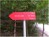 2
2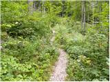 3
3 4
4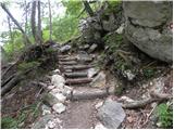 5
5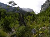 6
6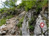 7
7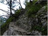 8
8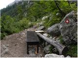 9
9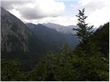 10
10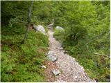 11
11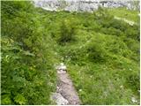 12
12 13
13 14
14 15
15 16
16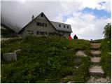 17
17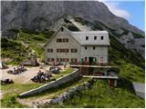 18
18 19
19 20
20 21
21 22
22 23
23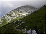 24
24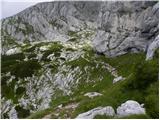 25
25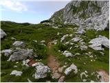 26
26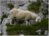 27
27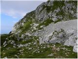 28
28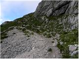 29
29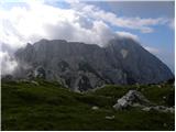 30
30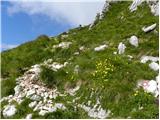 31
31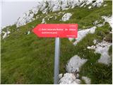 32
32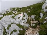 33
33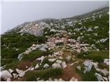 34
34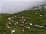 35
35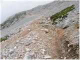 36
36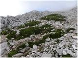 37
37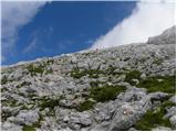 38
38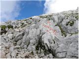 39
39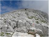 40
40 41
41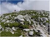 42
42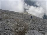 43
43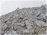 44
44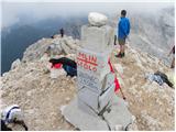 45
45
Discussion about the trip V Koncu - Grintovec (via Streha)
Show older messages
|
| Gost30. 07. 2006 |
When the organizers of the Grintovec run learned that Jonathan Wyatt would participate in this year's race, they hoped for a new record. Justifiably!The 33-year-old from New Zealand is a five-time world champion and record holder of numerous mountain runs. Since this year's extreme run with 1,957 meters of elevation also counts for the GP world series, Wyatt participated in the race starting in Kamniška Bistrica.Wyatt fulfilled the predictions and won with a time of 1:15:43. He improved the record of the Italian Marco Gaiardo by two minutes and 37 seconds! The best Slovenian was Simon Alič (1:23:15) in fourth place. Among women, the Czech Ana Picharova won (1:31:50).
source, www.rtvslo.si/
|
|
|
|
| Gost24. 05. 2007 |
Just for information and action of PZS and PD Kamnik: the logbook is full and half destroyed, as is the stamp pad...it wouldn't be bad if someone arranged this!
|
|
|
|
| proplayer11126. 07. 2008 |
I'm just wondering if it's suitable here also for less experienced ones and those who get dizzy in case of precipices
|
|
|
|
| nekdo126. 07. 2008 |
The path is easy. No precipices. But it's quite steep in places.
|
|
|
|
| Fazo9. 08. 2008 |
was there today, fun trail, but it grinds your knees from start to finish, mercilessly. and exactly once longer I took than the above poisoned winner....congratulations...
LP, Matevž
|
|
|
|
| kleja23. 09. 2008 |
I'm interested, what would it be like this weekend to go up there. Supposedly nice weather.
But does anyone know if there's any snow up there?
Best regards!
|
|
|
|
| Tadej23. 09. 2008 |
This morning it was lightly snowing in the Kamnik-Savinja Alps, so you can expect a little snow (just a few cm).
On shady slopes there is still some old snow (this applies to the approach from the north side).
|
|
|
|
| the dancer26. 12. 2008 |
Does anyone know the current situation here from the cable car to Kokrško sedlo and further via Streha to Grintovec  ? ?
|
|
|
|
| tilenm26. 12. 2008 |
We went on 20.12.2008 (Saturday), actually from Suhadolnik via Taško to Grintovec, but not past the saddle, but more directly. There is quite a lot of snow, but it was nicely consolidated (only about 10cm in the upper part), so no crampons needed.
LP,
|
|
|
|
| and1220. 04. 2009 |
Nice greeting
Since we plan to go to Grintavec this week and haven't been there yet, I'm interested in the conditions (is the path visible or not) and from which direction it's easiest to go up. Currently we plan the path from Kamniška Bistrica.
Lp
|
|
|
|
| MountainAvenger21. 04. 2009 |
Not Grintavec, not Grintevec, not Grinžnjevec, just nicely GrintOvec, don't know what causes such headaches (especially for Styrians). Easiest from Kamniška Bistrica, although from Suhadolnik is much nicer in my opinion.
|
|
|
|
| and1221. 04. 2009 |
sometimes one really wonders...
|
|
|
|
| trk21. 04. 2009 |
21.4.2009 Not Grintavec, not Grintevec, not Grinžnjevec, just nicely GrintOvec, don't know what causes such headaches (especially for Styrians). Easiest from Kamniška Bistrica, although from Suhadolnik is much nicer in my opinion .
Not čeprov, not čeprau, not čeprev, but it is čeprav.
|
|
|
|
| and1221. 04. 2009 |
ahhahahahahaha, good one mate
|
|
|
|
| MountainAvenger21. 04. 2009 |
Proper names are as they are and we don't change them, if I'm not writing in standard Slovenian you're in no position to proofread.
Go crash into a wall. End of discussion.
|
|
|
|
| dzeko8. 07. 2009 |
Which trail is the nicest to Grintovec... I would set off on Sunday?
|
|
|
|
| NUŠA9. 07. 2009 |
You'll wear out your knees from every direction. Once you've walked all the paths, you'll know which one is the nicest for you.
|
|
|
|
| zarko tusek10. 08. 2009 |
In two weeks I plan to go to Grintovec, the classic route, since it's my first time going up.
Two things interest me,
first, up to which point is it usual to go by car,
and second, how to arrange sleeping in Cojzova koča...
Is there a big crowd on weekends in August, or enough places.
Thank you.
|
|
|
|
| jozo10. 08. 2009 |
With a car you can reach the lower station of the cargo cable car where there is parking. As for accommodation in August, it's best to contact the hut keeper at Koča na Kokrskem sedlu, Mrs. Vida Proje, GSM 051 635 549, and reserve accommodation in advance. Regards
|
|
|
|
| jprim10. 08. 2009 |
Regarding the road, I'd say it's in worse condition from Žagane peči onwards, so it's better to leave the car there (if it's lower), to the cable car is just a few minutes' walk.
LP!
|
|
|
|
| zarko tusek11. 08. 2009 |
Just one more thing,
as it's my first time on this mountain, is there anything special I should pay particular attention to, apart from what's written here on hribi.net.
Or is the path on this section really based only on strength, without any technical details, since I have a companion who besides Velebit - sv. brdo, Vaganski vrh, Risnjak and some Croatian mountains hasn't experienced anything that could be technically more demanding (no problems with strength and fitness).
Thanks.
|
|
|
|
| jozo12. 08. 2009 |
The path you're asking about is technically completely undemanding, but it does require considerable fitness, as you have to overcome 1658 meters of elevation gain, which is not insignificant. However, with nice weather at the summit, the effort will surely be rewarded. Go boldly! Best regards
|
|
|
|
| velikanka12. 08. 2009 |
Hello,
tomorrow I'm heading to Grintovec (via Streha) along a technically undemanding path. Since it's my first time, can this path be compared in terms of difficulty to the one to Stol via Zabreška path?
Thanks and best regards!
|
|
|
|
| jprim12. 08. 2009 |
Not at all - the path to Grintovec (I've already hiked three paths to Stol, soon also the climbing one) is of course more demanding, especially the ascent to Kokrsko sedlo requires quite some fitness, but no waving now, you can get there slowly too, from the saddle onwards the path is long, but no longer so intense in terms of gaining height, the path goes in zigzags, so whether you go or not ... to the top.
Have a nice day and full of enjoyment.
Best regards!
|
|
|
|
| polh13. 08. 2009 |
Nice trip!
The only thing that bothers me at the top of Grintavec is the half-collapsed concrete pillar. It seems to me it doesn't fit in the natural environment and doesn't resemble anything. It would be nice to put it in a museum 
|
|
|
|
| gabi14. 08. 2009 |
This half-collapsed concrete pillar has been like that for some years and the responsible association could really take care of it.
|
|
|
|
| Reny14. 08. 2009 |
Yes, that pillar is really something special, but let's leave it, as it's a nice achievement to hike this path to the summit in one go  ; I enjoyed the ascent, since there was no sun from the saddle and some fog cleared up so I could finally see parts of the valley and surrounding hills... Is this the peak with the most fog? When I look at it daily from home, it always has some hat (cloud) on it ; I enjoyed the ascent, since there was no sun from the saddle and some fog cleared up so I could finally see parts of the valley and surrounding hills... Is this the peak with the most fog? When I look at it daily from home, it always has some hat (cloud) on it  The descent in the lower half caused me knee pains... otherwise one of the easier paths to such height. The descent in the lower half caused me knee pains... otherwise one of the easier paths to such height.
|
|
|
|
| Reny14. 08. 2009 |
One remark: if anyone responsible reads this: from the direction of Češka koča hikers mentioned that a peg is missing below the summit and it's a bit complicated to cross-climb... LP
|
|
|
|
| velikanka16. 08. 2009 |
From Žagana peč the road is not in bad condition at all... this Saturday I was on Grintovec, the weather was gorgeous, visibility wonderful, all the effort was really rewarded!
|
|
|
|
| zvonko21. 04. 2010 |
HELLO
ON TUESDAY I PLAN TO GO TO GRINTOVEC, SO I'M WONDERING IF ANYONE HAS ANY INFORMATION ON THE SNOW CONDITIONS?
BEST REGARDS ZVONKO
|
|
|
|
| Klin21. 04. 2010 |
The Streha of Grintovec is still completely covered in snow, so an ice axe and crampons are mandatory.
|
|
|
|
| drejči23. 04. 2010 |
What's the condition of the road to the cargo cable car, can you get there normally with a passenger car?? lp
|
|
|
|
| Lenko2. 07. 2010 |
Hello,
has anyone perhaps been up this path last week? Any peculiarities? Thanks for the reply.
Best regards
|
|
|
|
| klm2. 07. 2010 |
I went to Grintovec via this path on Tuesday. I noticed no peculiarities. On the northeast side of the summit there's a small patch of snow, so you might slip into it. Otherwise cheerfully uphill and you're there!
|
|
|
|
| Lisa9. 08. 2010 |
Yesterday we came across a dead sheep on the path  . Approx. 10 minutes after the sign where you branch left to Grintovec. The carcass is fairly fresh. If anyone knows who to notify about this, please do so, as a whole bunch of flies has already started gathering around...grrr, very unpleasant. The path itself is ok, the top was all shrouded in fog, view rating 1 , so next time. . Approx. 10 minutes after the sign where you branch left to Grintovec. The carcass is fairly fresh. If anyone knows who to notify about this, please do so, as a whole bunch of flies has already started gathering around...grrr, very unpleasant. The path itself is ok, the top was all shrouded in fog, view rating 1 , so next time.
Regards
|
|
|
|
| petrah77722. 08. 2010 |
Today a nice and sunny day attracted a large number of hikers to Grintovec, all the effort was rewarded with a magnificent view of the surrounding peaks...
|
|
|
|
| Stingray30. 08. 2010 |
Yesterday I climbed Grintovec. Attaching GPS track image of the above described path in Google Earth for better idea (maybe useful to someone):
PICTURE
Some additional pictures from the path are HERE
|
|
|
|
| pelican8. 10. 2010 |
Is it possible to drive by car to Konec?
What's the situation at Grintovec?
|
|
|
|
| tol9. 10. 2010 |
You can nicely drive by car to Žagana peči, further on it's quite difficult because there are quite big holes. Praise to all who don't know how to drive on soft and unpaved surface.
Otherwise, if you don't know yet, you can get a fine, because the road is now closed with traffic signage, except for residents.
|
|
|
|
| jablan28. 10. 2010 |
Has anyone been there in the last few days since the snow on Grintovec? What are the conditions like?
|
|
|
|
| urbann16. 01. 2011 |
Went on this trail today. Crampons almost essential from Cojzove koča onwards, especially on descent. I enjoyed it immensely, otherwise conditions like end of April.
|
|
|
|
| Primoz_29. 01. 2011 |
how about the road from Kamniška Bistrica to the goods cableway?
|
|
|
|
| Primoz_31. 01. 2011 |
road checked ok
|
|
|
|
| Parkeljc11. 02. 2011 |
Today first time up, path initially dry, then icy then packed snow. To Cojzova koča without crampons. For summit need to be well prepared, snow from hut south-facing slippery even with crampons. Top real fairy tale... From start to summit and back 4 hrs 30 min.
|
|
|
|
| pelican11. 02. 2011 |
Still any snow to Kokrški?
|
|
|
|
| Parkeljc12. 02. 2011 |
No snow only from the lower cable car station, then the path is slightly icy, about two thirds are snowy, right below the saddle there's about half a meter of snow or more. In the snow there's a wide track of compacted footsteps. Downhill it's better to take untracked snow - tested! I don't recommend descending via the gully, as there's quite a bit of snow at first, later there's none and it's quite dangerous for sprains, dislocations,... I managed to get to the road, but the snow in the gully is only halfway up the gully..
|
|
|
|
| gornica22. 06. 2011 |
I'm wondering if anyone has been to Grintovec from Suhadolnik over Streha recently? What's the path like? We plan to go to the top of Grintovec via this path on Sunday. Thanks for the information and best regards to all who visit this forum and our beautiful mountains.
|
|
|
|
| nata2422. 06. 2011 |
Yesterday afternoon I was up there. The trail is completely dry and without issues. Good luck!
|
|
|
|
| gornica23. 06. 2011 |
Nata, thanks for the information, good luck to you too and safe steps.
|
|
|
|
| franjo6613. 07. 2011 |
IS ANYONE GOING UP AND NEEDS COMPANY?
I DON'T DARE GO ALONE, EVERYTHING IS UNKNOWN TO ME AND I REALLY WANT TO REACH THE SUMMIT.
|
|
|
|
| alpin14. 07. 2011 |
Franjo66; go the next Sunday 24.7 up, when there will be plenty to Grintovec. Then there will be quite a large number of us up the whole path to the summit, so no need to fear getting lost.
L.P.
|
|
|
|
| franjo6614. 07. 2011 |
THANKS FOR THE INFO!
|
|
|
|
| franjo6617. 07. 2011 |
And even if it rains, we'll still go to Grintovec!
|
|
|
|
| danicak24. 07. 2011 |
I read all the comments, my daughter and I are planning to go to Grintavec this week. I'm only worried about the road from Kamniška Bistrica to the cable car station (how long is that on foot?), it's not a problem if the road is bad, I'm just a bit afraid of the very steep forest road without barriers, I admit that I barely "survived" the drive to the Podvežak parking lot (destination Korošica), and even worse back, because it's very steep.
Thanks for the opinions.
|
|
|
|
| tol24. 07. 2011 |
The steepness on this path is not a problem, the problem is the ruts made by inexperienced drivers (they press the gas too hard, or brake abruptly).
If you leave the car at the intersection for Jermanca, you are just a step away from the Material Cableway, thus saving yourself the tank-like drive on the "polygonal" road.
|
|
|
|
| rjudnic24. 07. 2011 |
How is it now with the driving ban to the lower station of the material cableway? Is it just on the sign, or do municipal wardens also issue fines?
|
|
|
|
| John24. 07. 2011 |
I have never received any fine for parking at the lower station of the cableway, but it was about a year ago.
|
|
|
|
| danicak25. 07. 2011 |
thanks a lot for the info.
|
|
|
|
| jjakop14. 08. 2011 |
can someone tell me what's the difference in the ascent to Grintovec or to Storžič ŽRELO )?
|
|
|
|
| tol4. 08. 2011 |
from K.B. almost 2000
If you know how to register on hribi.net, you'll know how to look at the map (say geopedia.si)
|
|
|
|
| pohodnik384. 08. 2011 |
jjakop1@ to Grintovec you have three paths if you want adrenaline you can go up via Mlinarsko sedlo or Dolška škrbina, the easiest-technically is from Kokrsko sedlo via Streha where you only need fitness, no exposed sections
|
|
|
|
| krasovc5. 08. 2011 |
The nicest approach goes via the foot. It's not marked but traceable. Along the path towards the bivouac, 15 minutes, then up to the left. A little attention and you can catch the path.. But it's more for experienced ones, they say
|
|
|
|
| pohodnik385. 08. 2011 |
yes I know via Dolge stene I looked at it last time to try next time, but since it's not marked I didn't mention it before
|
|
|
|
| jjakop16. 08. 2011 |
pohodnik38 thanks for the help.
yesterday I went via STREHA, next time I'll go the harder path.
|
|
|
|
| jvali9. 08. 2011 |
kokrsko sedlo-grintovec: at the junction, above cojzova koča, where left is the path to grintovec, right is skuta-very demanding path-that path, there in my opinion a sign is missing that this same path-skuta leads to the bivouac via mlinarsko sedlo to grintovec. that's why my husband and I missed the direction, followed the grintovec sign and climbed the easier path, although we had planned the harder-more demanding path (pegs, cables, so adrenaline). an additional sign there would not be superfluous. we'll have to go there again, via suhadolnik to kokrsko and then bivouac-mlinarsko sedlo, and down via streha.
|
|
|
|
| slo9. 08. 2011 |
Perhaps there could really be a separate sign there too. Otherwise, in the path description "V Koncu - Grintovec (via Kokrsko and Mlinarsko sedlo)" at picture 24 it says that at this junction we continue in the direction of Skuta.
|
|
|
|
| jvali9. 08. 2011 |
Personally, I think the marking would definitely not be superfluous and a nice circular path would be offered to hikers. Only an addition is needed: bivak-mlinarsko sedlo-grintovec-difficult path, 2.5 hours or whatever. Then one can decide more easily when there. It is something else to follow markings when on the path than at home in front of the computer. Somehow you expect all possible paths or junctions to be listed too.
|
|
|
|
| Janez Seliškar10. 08. 2011 |
Regarding the topic title, only one and only marked path is possible: V Koncu-Kokrsko sedlo-Grintovec (via streho).
|
|
|
|
| čmrlj10. 08. 2011 |
please nicely anyone, tell me if the trail to Cojzova koča is passable also for a dog, or if there is any dangerous section on the trail, especially vertical, that wouldn't be suitable..
|
|
|
|
| garmont10. 08. 2011 |
Based on the above comments, I can't shake the feeling that too many hikers go to the mountains without a map of the terrain they want to move in. Just a quick glance at the map (Grintovci 1:25000) would solve the dilemma.
As for the described trail to Grintovec, it is completely suitable for a dog.
Lp
|
|
|
|
| jvali12. 08. 2011 |
garmont: yes, since then we have a map in the backpack. you are right.
|
|
|
|
| grand9. 09. 2011 |
On Saturday we're heading to Grintovec. Since there were some comments about the closed road or that driving is only allowed for residents, I'm interested how far I can go by car and how much longer the path takes? Lp
|
|
|
|
| Fusion12. 09. 2011 |
The sign at the spring really prohibits the road, but probably no one follows it, as all parking lots are full. At the junctions, you need to keep left.
I was yesterday on Grintovec and was at the parking lot at 6 am, half of the parking was already occupied.
The road is normally drivable even with passenger cars, but it is indeed a bit damaged in a few places. I watched a bit how some drive and it's no wonder the condition is like that.
Yesterday there was quite a crowd on the trail as well as on Kokrsko sedlo and on Grintovec.
At the end, it was best to wash a bit in the ice-cold spring of Kamniška Bistrica
|
|
|
|
| jprim12. 09. 2011 |
Hey, Fusion, you write about prohibited driving ... didn't you see the no swimming sign, now you've sprinkled some ashes on yourself - as they say.
|
|
|
|
| Fusion12. 09. 2011 |
hmmmm, the sign at the spring I really didn't see
I just cooled my feet a bit oops!
Thnx, next time I'll know to go a few meters lower
|
|
|
|
| jprim12. 09. 2011 |
Hey, hey it's so close to the road that you could crash into it with the car, what were you looking at, if there was some girl bathing somewhere.
|
|
|
|
| klada3. 10. 2011 |
Yesterday I conquered this jewel of the Kamnik-Savinja Alps for the first time. The feelings are indescribable. The hiking path is beautiful and well maintained. Only the road to the parking lot at the lower station of the cargo cable car is in poor condition for the last 50m. I advise parking cars lower.
I will use the opportunity to urge the portal editors to add a helmet under "Recommended equipment (summer)". Yesterday while ascending the gravelly rocky slope below Mali vrh, 100m below the hut at Kokrsko sedlo, an unpleasant incident happened to my colleagues who were 100m behind me. Rocks about 10cm in size started falling on them. Luckily they missed them by half a meter. And nothing happened to anyone. If they had known that a helmet is recommended on this path, they would surely have taken them. As far as I saw other hikers, none had a helmet, so I assume the rockfall was quite infrequent... Anyway: I hope my call for a recommended helmet will save someone injuries and a broken head.
The offer and friendliness of the hosts in the hut at Kokrsko sedlo is excellent.
In summary: we recharged our batteries. For about two weeks say. ... Really a great trip!
|
|
|
|
| klada4. 10. 2011 |
Look, my comment was not meant as yet another sensationalist comment, following the example of Slovenian news portals, which are usually accompanied by words like "shocking", "tragic", "unheard of" etc. ... It was meant purely as a recommendation to other hikers to be cautious. Since I regularly use the hribi.net portal to get information about conditions in the mountains, this time I felt like contributing to the community myself - to warn other hikers to be careful on the gravel avalanche slope under Kokrsko sedlo. And, as I wrote, if someone had recommended helmets to us, we definitely wouldn't have left them at home this Sunday ... That's it.
The trail, I agree, is really pleasant and easy.
|
|
|
|
| _sandra_4. 10. 2011 |
I was at Grintovec 14 days ago, luckily there was no falling rocks, but caution is not superfluous, I agree. As for the trail to Grintovec, it drags a bit at the end and really requires some fitness, so the trail is not exactly easy, but it's true that it depends on the person. 
|
|
|
|
| jax4. 10. 2011 |
Well, here I have to comment:
rocks about 10 cm in size, you say? Here even a helmet wouldn't help at all. Let everyone decide for themselves.
|
|
|
|
| Keko4. 10. 2011 |
I do not agree at all with the statement that a helmet doesn't help with a 10 cm diameter stone. It depends greatly on its speed, the angle at which it hits the helmet. In any case, you'll fare better with a helmet on your head than without it, since the helmet itself absorbs part of the energy, and the rest is evenly distributed over the entire skull. Even airbags in a car at 200 km/h don't help, yet everyone installs them, because most accidents happen at lower speeds, where the airbag is very effective. Same with helmet and falling rocks.
|
|
|
|
| katty4. 10. 2011 |
Lih tomorrow we're going with pelican-ko up this trail. And now I'm wondering, should I take the helmet with me or not? I otherwise think no, because it's just a trail without some wire protections and similar things.
|
|
|
|
| GregorC4. 10. 2011 |
Well, such a nuisance can happen on any trail, so I think helmet is not necessary on this trail.
|
|
|
|
| klada4. 10. 2011 |
Hehe, some really play the first ball. Don't be so uptight, come on ... Relax a bit, go to some mountain to enjoy the view, drink tea in the hut, and the world will be nicer.
Katty, look: Three weeks ago I went to Brana (direction: Logarska dolina - Okrešelj - Kamniško sedlo - Brana). On that trail, helmet is recommended for certain sections. And I took it with me. But no stone hit my head on the 'risky' sections. And I'm glad it didn't. ... Now the question: Am I angry that no stone hit me? - No. Was I sorry that I carried the helmet in vain for that hour, that my head is still hot today when I remember how it boiled? - No. Was I in a bad mood because the helmet wasn't needed most of the trail and took space in my backpack? - No. Will I take the helmet again next time I go to Brana from Log. direction? - Definitely. Will I take a helmet for the last part of the trail to Kokrsko sedlo next time? - Definitely ... From my hiking experiences in our mountains, you mostly don't need a helmet, but there are certain trail sections here and there, e.g. steep scree, crumbly rocky overhangs, short 'via ferratas', etc., where it's smart to smartly protect your smarts ... In 99.99% of cases you don't need the helmet at all. Similar to the seatbelt in the car. In those 0.01% cases you want it on your head. Because it can mean the difference between life and death, between carefree life and disability.
That even the best helmet can't protect you from falling meter-sized rocks is crystal clear to me too. ... But Keko already touched on that with the analogy about airbags at 200km/h, so I won't ...
When I helplessly watched stones falling between the two female colleagues, I tell you: I won't wish that on anyone. On the way home I pondered that I must warn others about it. That's all I wanted to convey!
Will you decide whether to take the helmet or not? - That's completely your decision. Ten more people can advise you that it is/isn't necessary, but in the end the decision is yours. My decision was to urge you other hikers to be cautious.
|
|
|
|
| andrej784. 10. 2011 |
Well said Klada, I sign under it!
|
|
|
|
| Marky6. 10. 2011 |
If the weather isn't too bad, I'm thinking of heading up this route to the summit this Saturday.
Is anyone else interested?
Planned "ascent" on Saturday 8.10.2011 at 6:00 "V koncu"..
|
|
|
|
| pikec16. 10. 2011 |
I'll do Sunday, a bit earlier
|
|
|
|
| katty6. 10. 2011 |
I did this route just yesterday, only the big elevation gain . The tour is great otherwise, full of awesome views. . The tour is great otherwise, full of awesome views.
Good luck to both.
|
|
|
|
| Marky6. 10. 2011 |
Katty, yes I know there's big elevation gain, but personally it doesn't bother me. Last week I did similar height in 3h.
I just hope the weather will be ok, or at least enough to enjoy the views.
Pikec1, when is that earlier?
|
|
|
|
| pohodnik386. 10. 2011 |
hm not sure if Saturday will already be suitable for Grintovec, namely tomorrow Friday it's supposed to snow up to 1000m, forecast up to 20cm snow on peaks above 2000m...I'd rather wait
|
|
|
|
| Marky7. 10. 2011 |
Tone, if it's too much or if a lot of snow falls (read approx. 20cm) I'd rather stay home, better.. hehe.. If not, it might happen that I'll go up.
Does anyone know where it's possible to see what the conditions are like up there (regarding snow etc.)?
|
|
|
|
| pelican7. 10. 2011 |
Best to call the hut keeper at Cojzova koča, she should still be up there until the end of the week.
|
|
|
|
| RetardVeverca7. 10. 2011 |
I'm also planning to go up tomorrow with a friend, but today over 50cm of snow should have fallen at the top, at 2000m around 40cm. So we'll try, if it looks too much we'll turn back and go to Stol
|
|
|
|
| Marky7. 10. 2011 |
Yeah nice nice.. but you probably have your winter "gear" so to speak..
Well, if you go up, let me know how it is, and maybe I'll go up on Sunday..
Safe on the path..
|
|
|
|
| RetardVeverca8. 10. 2011 |
Well today I went to Stol and it was gorgeous, clear weather, new snow around 20 cm, nothing tracked but the snow is extremely light and it's a real pleasure to break trail. So heading to Grintovec tomorrow morning as sun forecast all day. If you decide to go we'll meet Yes, ice axe, crampons, gaiters necessary.
|
|
|
|
| RetardVeverca10. 10. 2011 |
Today I did the ascent to Grintovec, it was unforgettable Extremely strenuous, snow on Kokrski snežnik around 20 cm, towards the summit about 40 cm. Light and unfrozen snow. Right at the top (last 50m elevation) there was occasional fog and on the entire roof there were moderately strong gusts of wind, otherwise nice weather.
|
|
|
|
| pikec110. 10. 2011 |
Oh, you mean yesterday? You think there was occasional fog? I have a view of Grintovec and it was capped all day
Best regards
|
|
|
|
| RetardVeverca10. 10. 2011 |
Yes, yesterday. I wrote already after midnight Yes I was up there, so the cap was really only on the top 100m elevation and my friend and I waited at the hut on Kokrski for about an hour because of that and it cleared up and when we went to the top it was as I wrote only the last 50m, and even that was swirling so that at moments you could see all directions clearly from the top. I'll post pictures soon, check them out yourself
|
|
|
|
| Marky10. 10. 2011 |
Nice variant.. Maybe a bit sorry that I didn't climb to the top myself. Well, given that now for the coming weekend they forecast nice weather, I hope I'll get up there too.. hehe
|
|
|
|
| Marky12. 10. 2011 |
Wow.. what a good variant.. You've documented it nicely
I'm going up on Saturday (15.10) or Sunday (16.10), to see how it will be.. weather should be nice (sunny) so..
If anyone else wants to go, company is always welcome.. hehe
|
|
|
|
| CarpeDiem24713. 10. 2011 |
Maybe in two days the snow will melt, you never know. The southern side looked pretty ok yesterday.
|
|
|
|
| Marky13. 10. 2011 |
Kucelj, what do you mean by summer gear?
I have a feeling that with a bit better summer gear (at least good boots and warm clothes) it shouldn't be a problem yet, but don't take my word for it..
As much as I look at webcams (Kredarica) there's hardly any snow up there anymore, so..
|
|
|
|
| bostjanp13. 10. 2011 |
If any snow falls on the hills tonight, the recommended equipment is only winter gear: crampons, ice axe, possibly gaiters. Don't fool around on slopes with such steepness with summer gear, especially if there's snow. Because if you slip once and it starts sliding.... it's not cool at all. Use your brains in your hands and feet and good luck.
|
|
|
|
| Marky13. 10. 2011 |
Boštjan, thanks.. luckily I have everything for the winter ascent, so snow can't touch me.. hehe..
You're definitely right.. no point in exposing oneself, because it's no joke here!
|
|
|
|
| Lunatic14. 10. 2011 |
But you need to know how to use winter gear too Otherwise there's no room for error
|
|
|
|
| pohodnik3814. 10. 2011 |
I completely agree with @Lunatic
|
|
|
|
| bostjanp15. 10. 2011 |
Does anyone have the latest information for today, 15.10.2011, what are the conditions for Grintovec? What equipment is recommended from Cojzova koča onwards? No snow has fallen in the last week, from the valley only small patches of snow are visible, so I'm wondering what the path to the top is like?
Thanks
LP
B
|
|
|
|
| panda15. 10. 2011 |
Very instructive, I watched all the army videos. One more reason not to go to the mountains in winter, because I get cold easily.
|
|
|
|
| pohodnik3815. 10. 2011 |
@panda we're already two, I won't spend a fortune on winter gear just to freeze up there in the heights, I've enjoyed lots of mountain beauty over the summer... maybe over winter some peak over 1500m where it's nice too, but when summer comes again there'll be action as usual
|
|
|
|
| JusAvgustin15. 10. 2011 |
You have no idea what you're missing...
|
|
|
|
| Marky19. 10. 2011 |
There, I finally made it
On Sunday I decided to head to Grintovec alone and it was really a super decision. Weather was ideal, conditions too, quite a few hikers, snow only a trace, so even summer hiking boots would suffice.. Before starting I met one hiker with whom we headed to the summit together.
Really super tour.. Pictures from the ascent can be viewed at M-foto.si
|
|
|
|
| ljubitelj gora19. 10. 2011 |
You can also add pictures to the conditions forum in the appropriate thread, there are already quite a few open ones, first enter the text, and then go back under your posted message on the forum and add the pictures.
|
|
|
|
| pelican19. 10. 2011 |
Marky - really cool pics...
|
|
|
|
| katty19. 10. 2011 |
Yes really, you nicely showed us your trip from Sunday. Bravo!
|
|
|
|
| MrvdMr-8217. 01. 2012 |
Hi, I'm interested in the conditions from the hut in Kamniška Bistrica to the lower cable car station? Thanks in advance for answers
|
|
|
|
| Flora117. 01. 2012 |
The road is mostly drivable for a passenger car up to the first boulder at Žagana peči. No snow and/or ice. Beyond the boulder there are deep potholes, which you can drive through even with a passenger car, but don't spare it. On foot, the path is normally passable.
|
|
|
|
| MrvdMr-8219. 01. 2012 |
Flora1 thanks for the info. Yesterday I was at the summit, the weather was wonderful, the view too
|
|
|
|
| Gurenski pohodnk20. 03. 2012 |
Has anyone maybe been up there in March?
What are the conditions like, can one reach Cojzova koča and continue to Grintovec normally and safely?
|
|
|
|
| maucec4020. 03. 2012 |
Yes Gurenc, go check the current conditions. Quite a few have been up to Grintovec recently!
|
|
|
|
| martinza21. 03. 2012 |
Grintovec was passable on Saturday without winter gear. Only on the way down did I have an ice axe in hand just in case.
|
|
|
|
| Gurenski pohodnk21. 03. 2012 |
Aha. Well super. Better check twice. Current conditions - hmhhm, your information - invaluable
Meanwhile we conquered Ojstrica via Korošica. A local said no problem for the car to the starting point - well then it got stuck pretty quickly as the road was all icy
Safe steps to everyone.
|
|
|
|
| novinsekp21. 03. 2012 |
We were up there on 15.3. (with crampons and ice axe). Conditions may have changed, but I wouldn't go up without winter gear. There's still quite a bit of snow below Cojzova koča, from Cojzova koča partially bare, but more snow towards the summit, requiring caution. Decide for yourselves... Winter is still in the high mountains...
|
|
|
|
| martinza21. 03. 2012 |
I also had all winter gear with me, but the snow was so firm that it wasn't needed. Still, definitely take winter gear on the route - you never know.
|
|
|
|
| Alni9. 07. 2012 |
Has anyone been on this trail recently?
How is the trail length now? Where can one park?
Does the 4 hours 30 min data still hold, or is it necessary to add another hour as written in the description??
|
|
|
|
| _sandra_9. 07. 2012 |
@Alni: you can park at Dom v Kamniški Bistrici or at Žagani peči; from Žagani peči to Grintovec with short breaks it's 4 hours of hiking, no more
|
|
|
|
| Alni9. 07. 2012 |
Thanks Sandra.
Is the trail demanding for an average to beginner hiker at this time? Is there any abyss, dangerous crossing, dangerous ascent?
Yesterday on the way to the top of LEDINSKA GORA I froze a bit once during the descent and now I'm a bit scared
|
|
|
|
| jprim9. 07. 2012 |
Ledinske gore, I really don't know where they are, I know Ledinski vrh, if you mean that one - there are no special features on the path through Streho compared to the summit of Ledinski vrh, maybe that first jump from the hut could be a bit awkward.
LP!
|
|
|
|
| Alni9. 07. 2012 |
Yes, sorry. Ledinski vrh
|
|
|
|
| Alni9. 07. 2012 |
Yes, sorry. Ledinski vrh
|
|
|
|
| _sandra_9. 07. 2012 |
@Alni: not dangerous, technically completely undemanding path
|
|
|
|
| andrej.bg19. 07. 2012 |
Please advise: I would like to climb the peaks of the Kamnik-Savinja Alps this year, but I'm no longer such a strong sixty-year-old, meaning the times of rushing are over. I'm interested if it's possible to do a circular tour in one day from Cojzova koča to Grintovec, then to Skuta and back, the second day I would dedicate to Kočna. Best regards to all mountaineers.
|
|
|
|
| keber119. 07. 2012 |
Of course it's possible, just count on 9-10 hours with breaks.
|
|
|
|
| franjo6624. 07. 2012 |
Can anyone describe the path from ŽALCA to the lower station of the cargo cableway at Kokrsko sedlo in more detail?
thanks in advance
franjo
|
|
|
|
| Flora124. 07. 2012 |
@Franjo66: One suggestion is via Gornji Grad, the other through Tuhinjska dolina.
|
|
|
|
| Alni21. 08. 2012 |
I'm curious about parking? What are the experiences if you park in V Koncu? Where to park to save at least some of the path?
|
|
|
|
| juhejnaprej21. 08. 2012 |
At the lower station of the cable car to Kokrško sedlo. With parking generally no problems, especially if you're earlier. It does happen that further from the house in Kamniška Bistrica the wardens scare people, but that has never deterred me from parking there.
|
|
|
|
| Alni21. 08. 2012 |
We will definitely be early, but I really wouldn't want to get a fine
|
|
|
|
| juhejnaprej21. 08. 2012 |
Well, given that this year I've parked in Koncu and at Jermanci at least 20 times and haven't gotten anything yet, I'd say a possible ticket would already be quite a small lottery hit
In short, go ahead without fear...
|
|
|
|
| Grenaleva10. 09. 2012 |
We were yesterday around half past seven in Konc and there was still plenty of parking. Bigger crowds were in the valley. But a smaller rock fell right in front of our noses too, so we turned away from the vertical walls. The path to Kokrsko sedlo is time-consuming and strenuous, even though we had no trouble with Ojstrica before. With kids 10 and 11 years we needed 2.5 hours to the saddle, same as quite a few adults.
|
|
|
|
| soraya18. 10. 2012 |
We’d go on Sunday to Grintovec via Streha on the easy path. Does anyone know about the conditions? I think it’s ok, at least according to the forecast weather.
|
|
|
|
| _sandra_19. 10. 2012 |
@soraya:
"panoramik 18.10.2012
Today was a really nice day to visit Grintovec, sky without clouds, wonderful views in all directions, only the strong wind disturbed the idyll a bit. But it was worth it. The path is dry, only here and there at the top there is some snow - but on the northern side of the mountain. There was no crowd at the top, altogether I met 6 hikers. The hut at Kokrsko sedlo is closed. Greetings to Marjan.
|
|
|
|
| soraya20. 10. 2012 |
Thanks, Marjan! So I start at 5 from Ajdovščina. Cheers!
|
|
|
|
| soraya20. 10. 2012 |
Sorry, Sandra. But I'm probably not the right one, thanks anyway for the greetings.
|
|
|
|
| halls14. 04. 2013 |
Hello! Does anyone know what the current condition of this path is? Thanks!!
|
|
|
|
| GričarA14. 04. 2013 |
Apparently there is a high risk of avalanches due to the thawing.
|
|
|
|
| gore so zakon1. 05. 2013 |
Hello! I'm interested if anyone has walked in this direction these days and what the current conditions on the path are like? Thanks
|
|
|
|
| AMEL19. 06. 2013 |
Hello! I'm wondering if anyone hiked to Grintovec in June and what the conditions on the path are like...thanks for all answers
|
|
|
|
| AMEL19. 06. 2013 |
thank you very much Sandra...we plan to go up on Sat or Sun...so all info is great
|
|
|
|
| 75'er10. 09. 2013 |
Can someone please tell what the current parking situation is and the condition of the road?
|
|
|
|
| garmin10. 09. 2013 |
The Dom in Kamniška Bistrica has a nicely arranged and spacious parking lot. An asphalt two-lane road leads to it, passable at all times of the year.
|
|
|
|
| Becar10. 09. 2013 |
Two-lane road, but not quite
|
|
|
|
| strelec195410. 09. 2013 |
It will hold up that it's a two-lane road
|
|
|
|
| Becar10. 09. 2013 |
Yes, in Kamnik, on the bypass...
|
|
|
|
| rantlo11. 09. 2013 |
The road is passable with a normal car, but requires more caution on three or four sections. Better to leave the car a few dozen meters before the cableway. Don't park where they store the wood.
|
|
|
|
| pablo215. 12. 2013 |
@Becar
Dual carriageway = one lane in each direction
|
|
|
|
| ms_primoz13. 03. 2014 |
Has anyone been to Grintovec via Streha recently? Can one get there only with crampons and poles without an ice axe? I would go on Saturday 15.3.
please for info.
|
|
|
|
| jax13. 03. 2014 |
Yes, many have been. In the last days it's almost a highway up there. Can you go without an ice axe? You can, until you slip. It's an easy route, but can be very treacherous in winter and has claimed many victims. So - yes, but I don't recommend it.
|
|
|
|
| G_K14. 03. 2014 |
ms_primoz, there are several meters of snow in the Alps, avalanche danger is high (even if only level 2), and you would venture onto the steep KSA without an ice axe? Safe steps and good luck!
|
|
|
|
| Suriljana27. 06. 2014 |
So where can one park? At the hut in Kamniška Bistrica or maybe higher up?
|
|
|
|
| acjom27. 06. 2014 |
The sign in Kamniška Bistrica is gone, to drive up the nice road to the freight cable car. Good luck
|
|
|
|
| balon9. 07. 2014 |
How much walking is there from the cargo cableway to the summit?
|
|
|
|
| otiv9. 07. 2014 |
At the top of the page it says 4.5 hours, which is accurate, unless you're in a hurry.
|
|
|
|
| Jurcekk25. 08. 2014 |
Today we went along this path. not exactly childishly easy you need a lot of stamina since you're constantly ascending or descending. nothing flat. You also cover a huge elevation gain.
|
|
|
|
| Pero_2426. 08. 2014 |
I'm wondering if it's allowed to drive by car to the cargo cableway. With my Subaru it's no problem, just if it's allowed? Regards
|
|
|
|
| ljubitelj gora26. 08. 2014 |
Straight ahead, the road is open to traffic.
|
|
|
|
| Pero_2427. 08. 2014 |
Okay thanks Since it's my first time going, I'd rather ask about the current condition. Lp
|
|
|
|
| Pero_2428. 08. 2014 |
Tomorrow I'm going, the weather should be excellent, so attack
|
|
|
|
| mashyms30. 08. 2014 |
I was up there yesterday too. Very nice path
|
|
|
|
| tancib26. 02. 2015 |
Hello, has anyone been on this trail in the last week? Or does anyone know what the conditions are like. Thanks. lpp
|
|
|
|
| tancib26. 02. 2015 |
I got a reply. They were there last week though. I think not much has changed.
|
|
|
|
| sebo30626. 02. 2015 |
In KSA there can be up to 20cm of new snow that fell at the beginning of this week, so I doubt the conditions haven't changed. New snow is on old hard base. Currently level 3 avalanche risk is declared.
|
|
|
|
| Nastasja21. 03. 2015 |
On March 19 crampons were found on the path to Grintovec. Whoever misses them, contact Marjan Kastelic (Marjan Kastelic-Muša) on FB.
|
|
|
|
| aditaker3. 06. 2015 |
Hello, I would like to ask what the conditions are like on this easy path to Grintovec? Is there still any snow or is the entire easy path dry? I'm asking because I have fear of cliffs and vertigo, fitness is no issue for me.
|
|
|
|
| e303. 06. 2015 |
The path is completely dry. Best regards
|
|
|
|
| valun8. 06. 2015 |
No worries about cliffs and such, there are none on this path. Just above the hut at the saddle there's a practically flat passage about 20m long, where you need to stay focused, which is always welcome anyway. As for vertigo, it might hit you a bit at the top, since everything will be below you then
Fitness is of course mandatory. The ascent (from K. Bistrica) is longer than from Vrata to Triglav. Most of the time you're grinding your knees, rocky ground, scree, sun etc.
But the whole thing can be nicely done as a two-day trip. After 17-18h when there's already shade on the path, up to the hut, overnight, then in the morning leisurely to the summit, stop at the hut on the way back and then descent.
cheers
|
|
|
|
| Grenaleva8. 06. 2015 |
Or by starting from Suhadolnik, where in my opinion there is a much nicer and easier path, which from the starting point to Kokrska at a moderate pace takes about 2 hours, then another 2 hours and you're at the top.
|
|
|
|
| valun8. 06. 2015 |
Well yes, of course also from Suhadolnik, but the question was posted under the heading V Koncu - Grintovec.
|
|
|
|
| jax9. 06. 2015 |
If you actually drive to the cable car and don't start already at the hut in Kamniška Bistrica, the paths from Bistrica and from Suhadolnik are approximately equally long. It's true - and here I agree with one of the previous commentators - that the path from Suhadolnik is much more pleasant to me personally. But that one is not entirely suitable for those prone to vertigo.
|
|
|
|
| maks5730. 08. 2015 |
On Friday my wife and I were on this path. Nice, not very demanding, but very strenuous tour that we certainly couldn't complete in the stated time. At this I can only say hats off to all those who manage to reach the top in 4.5 hours.
|
|
|
|
| radagremvhribe30. 08. 2015 |
I agree, such statements of walking time are not encouraging, one should think of the "weakest link"
|
|
|
|
| skrba30. 09. 2015 |
How is the condition for hiking? No snow yet?
|
|
|
|
| subaru1. 10. 2015 |
The trail is completely dry.
|
|
|
|
| loncaruros23. 10. 2015 |
Has anyone been to Grintavec in the last few days? What's the situation? Path?
|
|
|
|
| redbull24. 10. 2015 |
Grintavec is in the Julian Alps,, here it's Grintovec
good luck
|
|
|
|
| loncaruros24. 10. 2015 |
Well on Grintovcu... since the debate is open under the struck-through path, then we know what the debate is about, even if some slip-up is made... if something doesn't suit you, don't comment brihtol
|
|
|
|
| polh24. 10. 2015 |
Friendly provided an interesting fact about Grintavec and Grintovec. Thanks, I didn't know that
Concluded nicely with "good luck". What's the problem, why such silly unfriendliness at the end? Only that you don't have some history on the pleasant hiking forum...
|
|
|
|
| lino24. 10. 2015 |
Loncaruros, obviously we got out of bed on the wrong side. It happens.
Redbull - goodness is poor. Or from the neighbors: don't touch the lion while it's sleeping.
|
|
|
|
| Barentoter26. 10. 2015 |
As far as I know, Grintavec is the old name for Grintovec. On older maps, the name Grintavec is used.
In the Julians, there is Bavški Grintavec.
|
|
|
|
| jax26. 10. 2015 |
Well, that depends solely on the literacy level and good will of some Austro-Hungarian recorder who first wrote the name. Etymologically, however, it should definitely be Grintavec.
Oh, in my opinion, you won't need winter gear, even if there might be some white somewhere.
|
|
|
|
| deluxus23. 12. 2015 |
I'm interested in what the trail is like, if there's any snow or if it's currently well passable. Thanks
|
|
|
|
| and124. 12. 2015 |
Today from Suhadolnik to the summit. Trail without peculiarities, some snow on the path - it can be bypassed.
|
|
|
|
| ucakakla27. 12. 2015 |
What about the path to the starting point (V koncu)? Is it drivable and ice-free?
|
|
|
|
| ben27. 12. 2015 |
Dry, potholed in places but doable
|
|
|
|
| ucakakla27. 12. 2015 |
Thanks a lot for the info!
|
|
|
|
| natalia237. 04. 2016 |
Hello, I plan to go to Grintavec via this path on Wednesday, so I'm interested if anyone has walked this path recently, what the conditions are like, because I see that most hikers go from Suhadolnik..., thanks and safe steps to all
|
|
|
|
| svetilnik8. 05. 2016 |
On the way to Grintovec, I noticed two memorial plaques along the path, one on a stone in the lower part of the scree under Kokersko sedlo (Mitja Andrenšek), the other further from Jam towards the summit, but I didn't go to it (it's a bit higher). They are probably both related to accidents, and I'm curious what happened.
|
|
|
|
| dragon8. 05. 2016 |
Andrenšek died when he tried to help his friend who slipped and he jumped after him. They slid together, but couldn't stop because they had ice axes on their backpacks. The colleague was seriously injured
|
|
|
|
| Freya22. 05. 2016 |
We two were there yesterday. The road to the parking lot is extremely poorly (almost not at all) marked. You come to quite a few junctions and none is marked. I see that no one has pointed out this problem yet. The road is also in poor condition. The trail itself is demanding, especially that last ascent to Cojzova koča - a bit on snow, a bit on bare ground, where it just seems easier. From Cojzova koča to Grintovec first a nice section, then again just effort. Snow is about 1m deep, it sinks in and you slide so without crampons (at least towards the clear summit) I strongly advise against. Yesterday the weather deteriorated and we were walking in the cloud so we didn't have views either. The descent is equally difficult, strenuous and dangerous so I warmly recommend waiting for the snow to melt, unless you have an exceptional desire to walk on snow that sinks under your feet.
|
|
|
|
| gams4422. 05. 2016 |
where did you leave the car
|
|
|
|
| redbull23. 05. 2016 |
Freya isn't that bad, you'll scare the hikers first
|
|
|
|
| rokjohan123. 05. 2016 |
No big deal with the road. It's quite solid for this time. Was up there on Saturday. Super path, super weather. But you need to go very early. I started at 5, and by 8 on descent it was already sinking in.
|
|
|
|
| ljubitelj gora23. 05. 2016 |
But there is also a prohibition sign in both directions.
|
|
|
|
| redbull24. 05. 2016 |
Take the signs home, where there aren't any.
|
|
|
|
| jprim24. 05. 2016 |
The mountain lover probably meant that there's no point commenting on the bad road, since driving is prohibited there anyway.
Regards
|
|
|
|
| Freya27. 05. 2016 |
Well, let's leave the path. But if driving is prohibited, then I don't know why "parking lot" is shown here as the starting point. And I'm not scaring hikers, the view is wonderful but the path is demanding - just my opinion. It is really well marked so you can't stray from the right path.
|
|
|
|
| grega_z_brega27. 05. 2016 |
This is a public path that is officially open for traffic in a certain period.
Since no winter maintenance is carried out, this public path is closed during winter.
Maintenance is carried out once a year, at the beginning of June, when the mountaineering season begins.
To protect the public path manager from possible compensation claims, a no-entry sign is placed there until then.
|
|
|
|
| ljubitelj gora27. 05. 2016 |
In April there was no sign there, on Sunday there was.
|
|
|
|
| grega_z_brega27. 05. 2016 |
LG, because they keep removing it and messing around
|
|
|
|
| ljubitelj gora27. 05. 2016 |
Perfectly possible, even on our local road a mirror disappears every month.
|
|
|
|
| grega_z_brega27. 05. 2016 |
even the local signs between individual places have already been swapped for us
|
|
|
|
| thinkblue1. 06. 2016 |
What are the weather conditions on Grintovec? Is there still snow?
|
|
|
|
| rokjohan12. 06. 2016 |
There's still a little, but you don't need winter gear. At least I didn't when I was up there on Saturday. You just have to be a bit careful over the Streho, otherwise no issues
|
|
|
|
| Blazz0911. 07. 2016 |
LP
I've never been higher than 1700m before so I'm curious what equipment you use for Grintovec.
What do you recommend, hiking poles, high hiking boots over the ankles or is it just a matter of individual preference what's easier for them.
From what I've read the trail is physically very demanding, but suitable for those who always have a fear of heights in our blood. Given the height of the mountain 2558m it's probably wise to bring an extra piece of clothing too. Please for some opinion or advice.
LP
|
|
|
|
| jax11. 07. 2016 |
You don't need anything special. High boots are standard, although low ones work too, poles are recommended. You won't be cold these days for sure, but a windbreaker goes in the backpack just in case. As for the height, don't worry - nowhere exposed.
|
|
|
|
| Blazz0924. 07. 2016 |
I made it. I conquered my first two-thousander. The ascent took me less than 4 hours, at the top there was strong wind and clouds but it was still a great experience.
For beginners like myself, for the ascent to Grintovec I recommend mountaineering boots over the ankles, some anorak and a hat.
The path is not exposed, but at least for me it's quite strenuous.
|
|
|
|
| Joco7926. 08. 2016 |
Hello. I'm wondering if you can drive to V Koncu with a car or if you need to leave it at the Koča in Kamniška Bistrica. Thanks for the answer.
|
|
|
|
| zokipoki26. 08. 2016 |
Joco, a month ago it was still possible.
|
|
|
|
| Joco7927. 08. 2016 |
Thanks for the info Zoran.
|
|
|
|
| fpetel111. 09. 2016 |
Yesterday we were at the summit of Grintovec. Very popular path.
Regarding the comment about wearing a helmet, it happened to me on this path already in the forest above Konc - years ago, that a huge stone flew over me.
Despite the ease of the path, due to the terrain it's recommended to wear a helmet, because around you for a considerable part of the path to the saddle there are steep overhangs and crumbly rocks.
|
|
|
|
| rokjohan110. 10. 2016 |
Conditions? Lots of snow? Crampons needed?
|
|
|
|
| skymark12. 10. 2016 |
crampons needed, definitely, although it's very windblown
|
|
|
|
| redbull13. 10. 2016 |
Wait until Monday, you won't need winter gear
|
|
|
|
| simonxsimon30. 10. 2016 |
What's the condition on Grintovec?
|
|
|
|
| Zgaga5. 12. 2016 |
Yesterday I was on Grintovec and drove to the starting point at the cable car without issues. The road is gravel, some potholes here and there, but no problem.
|
|
|
|
| redbull5. 12. 2016 |
Who's been there since time immemorial
|
|
|
|
| frko16. 03. 2017 |
Has anyone visited Grintovec these days? Interested in the path conditions as we plan to go up on Saturday. Thanks for the reply. Franc
|
|
|
|
| Dariny27. 04. 2017 |
Is the path marked all the way so that one doesn't get lost anywhere due to some bullshit?? Thanks
|
|
|
|
| mukica27. 04. 2017 |
It's marked all the way, no worry... follow the markers and you're good.. but hope there's no fog, because then you can easily get a bit lost
|
|
|
|
| gj27. 04. 2017 |
You are never lost, if you always know where you are
|
|
|
|
| jnezm4. 06. 2017 |
Hello, I planned to head to Grintovec on Friday, just wondering if anyone has info on the conditions at the top? Thanks and best regards.
|
|
|
|
| ucakakla4. 06. 2017 |
The trail is completely dry, winter gear is not needed. Regards
|
|
|
|
| bastian11. 06. 2017 |
Today was at Grintovec. No snow, the path is excellent, fantastic weather, lots of people. But it's sad that Cojzova koča at Kokrsko sedlo is closed and nothing indicates it will open soon.
|
|
|
|
| slimat9. 07. 2017 |
I'm interested if the path to Grintovec from Kamniška Bistrica is easier than from Suhadolnik? Or can I take my dog who is otherwise used to hiking with me? Of course if there are no pitons or gullies where the dog can't go, I'd be happy for a comment
|
|
|
|
| mahavirya14. 07. 2017 |
Is there water anywhere on this trail?
|
|
|
|
| tinky14. 07. 2017 |
At Kokrsko sedlo you can get something else besides water
|
|
|
|
| slimat14. 07. 2017 |
Thanks Daam for the reply, this Sunday I'll climb Grintovec with my dog, I'll go from Suhadolnik because it's closer to me, I'll follow the advice, really thank you, yes and we'll treat ourselves to water and more
|
|
|
|
| hribi198029. 05. 2018 |
Is it possible without crampons and ice axe to the summit?
Thanks and regards
|
|
|
|
| redbull30. 05. 2018 |
The forum conditions say it all. Possible also with ice axe, otherwise the path has been normal without winter gear for some time already
|
|
|
|
| hribi198031. 05. 2018 |
Thanks for the info.
Again something new
best regards
|
|
|
|
| coupet12. 06. 2018 |
Is the road to the parking lot at the end normally drivable or even open now?
Regards
|
|
|
|
| NYG12. 06. 2018 |
It is open, but in quite poor condition on some sections.
|
|
|
|
| oselica25. 06. 2018 |
I'm interested if the path after the higher parking lot is closed until 4:30 or 5:30. Thanks.
|
|
|
|
| modrook1228. 06. 2018 |
Is the path to Konec allowed, or is there a prohibition sign?
|
|
|
|
| redbull29. 06. 2018 |
If time is chasing you, then it is allowed to the end
|
|
|
|
| barabica4. 07. 2018 |
Is the road to the parking lot at V Koncu really that bad? Can one get there with a passenger car?
|
|
|
|
| tamden8. 07. 2018 |
Has anyone checked the road conditions yet?
|
|
|
|
| garmont8. 07. 2018 |
Checked yesterday.
The road is OK and normally drivable for passenger cars.
|
|
|
|
| tamden8. 07. 2018 |
Thanks garmont,
I'll go check it out tomorrow myself
|
|
|
|
| modrook129. 07. 2018 |
Yesterday we were on Grintovec. Road ok, no prohibition sign anywhere. At the top very windy and cold.
|
|
|
|
| tamden10. 07. 2018 |
Hello mountaineers,
the road is really in excellent condition and I hope it stays that way for a while. Even those with slightly lower cars can get up without problems.
Now one question.
Is this path comparable to the path to Triglav or to Kredarica? The elevation gain is similar (about 1600m), from Krma.
|
|
|
|
| VanSims10. 07. 2018 |
It is comparable to the path from Krma to Kredarica, but not at all to the path to Triglav!
|
|
|
|
| kenig9. 10. 2018 |
On Saturday I plan to conquer it, so I'm interested in the current path conditions (snow, ice, crampons...), if anyone has fresh info. Thanks and best regards
|
|
|
|
| lijaneja9. 10. 2018 |
Just boldly up. The hut at the saddle should still be open too. No additional gear needed for hiking.
|
|
|
|
| Accapi10. 10. 2018 |
With a few like-minded people, we would like to catch the sunrise on the summit via this route on Friday. I'm interested if there is any section on the path to the hut where we need to be particularly careful in the dark. Would it perhaps be better to do it all in 2 parts with overnight at Cojzova hut or is the route entirely suitable also in one go?
|
|
|
|
| Vitaja11. 10. 2018 |
I think Cojzova hut is now closed. Check before you go. We were there last Sunday when it was still open. There are no precipitous sections, but below Cojzova hut it's rocky and lots of scree, so you need to be very careful.
|
|
|
|
| kenig15. 10. 2018 |
The Cojzova hut closed on Sunday.
|
|
|
|
| kenig17. 11. 2018 |
aja, regarding the closed road I think only I took it into account, there was quite heavy traffic
|
|
|
|
| exwannabe17. 11. 2018 |
At least you did the tour properly... up there they drive "softies", for whom an extra half hour of walking is an abnormal obstacle... except those with real physical/health limitations...
|
|
|
|
| hribi198023. 12. 2018 |
What are the current conditions on Grintovec.
What equipment do I need.
lp
|
|
|
|
| Lunatixz24. 12. 2018 |
The answers to the questions are: winter and winter. Lp!
|
|
|
|
| mornar14. 07. 2019 |
What is the condition of the road to the cable car station? How far can one go with a not too high car? Thanks and best regards.
|
|
|
|
| Zgembo21. 07. 2019 |
mornar, judging by the fact that I saw a lot of parked cars at the cargo cableway, the road is probably good, and they were ordinary cars.
|
|
|
|
| kekec197010. 09. 2019 |
On Thursday morning I'm heading to Grintovec. Looking for company, preferably female, but not necessary.
|
|
|
|
| kekec197010. 09. 2019 |
I'm from Celje with my own transport.
|
|
|
|
| Romancha29. 10. 2019 |
On Sunday 27.10. someone lost the lower part of a hiking pole. No need to climb again, contact me and you'll get it in the valley.
|
|
|
|
| Valgirt slo 11. 12. 2019 |
Hello.... What are the current conditions on Grintovec... I'd tackle it on Sunday... I know winter gear is needed but I'm wondering if the track is safe...
Pl.
|
|
|
|
| Janez Seliškar11. 12. 2019 |
In winter conditions on Grintovec, the track is completely irrelevant and cannot be either "safe" or "unsafe". You need to master movement in such conditions with appropriate gear!
|
|
|
|
| henry25. 12. 2019 |
What's the current situation on Grintovec, are mini crampons enough or is better equipment needed?
|
|
|
|
| gams125. 12. 2019 |
 , hope someone nicely answers this so an avalanche comes down ... , hope someone nicely answers this so an avalanche comes down ...
|
|
|
|
| drdivx25. 12. 2019 |
I'll answer. Mini crampons for the ascent to Grintovec are fine on condition that they are in the backpack or at home in the box.
On the feet 12-point crampons and two ice axes in experienced hands is the minimum condition for ascending the mountain. One more tip. Better stay home, warm.
|
|
|
|
| jax25. 12. 2019 |
Wait. Why exactly would you need 2 ice axes for Grintovec? On max 30 degrees incline? Let's be serious. What can be a problem at Grintovec is the risk of slipping. And here you can help yourself much better with one ice axe than with two.
|
|
|
|
| drdivx25. 12. 2019 |
gams1 rightly predicted an avalanche would come down, but just some snowball.
jax, just for you. You don't need crampons or ice axe. For you a spruce twig you stick up your ass is enough to look like a wild rooster even from nearby.
|
|
|
|
| garmont26. 12. 2019 |
@Drdivx...jax explained it nicely to you that two ice axes are unnecessary for Grintovec via Streha. What was wrong with that?
Everyone who knows Grintovec in winter would tell you the same.
|
|
|
|
| ločanka26. 12. 2019 |
Such comments, like the one from drdivx, show the level of the person who makes them and not at all the level of the person they are addressed to.
Even less worthy is a hiker who wants to boast about some knowledge of the mountains, but only masters belittling other people.
|
|
|
|
| Možina Iztok8. 06. 2020 |
Hello,
I plan to go to Grintavec, wondering if the starting point is still at the hut. Also please explain both name variants - Grintovec and Grintavec. On the map it's Grintovec, on the summit Grintavec.
Many thanks for the answers.
|
|
|
|
| mukica9. 06. 2020 |
There are several starting points, some paths lead to the hut at Kokrško sedlo and then you follow the description.
It's the same peak, which is emphasized differently...
|
|
|
|
| botanik6. 07. 2020 |
Hi!
I'm interested if driving by car from the hut in Kamniška Bistrica to V Koncu is still prohibited?
Thanks for the info
|
|
|
|
| bongo6. 07. 2020 |
Of course it is, with a sign and addition regarding exceptions (land owners, delivery etc.). Good luck
|
|
|
|
| redbull6. 07. 2020 |
We don't live in the same world
|
|
|
|
| cugi14. 07. 2020 |
Is driving prohibited from the hut in Kamniška Bistrica to the parking lot in Koncu? How much time of moderate walking is needed from the hut to the parking lot in Koncu?
|
|
|
|
| bongo14. 07. 2020 |
Of course nothing has changed in a week. Driving is prohibited by a sign and supplement regarding exceptions (land owners, delivery etc.). 40m to 1h
|
|
|
|
| repa&zelje26. 07. 2020 |
The sign for driving ban in Kamniška Bistrica is no longer there, or rather turned aside. The road is in excellent condition. During the weekend in corona time expect parking problems.
|
|
|
|
| DINO876. 05. 2021 10:52:22 |
Has anyone been to Grintovec in the last week/two? What are the conditions like up there and on the path? Thanks
|
|
|
|
| DINO876. 05. 2021 14:59:42 |
Many thanks
|
|
|
|
| MonikaG4. 06. 2021 10:35:26 |
How is the parking at V Koncu now? Can you park there or not? How about Cojzova koča, is it open currently? I read on different channels and each time a different answer Thanks in advance for help.
|
|
|
|
| gmirko4. 06. 2021 20:56:58 |
Cojzova koča na Kokrskem sedlu is closed. Overnight stay is possible in the winter room, equipped with some beds and blankets.
It says on the PZS website.
|
|
|
|
| Kati99005. 07. 2021 18:18:52 |
Does anyone know if the road to the V Koncu parking lot is now allowed or still not? Thanks for the reply
|
|
|
|
| _sandra_5. 07. 2021 18:52:18 |
No sign anywhere prohibiting driving or parking, at least not this Saturday. The road is ok.
|
|
|
|
| rokjohan16. 07. 2021 05:18:09 |
The sign is currently removed, question for how long. Road normally drivable to the freight cableway
|
|
|
|
| Kati99006. 07. 2021 08:22:23 |
Many thanks
|
|
|
|
| BioK22. 07. 2021 11:14:02 |
According to the information, the sign is placed in winter time, when they cannot maintain the road.
Click on the link
|
|
|
|
| mornar9. 09. 2021 13:25:14 |
Could someone please explain the condition of the road to the cable car and whether driving there is allowed. Regards.
|
|
|
|
| zwbgr9. 09. 2021 15:54:43 |
The condition is quite solid considering the traffic, there are some deeper potholes and ditches in the gravel, but that's no problem for a good driver. Driving is obviously allowed, judging by the number of parked cars last weekend and the answers above.
|
|
|
|
| mornar9. 09. 2021 20:13:21 |
Thank you very much. Regards.
|
|
|
|
| lepenatka5. 07. 2022 16:26:41 |
During the week there was enough space, on the weekend probably crowded. The earlier you arrive, the higher you park.
|
|
|
|
| tkozic12. 07. 2022 14:59:04 |
Hello!
What's the condition in the bivouac under Grintovec? There used to be some mattresses, then later just bare planks, how is it now?
|
|
|
|
| jprim12. 07. 2022 19:40:24 |
I don't know how it is now, I only know this, that the bivouac is intended whether night or thunderstorm catches you; you don't stay in the bivouac more than a day, like some hikers did. You sleep at Kokrsko sedlo.
LP!
|
|
|
|
| bbugari113. 07. 2022 09:39:44 |
Inappropriate response, tkozic didn't ask about camping, but about overnight stay, bivouac is for that purpose.
|
|
|
|
| zagorec15. 07. 2022 08:00:09 |
Hello, I need help. I'm planning to go to Grintovec on Sunday from the direction of Kamniška Bistrica via Kokrško sedlo as usual. I saw a notice today that some part of the path is closed due to a landslide, and I'm wondering if the path I'm planning to take is normally passable to the summit?
Thanks in advance.
|
|
|
|
| jax15. 07. 2022 08:05:50 |
Perfectly normally passable. The collapse was on the path Dolška škrbina-Grintovec (so from the direction of Kočna).
|
|
|
|
| zagorec16. 07. 2022 14:18:42 |
Jax, thank you very much.
|
|
|
|
| barbaraa25. 07. 2022 14:12:43 |
Good trail description, technically undemanding, but the ascent to Cojzova koča can be a bit psychologically challenging. Cojzova koča has been extensively renovated, the waitress is super friendly. On the rocky section before the summit, markers are sometimes no longer visible, but you can't miss it, the summit is obvious. At the summit it's superb.
The road is currently open all the way to Konca.
|
|
|
|
| deyagrey6. 09. 2022 08:23:54 |
@bbugari1 - bivouacs are not intended for tourist overnight stays, but are placed to provide shelter in extreme emergencies! That's why they don't provide comfort - i.e. beds. For that there are huts, which you also pay for!
|
|
|
|
| turbo6. 09. 2022 08:55:23 |
Well, it depends. The bivouac in Velika Dnina, under Špik, Za Akom and elsewhere is also intended for overnighting before the tour, so that the next morning you are in the wall with the day and the sun catches you high in the rocks.
|
|
|
|
| bbugari16. 09. 2022 14:04:16 |
First post after six years on the forum, and then this???
Where did I say or hint at tourist overnighting, or multiple consecutive nights in a bivouac???
Come on, go back to hibernation.
|
|
|
|
| Kanjanez25. 09. 2022 14:30:25 |
Hiked this path on Tuesday. Little snow, crampons, gaiters not necessary.
|
|
|
|
| serpa62. 11. 2022 13:41:08 |
Hello,
Has anyone visited in the last week?
How is the condition?
Best regards
|
|
|
|
| grega_z_brega2. 11. 2022 15:38:43 |
Uncountable visits.
The condition will change in the next few days though.
|
|
|
|
| G3420. 11. 2022 16:56:16 |
I've been here already. The view is great. I went from Kamniška Bistrica. That extends the trail by about another hour. If you want to shorten the trail, I recommend staying overnight at the hut at Kokrško sedlo.
|
|
|
|
| blaz9116. 06. 2023 00:26:27 |
hey, I'd like to go on this trail on Saturday. all ok, anyone been?
|
|
|
|
| nejcf16. 06. 2023 01:49:51 |
The trail has been closed since yesterday due to falling rocks.
|
|
|
|
| rdemiro23. 06. 2023 09:26:46 |
hi. is this path open? I'd go tomorrow.
|
|
|
|
| garmont23. 06. 2023 09:41:51 |
Read above.
The path is closed.
|
|
|
|
| rdemiro23. 06. 2023 10:39:24 |
I saw that, just wondered if it was already open by chance. Thanks
|
|
|
|
| Jure 223. 06. 2023 11:48:07 |
The path is officially open.
On MaPZS it is no longer marked as closed.
LP Jure
|
|
|
|
| rdemiro23. 06. 2023 14:03:33 |
yes, Cojzova koča posted on FB that it's open again
|
|
|
|
| hribi4324. 06. 2023 12:12:53 |
Is the trail to the summit already snow-free, or can you go easily without winter gear?
|
|
|
|
| ovi26. 06. 2023 18:48:44 |
Extremely strenuous tour - for those (@Turbo) who plan to do the path with your 4-legged darling -and children over 10 plus- start at dawn, take plenty of fluids and stamina- a little below the summit sheep are grazing-so their shepherds are there too ;-)- unsuitable for Chihuahuas and Pomeranians- otherwise well-marked path- attention- very strenuous (highlight in SLO for hiking with dogs)!
best regards - and safe steps - greetings Luka, Collie mix ;-)
|
|
|
|
| turbo27. 06. 2023 17:50:35 |
You have no idea where all, what all and where all my little dog and I have visited, walked, climbed, even climbed. So if you need any advice, just ask, gladly. Or you can read about our decade-long wanderings in the mountains at home and abroad, mostly in the beloved Carnic Alps
|
|
|
|
| Davorin287. 07. 2023 19:24:16 |
How is parking in Koncu? Can you get to Koncu, or do you have to leave the vehicle at the hut in Kam. Bistrici?
|
|
|
|
| grega_z_brega7. 07. 2023 20:53:49 |
Yes, the earlier you arrive, the more space there is.
|
|
|
|
| TanjaP28. 07. 2023 08:48:04 |
Hello! Does anyone know if the road to the trailhead is passable? Given the storms of the last days.
|
|
|
|
| TanjaP28. 07. 2023 10:52:30 |
Great! Many thanks @lijaneja
Where can one park? Can you drive all the way to V Koncu or to the cargo cableway?
|
|
|
|
| lijaneja28. 07. 2023 12:15:12 |
From the cargo cableway onwards only with an off-roader. Up to there, the little bridges are also nicely repaired. (if you didn't read my report above)
|
|
|
|
| Spela112314. 08. 2023 10:05:12 |
Hi, has anyone gone on this path in the last few days? Is the road to Konec and the path all okay?
Thanks
|
|
|
|
| ljubitelj gora14. 08. 2023 13:58:59 |
Will have to go from Suhadolnik, road OK, via Taško to Grintovec passable without much effort.
|
|
|
|
| DuKu18. 09. 2023 08:47:51 |
Hello. Please provide information if it's possible to drive by car to the V Koncu parking lot? Thank you
|
|
|
|
| Nadvojvoda22. 09. 2023 11:48:15 |
Normally passable (17.09.)
|
|
|
|
| suby161. 02. 2024 22:30:01 |
Nice greeting! Just wondering your opinion on visiting Grintovec this Saturday? Is it safe?
|
|
|
|
| lijaneja3. 02. 2024 21:52:29 |
Of course it is, and on Sunday too. The most demanding part is two hundred meters below Kokrško sedlo. You mustn't slip on the roof either, otherwise you fly over Ovnov čer into Kokra. Use your head, fitness, and proper gear, and it'll be a fine tour.
|
|
|
|
| Marjana K14. 07. 2024 11:14:05 |
Hello. Can someone confirm if it's possible to continue by car from Kamniška Bistrica to Žagana peč?
|
|
|
|
| ana14. 07. 2024 17:55:59 |
Yes, possible, was there on Wednesday. regards
|
|
|
|
| Neža931. 07. 2024 11:10:55 |
Hi, can I please get information if parking is possible at V Koncu now or not? 2 years ago there was no problem. thanks
|
|
|
|
| Hatsu1. 08. 2024 10:28:44 |
Works are being carried out at the starting point (at least yesterday they were), so about 100 meters before there is a sign prohibiting traffic in both directions. I parked a little before the sign, where there was space for about 4 vehicles, some cars were also parked behind the sign. Whether they were workers or hikers, I don't know.
|
|
|
|
| Neža93. 08. 2024 22:55:57 |
Right, I also parked before the sign, so "the early bird catches the worm" applies 🙂
|
|
|
|
| ahatimaha17. 11. 2024 08:33:18 |
Info 17.11.: shortly after Dom pri Kamniški Bistrici a no-entry sign has been placed.
|
|
|
|
| user031015. 06. 2025 13:38:51 |
is access to Koncu possible by car
|
|
|
|
| uros44423. 06. 2025 09:54:50 |
Possible by breaking rules? Am I right?
|
|
|
|
| Vrhovka26. 06. 2025 10:06:22 |
24.6.2025 road to Konca normally drivable, even with lower car.
|
|
|
|
| saqo17. 09. 2025 09:23:06 |
Is the hiking path over Streha past Kokrsko sedlo passable (I know due to floods some time ago something was closed, don't remember exactly what)? Thanks
|
|
|
|
| asdf17. 09. 2025 09:59:04 |
The path described on this page is open, but the path from Suhadolnik to Kokrsko sedlo is still closed. If a path is closed, you can check here:
https://mapzs.pzs.si/home/trails
|
|
|
|
| user7619. 09. 2025 19:31:00 |
Hi, is access to the parking lot at the cargo cable car (V Koncu) allowed by car? Thanks
|
|
|
|
| garmont20. 09. 2025 04:03:45 |
No problems.
|
|
|
|
| exwannabe29. 12. 2025 19:58:05 |
If you go further along the road from K.B. and park anywhere (at the cable car, on Jermanci), you can expect a police notice, as there is a sign below stating that driving is prohibited.
|
|
|
To post a comment you must log in:
If you do not yet have a username, you must first
register.