Starting point: Urbas (1280 m)
| Latitude/Longitude: | 46,4344°N 14,134°E |
| |
Walking time: 2 h 25 min
Difficulty: easy unmarked way
Elevation gain: 824 m
Elevation difference along the route: 824 m
Map: Karavanke - osrednji del 1:50.000
Recommended equipment (summer):
Recommended equipment (winter): ice axe, crampons
Views: 68.003
 | 4 people like this post |
Access to starting point:
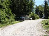
From the highway Ljubljana - Jesenice, we take the exit Lesce and follow the road ahead in the direction of Žirovnica and Jesenice. After a few km of driving, we will come to a crossroads, where the road to Žirovnica and Moste branches off to the right (from the direction of Jesenice, left). Only a few meters ahead, at the next crossroads, we turn left to Moste (right Žirovnica). Further on, we drive past the monument to the fallen fighters, where the road starts to rise on a slope under the railway track. At the top of the slope, the road to the right is at the sign for Vila Karin, but we continue straight towards Završniško jezero and Valvasorjev dom. The road then flattens and brings us to a crossroads, where the road to Valvasorjev dom branches off to the left. We take the mentioned road (straight to Koča pri izviru Završnice), which first ascends gently, then steeper and steeper on an occasionally quite rough road (the steepest parts are asphalted). Higher up, the road brings us to a somewhat larger crossroads, where we continue left towards Potoška planina (right Doslovška planina). The road then flattens and a little further brings us to the next crossroads, where the road to Valvasorjev dom branches off to the right, and we continue on the left lower road, which then continues for quite some time without major changes in elevation. The road then leads us past the turn-off to Ajdno and then starts to ascend steeper on an occasionally quite poor road. The road then flattens again and past Potoška planina brings us to the Urbas spring, near which there are a few smaller parking spots.
From Moste to the starting point there is approximately 10 km of driving.
Route description:
From the parking lot we first walk to the Urbas spring, where we notice the mountain sign for mountain pasture Belščica, which directs us onto an initially somewhat harder-to-follow footpath. For the first 15 minutes of walking the path ascends only gently, then it starts to ascend steeply through the forest. Higher the forest becomes thinner and slowly transitions into a belt of dwarf pines, and the path starts turning more and more towards the west. After a good hour of walking we step onto grassy slopes and the path after a few additional steps brings us to the bivouac on Belščica (emergency bivouac).
From the bivouac we continue towards the north and already after a few steps we notice a somewhat less visible little path that turns sharply right (direction east). Further we ascend along the mentioned little path, which ascends transversely across occasionally somewhat steeper slopes. The path, which crosses two more pronounced gullies, then brings us higher to a marked path, which we follow to the right, but only to the spot where the sign for Vajnež directs us left upwards.
Here we again leave the marked path, along which we walked only a few meters, and continue the ascent along a barely visible little path that after a short ascent brings us to the edge of the main ridge of the Karavanke. We then follow this path, which gradually transitions into easier pathless terrain, to the panoramic summit.
In fog the orientation in the upper part is very difficult.
Urbas - bivouac on Belščica 1:15, bivouac on Belščica - Vajnež 1:10.

The trip can be extended to the following destinations: Hochstuhl/Stol
Photos:
 1
1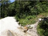 2
2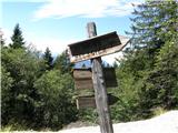 3
3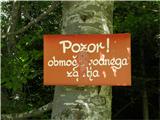 4
4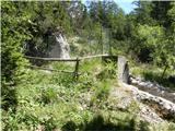 5
5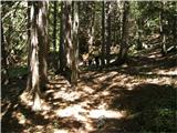 6
6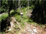 7
7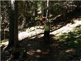 8
8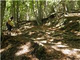 9
9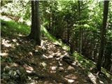 10
10 11
11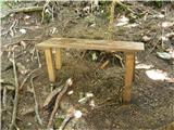 12
12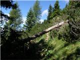 13
13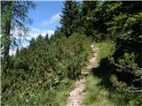 14
14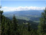 15
15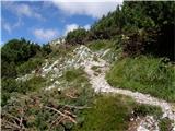 16
16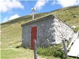 17
17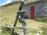 18
18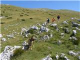 19
19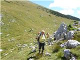 20
20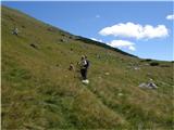 21
21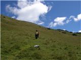 22
22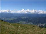 23
23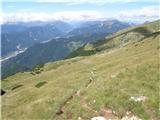 24
24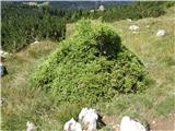 25
25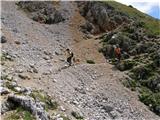 26
26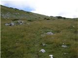 27
27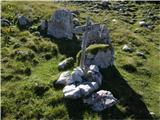 28
28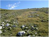 29
29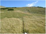 30
30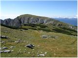 31
31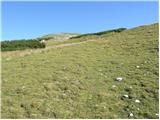 32
32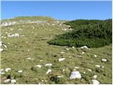 33
33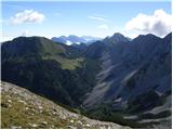 34
34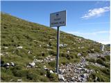 35
35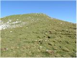 36
36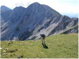 37
37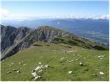 38
38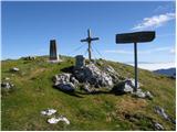 39
39 40
40
Discussion about the trip Urbas - Weinasch/Vajnež
|
| Gost25. 08. 2007 |
Definitely recommend! Especially recommend the loop valvazor-stol-vajnež-urbas-valvazor. From vajnež towards the bivouac you can go directly to the bivouac via the path from vajneževo sedlo, the satellite image published on this side can also help.
|
|
|
|
| Gost29. 08. 2007 |
Now that there is no more heat, this loop can be a really pleasant tour, but how many hours of walking for an experienced mountaineer? Bojan
|
|
|
|
| fpetel113. 09. 2008 |
Nice path. When I reached the bivouac I followed the unmarked path to the left for another 150 meters of elevation and went directly up to the top of the ridge and summit (crossing the marked path in between). Everywhere passable terrain - the north side is mostly steep.
|
|
|
|
| planinec alex11. 10. 2009 |
Yesterday they built a commemorative border stone on Vajnež.
|
|
|
|
| Klin19. 05. 2011 |
Nice hike I recommend for the weekend I recommend for the weekend
|
|
|
|
| mukl19. 02. 2012 |
Yesterday we climbed to Vajnež, it was extremely strenuous, despite almost no snow, ascent without crampons not possible. To the caretakers of the bivouac all criticism, with common thoughts we said that we would seek refuge there only in real dire need. Dirty, neglected, in short: pigsty with a pig that has no business there.
|
|
|
|
| Polesnjak27. 02. 2012 |
Road to Valvazorja is already OK, to Potoška planina still not. Through forest from Potoška planina crampons welcome but not necessary, from 1700 m.a.s.l. snow still quite unconsolidated so not icy. Upper part practically bare, where there is snow walking without poles more miserable. For winter ascent very friendly conditions, except wind which on some ridge spots blew so hard had to crawl, and even then tossed around well.
|
|
|
|
| Laščan15. 09. 2015 |
What's the condition of the road to Potoška planina like - how rutted is it?
|
|
|
|
| Sandrca17. 09. 2015 |
About a month ago the road was just fine / in the same condition as the road to Valvasorjev dom
|
|
|
|
| Majdag17. 09. 2015 |
... Laščan given the recent storm and the condition of other forest roads I walk on, the path is probably quite torn up. The caretaker at Valvasorjev dom surely knows the most about the passability of that road.
|
|
|
|
| marezt17. 09. 2015 |
@laščan the road is fine... unless you have a Ferrari it won't go... otherwise though! But if you have time I suggest you drive to Valvasorjev dom and go to Stol, then further along the ridge (via Potoški stol)... (about 30min) towards Vajnež.... then descend this path towards Urbas!
|
|
|
|
| vizi27. 09. 2016 |
I'm planning a circular route to Vajnež from Valvazorjev dom via Urbas with return via Stol. A few questions for those who have hiked around there recently.
What's the condition of the road to Valvazorjev dom for a passenger car? Is the first section Valvazor-Urbas marked, will I find it? On the route map, there's a dashed turn-off towards Vajnež from the first part of the path - is it usable?
|
|
|
|
| tinky27. 09. 2016 |
See current conditions/ Karavanke, Stol, page 43/ Todi,Tinky/ we went in the opposite direction, everything is marked. But I don't know about the road this year. Regards.
|
|
|
|
| vizi28. 09. 2016 |
Thanks for the info!
|
|
|
|
| J.P.8. 10. 2017 |
Update: the starting point at Vajnež is less visible. You can park at the white work hut from which a few steps forward to the right is the start of the trodden path. (sign for Belščica is very damaged and can be overlooked, as well as the "Pozor!" sign). Lp
|
|
|
|
| el rocco4. 07. 2018 |
Just back from Vajnež. Signs below at the water intake (5 min further from Potoška planina) are brand new and praise to whoever installed them. The path itself is unmarked, but so well-trodden you can't miss it. At two points in the forest fallen spruces require some acrobatics, but nothing special. To the top it goes steeply but the path is normally passable.
|
|
|
|
| tango4. 09. 2020 |
Pleasant, non-strenuous tour with beautiful views. From Vajnež, a quick hop to Mali vrh and a snack with wonderful views on Kamnitnik. Great, highly recommended!
|
|
|
|
| J.P.24. 04. 2021 20:13:44 |
Today it was possible to park at Valvasorjev dom or Potočka planina (just before the starting point there are larger patches of snow). From Vajnež we traversed to Stol. Conditions are excellent, some traps on icy slopes in the morning. Sinking in the afternoon, especially lower towards the valley. Above about 1300m no more snow. Safe steps to all. LP
|
|
|
|
| Anka TM2. 11. 2022 16:38:07 |
Hello. I'm interested in what condition the road to the Urbas starting point is in? Thanks and best regards
|
|
|
|
| Trobec3. 11. 2022 10:21:16 |
Apparently quite good. They rip you off for 10€ if you want to go up by car. Down (at the lake) for 5€
|
|
|
|
| bumbi4. 11. 2022 18:15:14 |
Road use from 1 November onwards is no longer chargeable.
|
|
|
|
| Trobec7. 11. 2022 09:40:46 |
Commendable
|
|
|
|
| nejka027. 11. 2022 11:08:57 |
They made the right decision that it's not chargeable over winter.
|
|
|
|
| nekdo_nekje28. 06. 2023 23:02:06 |
On Sunday, June 4th, I went on the trail with a friend. The start of the path is hard to find, and you have to orient along the stream, currently the ground by the stream is covered with impermeable black material. Right at the stream, it turns into an unmarked slope with no sign, very easy to miss the path.
|
|
|
|
| natasacraine9. 04. 2024 10:24:52 |
and who knows what the path is like or what the conditions are? Thanks
|
|
|
|
| natasacraine12. 04. 2024 13:59:23 |
does the road have to be paid for now?
|
|
|
|
| Toni-k12. 04. 2024 16:47:42 |
no, until the end of April the gate is raised and free
|
|
|
|
| natasacraine14. 04. 2024 13:25:27 |
Thanks... it's true, I used it yesterday... and it's nicely macadamized too...  so no problems getting up. so no problems getting up.
|
|
|
|
| Hribec4. 09. 2024 20:33:28 |
The road or gravel road is in excellent condition.
|
|
|
|
| Zgembo7. 09. 2024 17:57:00 |
The road is super, it costs 10€, from 1 November onwards it's free
|
|
|
|
| di14. 07. 2025 18:02:32 |
Is there a stamp at Vajnež?
(Not clearly visible from the picture; not in the description either.
A few years ago there wasn't.)
|
|
|
|
| DVas15. 07. 2025 15:52:32 |
It was in September 2023.
|
|
|
|
| di26. 09. 2025 06:45:58 |
There's a stamp.
The last part of the ascent is pathless.
|
|
|
To post a comment you must log in:
If you do not yet have a username, you must first
register.