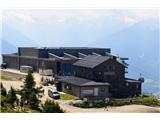
Zgornja postaja žičnice Patscherkofelbahn - Glungezer Hütte
Starting point: Zgornja postaja žičnice Patscherkofelbahn (1965 m)
| Latitude/Longitude: | 47,21012°N 11,45202°E |
| |
Walking time: 2 h 45 min
Difficulty: easy marked way
Elevation gain: 645 m
Elevation difference along the route: 680 m
Map:
Recommended equipment (summer):
Recommended equipment (winter):
Views: 732
 | 2 people like this post |
Access to starting point:
If we drive on the highway along the river Inn, we go to the exit Innsbruck-Mitte. If we are already in Innsbruck, we drive towards the south of Innsbruck towards the entrance Innsbruck-Mitte, but we don't go on the highway. Then we follow the signs for Igls or Innsbruck-Igls, and higher up the signs for the Patscherkofelbahn cableway. We park by the lower station of this cableway (large parking lots) and with a cable car we go to the upper station.
Route description:
From the upper station of the Patscherkofelbahn cableway we head east along the tourist path Zirbenweg ("stone pine path"; stone pine is a rare species of pine). This gently and easily leads us across the northern slopes of Patscherkofel over open terrain incredibly rich in rhododendron. Every so often far behind us the distinct horn of the peak Sonnenspitze appears and to the right of it the saddle, which is our final goal. To the distinct saddle Boscheben (2035 m) east below Patscherkofel we gain only a little altitude (at the saddle a turn-off to the right to the eponymous hut, which is a couple of minutes' easy walk). To here 0:45.
We continue across the forest traverse and then a bit more undulating up and down across the rocky step. Soon after it, about 20 minutes' walk from the Boscheben saddle, we arrive at a valley where the paths fork: the tourist path Zirbenweg turns sharply left, our path continues straight ahead (sign for Glungezerhütte). From the fork we ascend first gently along the bottom of the valley, soon more steeply up its left slope. Higher up the path levels out again and we traverse right around the Viggarspitze peak (also possible a quick trip to this peak; ca. 15 minutes ascent). There follows a long, even, gentle ascent up the bare, southwest-facing slope on a mostly rocky path.
In the last third of the tour the path finally heads noticeably more steeply upwards. After crossing the last clearings we tackle the final 150 entirely rocky altitude metres in zigzags. When on the saddle we look over the edge, we spot the Glungezerhütte hut. A short crossing over a mini valley leads to it.
Two additional suggestions: From the hut a quick and easy ascent to both nearby peaks is possible. To the rounder Glungezer (10 minutes; from the summit views open up along the ridge to the south; on the forepeak stands a memorial to the air crash of 1964 - see hut description) we climb from behind the hut southeastwards. To the bolder Sonnenspitze (10 minutes; excellent view to the north) we head westwards from the bivouac standing by the hut.

Along the route: Patscherkofel (2246m), Boscheben(hütte) (2035m), Viggarspitze (2306m), Sonnenspitze (2639m), Glungezer (2677m)
Photos:
 1
1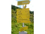 2
2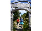 3
3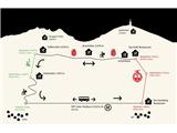 4
4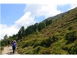 5
5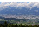 6
6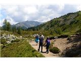 7
7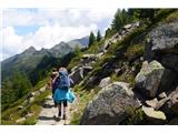 8
8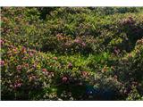 9
9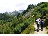 10
10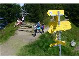 11
11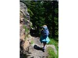 12
12 13
13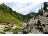 14
14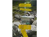 15
15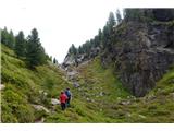 16
16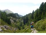 17
17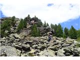 18
18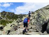 19
19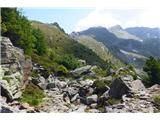 20
20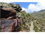 21
21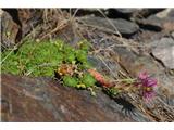 22
22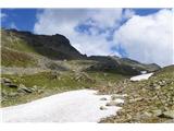 23
23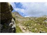 24
24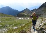 25
25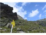 26
26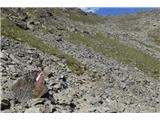 27
27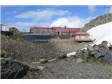 28
28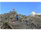 29
29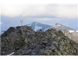 30
30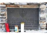 31
31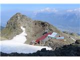 32
32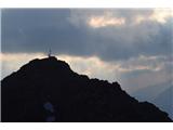 33
33 34
34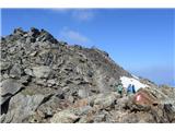 35
35 36
36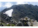 37
37
Discussion about the trip Zgornja postaja žičnice Patscherkofelbahn - Glungezer Hütte
To post a comment you must log in:
If you do not yet have a username, you must first
register.