Untere Valentinalm - Lake Wolayer See
Starting point: Untere Valentinalm (1220 m)
| Latitude/Longitude: | 46,6225°N 12,9288°E |
| |
Walking time: 3 h
Difficulty: easy marked way
Elevation gain: 731 m
Elevation difference along the route: 1018 m
Map: Tabacco 9
Recommended equipment (summer):
Recommended equipment (winter):
Views: 6.788
 | 2 people like this post |
Access to starting point:
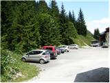
From Trbiž/Tarvisio we head onto the highway towards Videm/Udine. At the settlement Carnico, we leave the highway and first follow the signs towards the settlement Tolmezzo, then the signs for Austria and the mountain pass Pso di Croce Carnico / Plöckenpass. On the mountain pass, we descend to the Austrian side past the mountain hut Plocken Haus. Soon, the road towards the mountain hut Untere Valentinalm branches off to the left, where there is also a smaller parking lot.
Route description:
At the mountain hut, we go on the mountain road following the signs Ob. Valentinalm and Wolayer See. The road is quite level and is closed to public traffic. We soon leave the road and turn right on a footpath which later crosses the road several times and in less than an hour brings us to the hut Obere Valentinalm from which there is a nice view towards Rauchkofel (2460m) and on the northern wall of the mountain Kellerspitzen (2769m).
From the hut, we continue on a well-marked footpath past the mountain pasture on which livestock grazes in the summer. At the end of the mountain pasture the path turns a little to the left, where we start ascending through the valley below the mighty mountain walls of Coglians. The path through the valley, which occasionally runs on grassy slopes and occasionally on slopes covered with rocks and boulders, brings us in about an hour to a crossroad on the saddle Valentin Torl (2238m). Right runs the path to Rauchkofel, and left a very demanding climbing path to Monte Coglians. We choose the middle path, which from the saddle starts descending and in approximately half an hour brings us to the lake Wolayer See from where there is a very nice view towards Monte Coglians and Monte Capolago. By the lake is also the mountain hut Wolayerseehütte.

Photos:
 1
1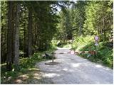 2
2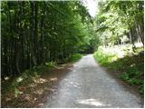 3
3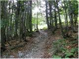 4
4 5
5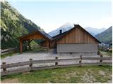 6
6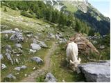 7
7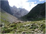 8
8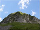 9
9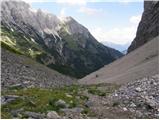 10
10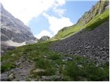 11
11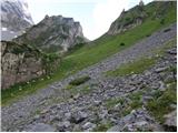 12
12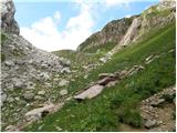 13
13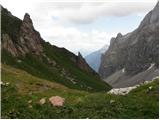 14
14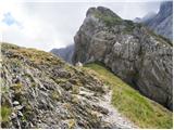 15
15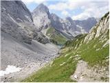 16
16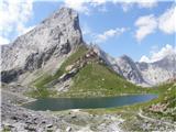 17
17
Discussion about the trip Untere Valentinalm - Lake Wolayer See
|
| Ivan192729. 05. 2024 14:03:45 |
Does anyone know if this path from Valentinalm to Wolayer See is currently passable or if there's any snow on it? As far as I know, the huts by the lake are still closed this weekend, right? Thanks for any response.
|
|
|
|
| turbo29. 05. 2024 16:50:20 |
|
|
|
|
| Ivan192729. 05. 2024 19:40:54 |
I wrote them an email, they replied that there is still a lot of snow. Parking at the hut is 5 euros anyway.
|
|
|
|
| dprapr30. 05. 2024 14:03:14 |
On the southern side, from Tolazzi there is definitely less snow.
|
|
|
|
| turbo30. 05. 2024 15:04:51 |
From Tolazzi it would be doable, probably still snow by the lake, it lingers there a long time. Or up from Lesna dolina, Lesachtal, no other way, since the road to Passo di Monte Croce Carnico on the Italian side is CLOSED due to avalanche!
Also a camera showing how those areas look from the valley on the Austrian side:
https://www.alpenhof-wolayersee.at/livebild/
|
|
|
To post a comment you must log in:
If you do not yet have a username, you must first
register.