Ukanc - Ožarjeni kamen (Ferata Ožarjeni kamen)
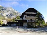
Starting point: Ukanc (531 m)
| Latitude/Longitude: | 46,27926°N 13,82942°E |
| |
Route name: Ferata Ožarjeni kamen
Walking time: 1 h 50 min
Difficulty: extremely difficult marked way
Via ferrata: D
Elevation gain: 429 m
Elevation difference along the route: 460 m
Map: TNP 1:50.000
Recommended equipment (summer): helmet, self belay set
Recommended equipment (winter): helmet, self belay set, ice axe, crampons
Views: 31.650
 | 5 people like this post |
Access to starting point:
From the highway Ljubljana - Jesenice we take the Lesce exit and follow the road towards Bled, Bohinjska Bistrica, Ribčev Laz and Ukanc. On the west side of the lake, we leave the road towards Koča pri Savici and turn right towards Ukanc. We follow this road to the parking lot near the abandoned hotel Zlatorog where we park. Parking is also possible at some of the other parking lots on the west side of the lake. The parking lots are paid.
Route description:
The described path is currently CLOSED! Data from 7.7.2021.
From the parking lot, we continue on the main road to the first junction where we turn onto the footpath towards the lake. At the lake, we continue towards the north on the path which leads around the lake. On the northwestern edge of the lake where there is a junction, we continue right and walk for a short time still on the path which leads around the lake then the signpost for the climbing area Uket directs us left onto a narrow footpath.
We go on the mentioned footpath which at first ascends several times in zigzags. There is also quite a few fallen trees on the path here. We quickly come to a junction where a sign on the rock directs us to the right towards the climbing area, left leads the path towards Savica.
Further on the path is marked with red dots and all the time runs towards the east. The path is relatively poorly trodden and mostly slightly ascends, on some spots it also descends a little. Here through the forest occasionally a nice view opens up towards Lake Bohinj and towards Vogel. When we get to the climbing area we will first on the rock notice the caption »Uket«, here we for a short time still continue on the footpath which crosses slopes towards the east then on the left we notice steel cables.
Before the entry into the climbing path we must equip ourselves with a self-belay set and a helmet. It is also highly recommended to use climbing gloves. Climbing on the secured path when wet is not recommended.
The secured path is already from the very beginning quite demanding and first ascends diagonally along the wall upwards. Soon the path turns to the left and we are already in front of the first demanding almost vertical ascent. Then the path all the time ascends on a monolithic ridge, often on the path there is also some grass and trees or bushes. The path otherwise all the time offers wonderful views of Lake Bohinj. The path, which is all the time very exposed, then several more times almost vertically ascends, on the path there are also some shorter demanding crossings. Such a path then runs all the way to the end of the secured path where there is also a marked junction.
Right downwards leads the path which is marked with the caption »bivak« and is secured with a rope. The mentioned path leads towards a gully, which is surrounded by overhanging walls and thus offers shelter.
At the junction we continue straight upwards and the path soon turns to the left and then crosses slopes towards the west. The path, which here runs on mostly forest-covered slopes, then also ascends a little. The slope becomes more grassy and the path soon turns slightly to the right. There follows the last shorter ascent to the top where there is a logbook box.
We descend left steeply downwards on the slope, which is secured with a steel cable and a rope. After the steep descent follows a crossing, which brings us to scree. We continue left downwards on a long scree slope, which allows fast descent. At the end of the scree we come into the forest and continue slightly left and downwards where we then join the path marked with red dots. We continue right downwards to the lake and then back to the starting point.
The described path is difficulty level D and is suitable only for experienced mountaineers with enough strength in their arms. Some additional difficulties can also be caused by the steel cable, which is somewhat thinner than usual on such demanding paths. The steel cables are otherwise attached to bolts and not to larger pitons as we see on most other secured paths. The steel cable is thus often right by the wall and somewhat hinders clipping the self-belay set.
The climbing part of the path has 300 elevation meters, for climbing we will need approximately one hour.

Along the route: Bohinjsko jezero (525m)
Photos:
 1
1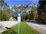 2
2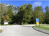 3
3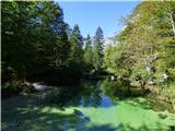 4
4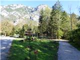 5
5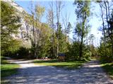 6
6 7
7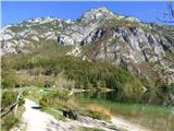 8
8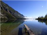 9
9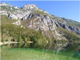 10
10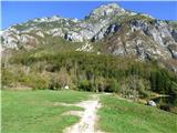 11
11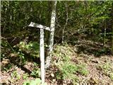 12
12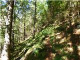 13
13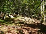 14
14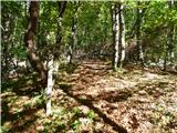 15
15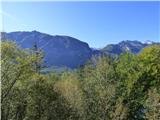 16
16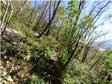 17
17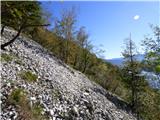 18
18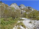 19
19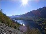 20
20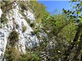 21
21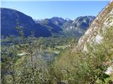 22
22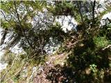 23
23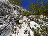 24
24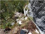 25
25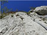 26
26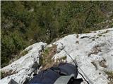 27
27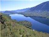 28
28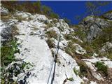 29
29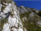 30
30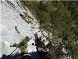 31
31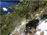 32
32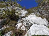 33
33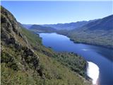 34
34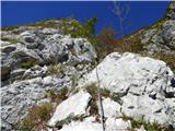 35
35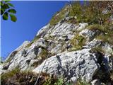 36
36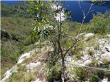 37
37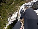 38
38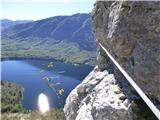 39
39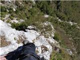 40
40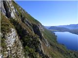 41
41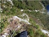 42
42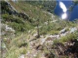 43
43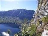 44
44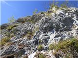 45
45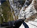 46
46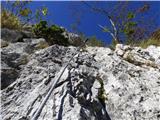 47
47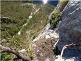 48
48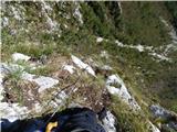 49
49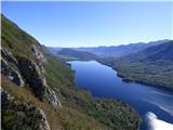 50
50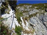 51
51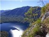 52
52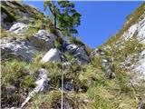 53
53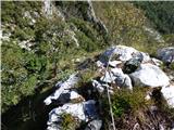 54
54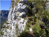 55
55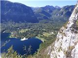 56
56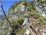 57
57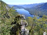 58
58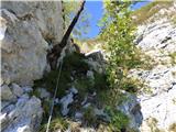 59
59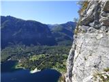 60
60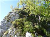 61
61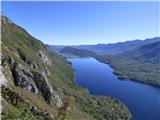 62
62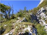 63
63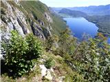 64
64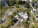 65
65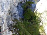 66
66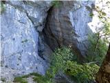 67
67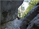 68
68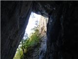 69
69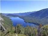 70
70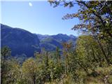 71
71 72
72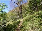 73
73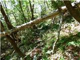 74
74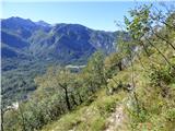 75
75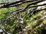 76
76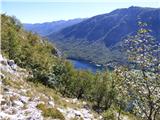 77
77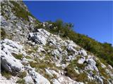 78
78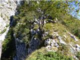 79
79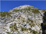 80
80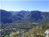 81
81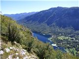 82
82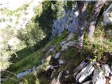 83
83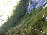 84
84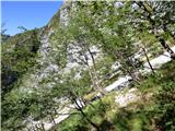 85
85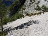 86
86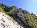 87
87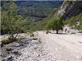 88
88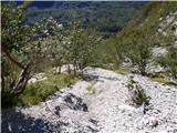 89
89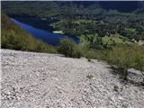 90
90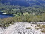 91
91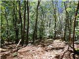 92
92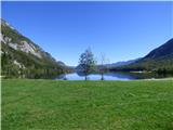 93
93
Discussion about the trip Ukanc - Ožarjeni kamen (Ferata Ožarjeni kamen)
|
| Michel3. 05. 2019 |
Excellent via ferrata, quite alpine in my opinion. There are also bolted belays in between, excellent tour for practicing rope technique and movement in a rope team.
Some spots are more demanding. I recommend approach shoes.
Views are fantastic!
Coordinates of the via ferrata start: 46.2882609, 13.8359730
|
|
|
|
| janezs733. 05. 2019 |
The above described part is only the lower half of the via ferrata, the harder part is above. We already have additional descriptions and numerous opinions on this forum.
forum ozarjeni kamen
|
|
|
|
| Parkeljc23. 05. 2019 |
The access to the via ferrata is excellently marked and described, but only up to the branch for the crag. From the cairn marking the branch to the crag, however, we continue ever steeper for a few more minutes to the via ferrata entry, the "path" practically disappears. And it ascends very steeply. It took me about 30 min to the entry.
As on all via ferratas, this one in damp or wet conditions is not suitable for ascent. I admit, initially I slightly underestimated it, from the start the mind was slightly tested, perhaps because I was alone, difficulty,..
The descent is also left "free-style à la Prešeren". Especially after leaving the cable, we seek the most suitable spots on the screes for descent and occasionally need to be more careful. The pleasure on descent (not for those in heavy boots  ) comes only somewhat lower. It is also worth noting that there are no orientation points on the scree. We follow only the lowest point of the scree. ) comes only somewhat lower. It is also worth noting that there are no orientation points on the scree. We follow only the lowest point of the scree.
Do not venture into the via ferrata without climbing gloves, the cable is thinner and the grip must be accordingly stronger, yet it slips
(blisters  ). ).
|
|
|
|
| don kihott29. 05. 2019 |
Drilled bolts instead of expansion bolts!!!
|
|
|
|
| Tadej8. 07. 2021 07:11:24 |
The described path is CLOSED until further notice!
|
|
|
|
| LISAC20. 08. 2025 19:57:55 |
Hi. Is the trail still closed? Does anyone know what will happen to it in the future? Thanks and regards.
|
|
|
To post a comment you must log in:
If you do not yet have a username, you must first
register.