Turracher Höhe - Rinsennock (northern way)
Starting point: Turracher Höhe (1795 m)
| Latitude/Longitude: | 46,9147°N 13,875°E |
| |
Route name: northern way
Walking time: 1 h 45 min
Difficulty: easy marked way
Elevation gain: 539 m
Elevation difference along the route: 539 m
Map:
Recommended equipment (summer):
Recommended equipment (winter): ice axe, crampons
Views: 7.286
 | 2 people like this post |
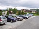
Access to starting point:
From Austrian Carinthia (Kärnten): first we drive to the settlement of Feldkirchen, from where we follow a well-marked road to the mountain pass Turracher Höhe.
From Austrian Steiermark and Salzburg we drive to the valley of the river Mur and follow the road to the settlement of Predlitz (the settlement is located west of the town of Murau). In Predlitz we leave the main road and continue driving towards the mountain pass Turracher Höhe.
Route description:
From the parking lot on Turracher Höhe we head on the path in the direction of the summits Kornock and Rinsennock. After a few minutes of walking on the road, we come to a path junction in the immediate vicinity of the summer sledding track. At the junction there are mountaineering signs, where it says Kornock and Rinsennock left and right (possible circular path). If we have decided for the ascent on the somewhat more northern path we continue right on the road, which through the underpass crosses the sledding track and then turns left upwards. The slightly ascending road soon brings us out of the forest onto expansive grazing areas. Further on the road slowly changes into an increasingly steep cart track, which higher brings us to the next path junction. We again continue right (ascent to the summit possible also left) and follow the cart track, which ascends over grassy slopes, to the concrete building (transformer) on which we already from afar see the blazes. Further the path turns somewhat left and after a short ascent brings us to the summit slope of Kornock. Follows an ascent on the panoramic grassy slope to the mentioned summit, in the middle of which we see the upper station of the cable car. Behind the cable car the path narrows and brings us to the information boards on the top.
From here we continue in the direction of Rinsennock on a panoramic path, which leads us along an increasingly steep ridge. The path along which we walk in snowless conditions does not present major difficulties, in winter conditions however there is a risk of slipping. After half an hour of ridge walking the steepness eases and the path brings us to the summit.

Photos:
 1
1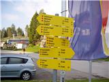 2
2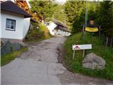 3
3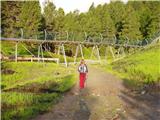 4
4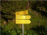 5
5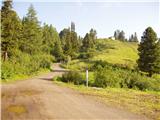 6
6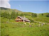 7
7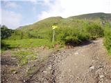 8
8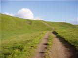 9
9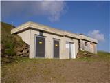 10
10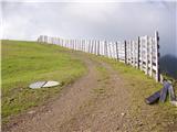 11
11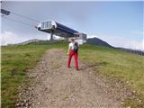 12
12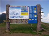 13
13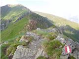 14
14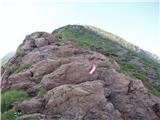 15
15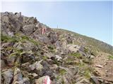 16
16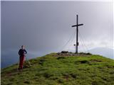 17
17
Discussion about the trip Turracher Höhe - Rinsennock (northern way)
|
| Kokta31. 03. 2012 |
Nice trail, especially the last part along the ridge.
|
|
|
|
| felix29. 07. 2022 17:44:35 |
Could those who describe the paths indicate the real times as on the signposts, not the times you walk yourselves? Here the walking time is stated as 1h 45 min, but on the signposts we can see that the times are much longer - 2h 30 min. This can mislead average hikers.
|
|
|
To post a comment you must log in:
If you do not yet have a username, you must first
register.