Turnovka - Koča na Travniku
Starting point: Turnovka (1378 m)
| Latitude/Longitude: | 46,4183°N 14,8179°E |
| |
Walking time: 35 min
Difficulty: easy marked way
Elevation gain: 170 m
Elevation difference along the route: 170 m
Map: Kamniške in Savinjske Alpe 1:50.000
Recommended equipment (summer):
Recommended equipment (winter): ice axe, crampons
Views: 323
 | 1 person like this post |
Access to starting point:
a) Drive to Ljubno ob Savinji, then follow the signs for Smrekovec. In Ljubenske Rastke turn left, then begin ascending first along the slopes of Bezovec and later Komna. Follows a traverse of the slopes to the left, passing the parking lot for Komen (also possible to Koča na Travniku), but we continue straight in the same direction following the road to the parking lot for Koča na Travniku. Red mountain signs for Koča na Travniku are at the starting point.
b) Drive to Ljubno ob Savinji, then follow signs for Logarska dolina. Shortly after the mentioned place, arrive at a crossroads where you turn right onto the side road towards Primož pri Ljubnem, then follow signs for Koča na Travniku. Up to approximately 900 m elevation we mostly ascend, then the road leads over a pass, followed by a longer traverse to the right. Later, the access variant from the center of the Ljubno ob Savinji settlement joins from the right. Higher up we ascend further over Pečko or Robnikova planina, crossing the marked path Žep stream valley - Koča na Travniku, but continue along the road which returns to the forest and continues for some time together with the marked path. When the marked path turns left, continue traversing a bit longer, when mountain signs reappear along the path along with parking signs, park at the Turnovka parking lot.
Route description:
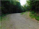
From the parking lot, head to the marked path with signs for Koča na Travniku. The path initially leads along a cart track, where at a few junctions we follow the markers, higher up the markers lead to a mountain path that steeply ascends through the forest for a while. After the steep section, the path levels out, crosses a pasture fence and leads us from the forest to pasture areas near Koča na Travniku.
From here only a short walk remains and with nice views we reach the mountain hut.
Description and photos refer to the condition in July 2025.
Photos:
 1
1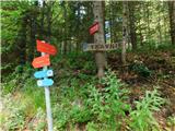 2
2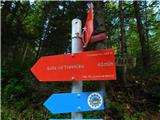 3
3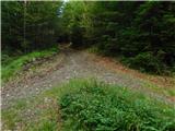 4
4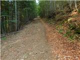 5
5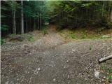 6
6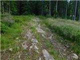 7
7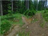 8
8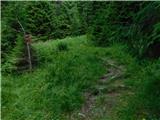 9
9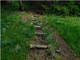 10
10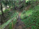 11
11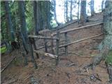 12
12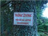 13
13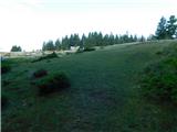 14
14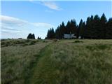 15
15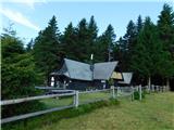 16
16
Discussion about the trip Turnovka - Koča na Travniku
To post a comment you must log in:
If you do not yet have a username, you must first
register.