Turkov rovt (Vrata) - Begunjski vrh (snowy approach)
Starting point: Turkov rovt (Vrata) (941 m)
| Latitude/Longitude: | 46,4179°N 13,858°E |
| |
Route name: snowy approach
Walking time: 4 h 30 min
Difficulty: easy pathless terrain
Elevation gain: 1520 m
Elevation difference along the route: 1520 m
Map: Triglav 1 : 25.000
Recommended equipment (summer):
Recommended equipment (winter): ice axe, crampons
Views: 9.493
 | 4 people like this post |
Access to starting point:
We leave the Gorenjska motorway at the Hrušica exit and follow the road ahead towards Kranjska Gora. Just before the village of Dovje, a road branches off to the left from the main road towards Mojstrana (Vrata, Kot and Krma). We follow the road ahead towards the Vrata valley and drive along it to the road sign at approximately 10.5 km. Here, on the left side of the road, we will spot a small parking lot and a road that crosses the river. We park so as not to block the passage across the river (Triglavska Bistrica).
In winter, the road to Vrata is closed. This can extend the walk by 1 to 2 hours.
Route description:
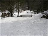
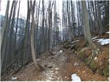
From the parking lot, we descend to the stream and on the other side take the footpath that ascends through the forest. After a few minutes of ascent, the path from Aljažev dom joins from the right. We continue left further through the forest. After a little less than an hour of walking, we emerge from the forest onto the scree, where we head right upwards towards the wall. Even without snow, orientation is not difficult as the path here is well trodden. When we reach below the walls, we turn left and continue ascending the scree, which in unfavourable conditions is dangerous for snow avalanches or slips. Further on, we continue ascending along the right side of the valley up to the point where the steepness eases. When the steepness eases, we walk up the valley full of large rocks (boulders). Further on, we proceed depending on snow conditions. Usually, we continue up the valley and then slightly left below Visoka Vrbanova špica. This section of the path is quite steep and, with little snow, the direct ascent is blocked by cliffs (with less snow, we head right below Begunjski vrh and then cross leftwards). Above this steep section, we reach a saddle, where the view opens to Triglav. Here, it is a good five minutes to the left to Staničev dom, which has a winter room. For the direct ascent to Begunjski vrh, we continue in the same direction and cross the slopes of Begunjski vrh southwards in a moderate ascent. When we reach the ridge, we turn right and reach the summit in a few minutes.
The summit slope is often icy.

Along the route: Begunjska vratca (2342m)
Photos:
 1
1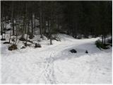 2
23
 4
4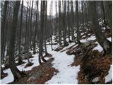 5
5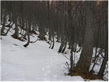 6
6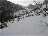 7
7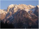 8
8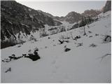 9
9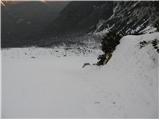 10
10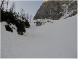 11
11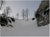 12
12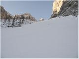 13
13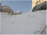 14
14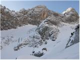 15
15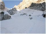 16
16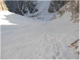 17
17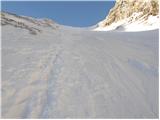 18
18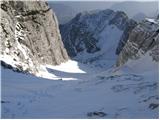 19
19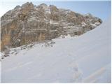 20
20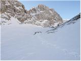 21
21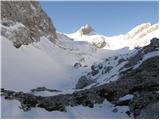 22
22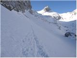 23
23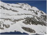 24
24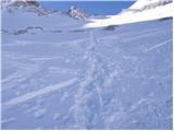 25
25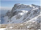 26
26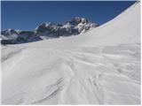 27
27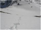 28
28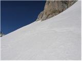 29
29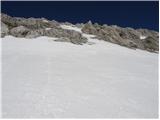 30
30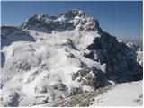 31
31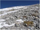 32
32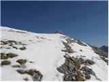 33
33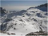 34
34
Discussion about the trip Turkov rovt (Vrata) - Begunjski vrh (snowy approach)
|
| ZoranV10. 05. 2013 |
Behind Cmirom, the last minutes of skiing are counting down. The snow is otherwise super transformed, but there is already a lot of rocks in places and quite a few interruptions. You can drive up to about half of the scree towards the forest. When the sun presses into your back, it can be quite strenuous, so the clouds were welcome.  On the way, we met three cool Dolenjci with whom we quenched our thirst in Aljažev dom. C/2&Z On the way, we met three cool Dolenjci with whom we quenched our thirst in Aljažev dom. C/2&Z
A few more snapshots in the video.
http://www.youtube.com/watch?v=4xA1Fo8hVx0
Panorama from the top of Begunjski vrh. For first-time visitors, a test panorama opens where you click test or skip and the view from Stol will appear (visibility very poor unfortunately)
http://pan0.net/upano.php?id=4888
|
|
|
To post a comment you must log in:
If you do not yet have a username, you must first
register.