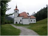
Tržič - Koča na Kriški gori
Starting point: Tržič (577 m)
| Latitude/Longitude: | 46,3607°N 14,3095°E |
| |
Walking time: 2 h 15 min
Difficulty: easy marked way
Elevation gain: 894 m
Elevation difference along the route: 894 m
Map: Karavanke 1:50.000
Recommended equipment (summer):
Recommended equipment (winter): ice axe, crampons
Views: 55.917
 | 2 people like this post |
Access to starting point:
From the highway Ljubljana - Jesenice we take the exit Ljubelj and follow the road ahead towards Ljubelj and Tržič. Just a few meters before the gas station, we leave the main road and continue driving right in the direction of Tržič. In Tržič, at the Mercator store we turn right and the road after a short ascent past apartment blocks brings us to a crossroad, where we continue right. Next follows driving on a narrow road, which we follow for just over 200 m, then at the crossroad we continue sharply left on an ascending macadam road, which quickly brings us to the church of St. Joseph, which is the starting point for our tour.
Route description:
Near the church we will notice hiking signposts, which point us to the right on an ascending footpath. The path at first moderately ascends through the forest and then joins a wide cart track, which we follow to the right. The cart track soon ends and changes into an increasingly steep footpath. Ahead a relatively steep path, which runs through the forest, then past Mala Mizica (764 m) brings us to Velika Mizica (976 m), where there is a nice viewpoint.
From the vantage point, we continue on a marked path, which starts ascending even steeper. Higher, the path flattens a little and further leads us on a pleasant forest-covered ridge. A little further ahead, the path leaves the forest a little to the right, onto panoramic grassy slopes of Kriška gora (nice view towards the south on Gorenjska and Škofjeloško hribovje). The path ahead flattens a little more and after a few minutes of additional walking brings us to a junction, where the path from the village Križe joins from the right (or from Gozd, a steep path).
We continue on a much more beaten track, which in a moderate ascent, initially partly still running through the forest, brings us to the upper grassy slopes. Here the path entirely flattens and in a few minutes of panoramic walking brings us to the mountain hut on Kriška gora.

Along the route: Mala Mizica (764m), Velika Mizica (976m)
Photos:
 1
1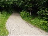 2
2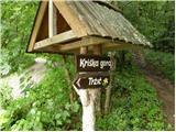 3
3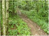 4
4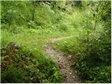 5
5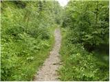 6
6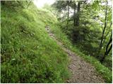 7
7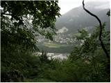 8
8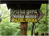 9
9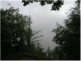 10
10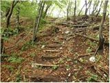 11
11 12
12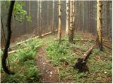 13
13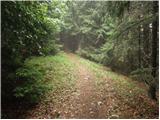 14
14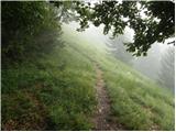 15
15 16
16 17
17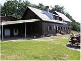 18
18
Discussion about the trip Tržič - Koča na Kriški gori
|
| Gorski Jelen26. 06. 2010 |
I went on this trail on a nice May Sunday. On the whole trail I met one hiker somewhere in the middle who was already returning at seven. I recommend it to all those who don't like crowds. The trail itself offers much more views than the classic from Gojz.
|
|
|
|
| pelican31. 10. 2010 |
Yesterday there was hardly anyone on this path.
We arrive at the top, and the hut is full of people..
Nice trip and nice sunny weather!
|
|
|
|
| Kanjanez18. 03. 2019 |
Yesterday with a colleague; the trail to the hut is steeply steep, but the body rests when the soul enjoys the greater vantage points. I recommend it.
|
|
|
|
| jprim18. 03. 2019 |
Well, yesterday there were hardly any nice views from the top.
Lp!
|
|
|
|
| Ana Fila21. 04. 2019 |
Nice forest trail, steep uphill for a full two hours. Excellent view at the hut.
But 15 minutes below the hut on the path, which used to be a marked confusion of various crossing paths. We then joined the marked path from Križe on the right, after going too far up and then descending a bit.
Similarly, on the way down we got lost because it's unclear which path goes down to Križe, to Gozd and which to Tržič.
Well, in the end we found the right one.
|
|
|
To post a comment you must log in:
If you do not yet have a username, you must first
register.