Tržič - Kamnek (Milanova pot)
Starting point: Tržič (530 m)
| Latitude/Longitude: | 46,3647°N 14,3103°E |
| |
Route name: Milanova pot
Walking time: 1 h 5 min
Difficulty: easy unmarked way
Elevation gain: 343 m
Elevation difference along the route: 355 m
Map: Karavanke - osrednji del 1:50.000
Recommended equipment (summer):
Recommended equipment (winter): ice axe, crampons
Views: 3.120
 | 1 person like this post |
Access to starting point:
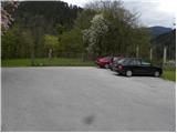
From the Ljubljana - Jesenice highway, we take the Ljubelj (Tržič) exit, then before the gas station in Bistrica pri Tržiču we turn right downhill, where we quickly arrive in Tržič. At the intersection past the Mercator store we turn left in the direction of the Tržič Museum, but we continue straight on Koroška cesta, which we follow through the town center to the nearby pizzeria. Here we turn right through the old courtyard gates and then past the parking lot for pizzeria guests and the children's playground we drive to the parking lot by the castle.
We can also park somewhere else in Tržič.
Route description:
From the place where we have parked, we first walk to the pizzeria, then continue on the asphalt road in the direction of Dobrča over Ravne and Kofce past Završnik. The road along which we walk soon splits, and this time we continue on the upper road (slightly left Dobrča), which leads us past a few more houses and a sign (cross). A few tens of meters ahead from the cross, at the place where there is a sign for speed bumps, we continue slightly right onto the side road, along which we climb to the nearby allotments. Along the worse road we climb above the allotments, where the path leads us to the water supply facility, which we go around on the right side. Above the water supply facility the road finally turns into a cart track, which then enters the forest through which it ascends moderately to steeply. Higher up, the wider cart track along which we continue turns left, then we leave it a little before its end and continue sharply right onto the well-trodden and marked Milanova pot. The path continues to ascend with occasional zigzags and occasional views, then brings us to a smaller saddle north of Kamnek.
Here we continue right (left Kofce, straight Slap, sharply right leads the path that bypasses the summit of Kamnek and then descends to Tržič) and continue the path along the initially still overgrown ridge, which we then follow to the summit a few minutes away.

Photos:
 1
1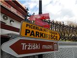 2
2 3
3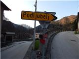 4
4 5
5 6
6 7
7 8
8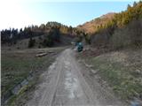 9
9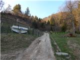 10
10 11
11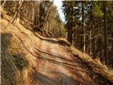 12
12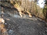 13
13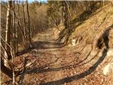 14
14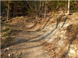 15
15 16
16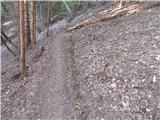 17
17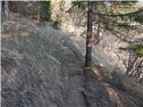 18
18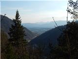 19
19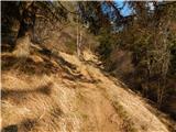 20
20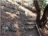 21
21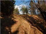 22
22 23
23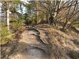 24
24 25
25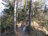 26
26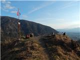 27
27 28
28
Discussion about the trip Tržič - Kamnek (Milanova pot)
|
| sirt113. 04. 2017 |
It has always been Kamnek.
Look at picture 23.
|
|
|
|
| peterr15. 04. 2017 |
This won't hold true; already in 1857 the folk poet Vojteh Kurnik published the poem Teržiška dolina file:///C:/Users/Peter/Documents/Downloads/Terika_URN-NBN-SI-DOC-UTUFU9R9%20(1).pdf
in which Kamnjek also appears, and Viktor Kragelj in his Historical Fragments of the Tržič parish in 1936, and you can find it on some old map as well. In Gorenjec 1910 (No. 19, May 14) it says that Kamnjek is the property of Neuhaus Castle (with a note explaining):
*) Kamnjek is the name of a rocky and steep hill on the northern
side of Tržič above the Neuhaus vineyard. Tržič residents call
the eastern slopes of Dobra mountain, on the right bank of the Mošeniški
stream; Kokovnica is the western edge of Kriška gora on
the left Bistriška bank. (See pp. 3 and 4 Addenda - description of Tržič)
file:///C:/Users/Peter/Documents/Downloads/Gorenjec_URN-NBN-SI-DOC-WZ5EKU5B%20(1).pdf
Over the years and with usage, some names change, but that doesn't mean those from many years ago aren't correct or that they never existed.
|
|
|
|
| Tadej15. 04. 2017 |
PD Tržič replied to me that Kamnek is correct.
|
|
|
|
| sirt116. 04. 2017 |
Peter
Names and even pronunciation of names!
|
|
|
To post a comment you must log in:
If you do not yet have a username, you must first
register.