Starting point: Trojane (561 m)
| Latitude/Longitude: | 46,1879°N 14,8828°E |
| |
Walking time: 1 h 30 min
Difficulty: easy unmarked way
Elevation gain: 287 m
Elevation difference along the route: 345 m
Map: Posavsko hribovje - zahodni del 1:50.000
Recommended equipment (summer):
Recommended equipment (winter):
Views: 6.564
 | 2 people like this post |
Access to starting point:
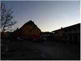
From the highway Ljubljana - Maribor, we take the Trojane exit, then continue driving on the parallel old road towards Trojane and Domžale. Our starting point is located right next to the catering company Gostinsko podjetje Trojane. We park somewhere nearby, as parking in front of the catering company is permitted only for guests.
Route description:
From the parking lot at the catering company Gostinsko podjetje Trojane, we walk to the bus stop, from there we carefully cross the main road. On the other side of the road, we ascend steep stairs and above them continue to the left. After a few steps, we will reach a marked path, which we follow to the right among houses to the nearby inscription box.
From the inscription box, the path which runs on a worse road starts descending towards the valley of the stream Bolska. When we arrive in the mentioned valley, we step onto a wider macadam road, which we follow to the left. Further on, we ascend for some time along the mentioned valley, then the road veers somewhat to the left from it. Further, we ascend traverse-wise to the right, crossing a larger number of smaller streams and springs, which mostly dry up on dry days. Higher up we arrive at a marked junction, where we continue on the left wider macadam road, along which there are also signs for "pašnik Lipovc". From the junction onwards the road ascends only for a short time, then gradually begins to descend gently and brings us to the next junction.
Here we continue right towards the pasture Lipovec (straight Špilk and Kekec), where first we cross the fence, then after two minutes of further walking we reach the shepherd hut on the aforementioned pasture.
We bypass the shepherd hut on the left side and immediately after it continue right to the nearby trough with water. At the trough we leave the trail and continue the ascent on easier pathless terrain, our direction being the nearby summit, which we reach after 5 minutes of further walking.

Photos:
 1
1 2
2 3
3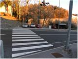 4
4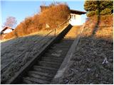 5
5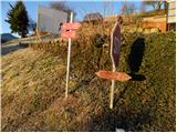 6
6 7
7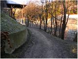 8
8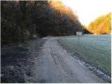 9
9 10
10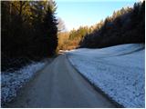 11
11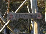 12
12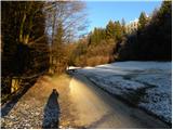 13
13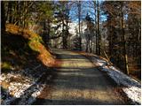 14
14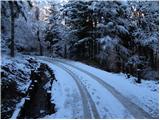 15
15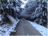 16
16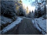 17
17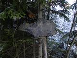 18
18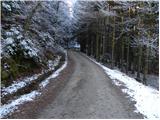 19
19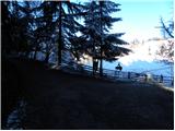 20
20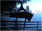 21
21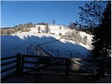 22
22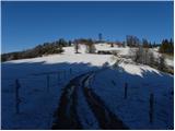 23
23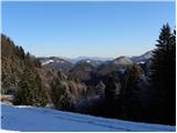 24
24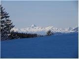 25
25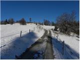 26
26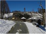 27
27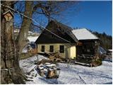 28
28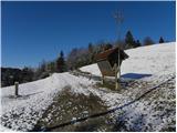 29
29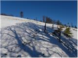 30
30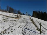 31
31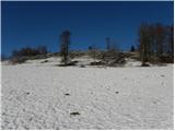 32
32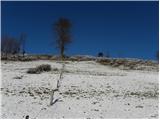 33
33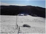 34
34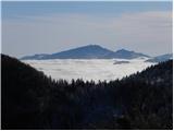 35
35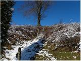 36
36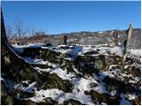 37
37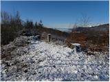 38
38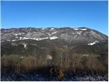 39
39 40
40
Discussion about the trip Trojane - Lipovec
|
| bruny20. 12. 2011 |
Yeah obviously a  interesting peak above the Lipovec pasture, which was unfortunately hidden interesting peak above the Lipovec pasture, which was unfortunately hidden  in fog when I was walking the Rokovnjaška planinska pot towards Špilk... In the direction from Lipovec towards Prvine above Trojane there are two more peaks, namely Reznarca at 913 m and Vrhe at 899 m. I'm a bit curious if anyone has visited them or if there are any specific paths leading to them. There's little info on the web!? Between Reznarca and Špilk there should also be a cross... I got info about Reznarca that it was a point of one of the Pustolovec Rajd society's adventures a few years ago. I assume they are less visited than Lipovec and Špilk... in fog when I was walking the Rokovnjaška planinska pot towards Špilk... In the direction from Lipovec towards Prvine above Trojane there are two more peaks, namely Reznarca at 913 m and Vrhe at 899 m. I'm a bit curious if anyone has visited them or if there are any specific paths leading to them. There's little info on the web!? Between Reznarca and Špilk there should also be a cross... I got info about Reznarca that it was a point of one of the Pustolovec Rajd society's adventures a few years ago. I assume they are less visited than Lipovec and Špilk...
|
|
|
To post a comment you must log in:
If you do not yet have a username, you must first
register.