Starting point: Treskavac (319 m)
| Latitude/Longitude: | 45,02988°N 14,6713°E |
| |
Walking time: 50 min
Difficulty: easy marked way
Elevation gain: 222 m
Elevation difference along the route: 222 m
Map:
Recommended equipment (summer):
Recommended equipment (winter):
Views: 6.473
 | 2 people like this post |
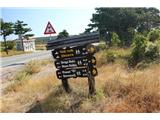
Access to starting point:
We drive to the island of Krk and continue along the road towards Baška. Somewhere in the middle of the road between the town of Krk and Baška, we will reach the Treskavac pass, where we will notice numerous hiking trail signs. We park in a suitable place near the signs.
Route description:
From the signs, we continue along the initially gravel road, which is occasionally also asphalted. The asphalted path leads first between low pines. After fifteen minutes, we reach a fence, where we follow the markers and continue along the road, which is still asphalted and occasionally gravel. After about half an hour of walking, we notice another fence on the road, where we leave the road and continue right onto a poorly visible path along the fence (photo 11). Soon we reach signs and a hut, where we follow the markers. We continue along the path, which is sometimes poorly visible. A moderate ascent follows, which brings us to Veli Vrh in a few minutes.
Photos:
 1
1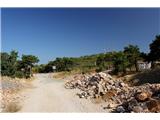 2
2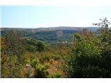 3
3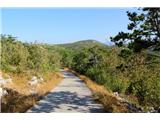 4
4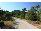 5
5 6
6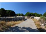 7
7 8
8 9
9 10
10 11
11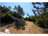 12
12 13
13 14
14 15
15 16
16 17
17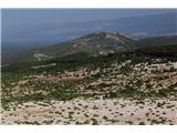 18
18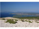 19
19 20
20
Discussion about the trip Treskavac - Veli Vrh
|
| lijaneja17. 12. 2013 |
Since those young autocampers have had their trailer in Pila (Punat) for some years I start right from the camp along the marked path past the Way of the Cross on trails to the summit.
|
|
|
To post a comment you must log in:
If you do not yet have a username, you must first
register.