Starting point: Treskavac (319 m)
| Latitude/Longitude: | 45,02988°N 14,6713°E |
| |
Walking time: 1 h 30 min
Difficulty: easy marked way
Elevation gain: 249 m
Elevation difference along the route: 249 m
Map:
Recommended equipment (summer):
Recommended equipment (winter):
Views: 14.916
 | 4 people like this post |
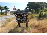
Access to starting point:
We drive to the island of Krk and continue along the road towards Baška. Roughly halfway between the towns of Krk and Baška, we arrive at the Treskavac pass, where we notice numerous hiking trail signs. We park in a suitable place by the signs.
Route description:
From the signs we continue along the initially gravel road, which is occasionally asphalted. The asphalted path leads first between low pines. After fifteen minutes we arrive at a fence, where we follow the markings and continue along the road, which is still asphalt and occasionally gravel. After about half an hour of walking, we notice a second fence on the road, where we leave the road and continue right onto a poorly visible path along the fence (photo 11). Soon we arrive at signs and a hut, where we follow the markings. We continue along the path, which is locally poorly visible. A moderate ascent follows, bringing us to Vele Vrh in a few minutes.
We continue along the poorly visible path, aided by markings on stones. After a few minutes of slight descent, we arrive at an abandoned pasture fenced with a stone wall. The crossing is well marked. Further on the path gently ascends and ahead we already see the summit with a stone marker. After a few minutes we are at its top, the highest point of the island of Krk - Obzova.

Photos:
 1
1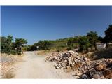 2
2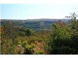 3
3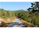 4
4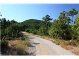 5
5 6
6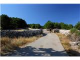 7
7 8
8 9
9 10
10 11
11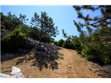 12
12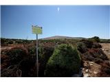 13
13 14
14 15
15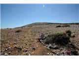 16
16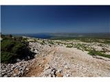 17
17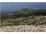 18
18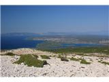 19
19 20
20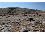 21
21 22
22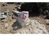 23
23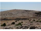 24
24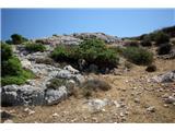 25
25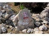 26
26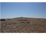 27
27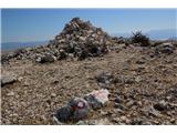 28
28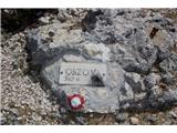 29
29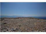 30
30 31
31
Discussion about the trip Treskavac - Obzova
|
| Tiranozaver14. 08. 2016 |
Beautiful hike and views. Congratulations to the association that additionally and newly drew the marks, because otherwise on the rocky ground it would be impossible to follow the path.
|
|
|
|
| anazala24. 04. 2018 |
really pleasant trip. maybe four hours of walking. nice view and not demanding path. caution anyway. then you can treat yourself to some swimming to enjoy the pleasant warm day. On Saturday 21.4.2018 it was fantastic.
|
|
|
To post a comment you must log in:
If you do not yet have a username, you must first
register.