Trenta - Zadnjiški Ozebnik
Starting point: Trenta (620 m)
| Latitude/Longitude: | 46,3772°N 13,7495°E |
| |
Walking time: 4 h 15 min
Difficulty: easy unmarked way
Elevation gain: 1464 m
Elevation difference along the route: 1464 m
Map: Trenta 1:25.000
Recommended equipment (summer):
Recommended equipment (winter): ice axe, crampons
Views: 17.859
 | 2 people like this post |
Access to starting point:
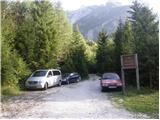
A) First, we drive to Kranjska Gora, and then we continue driving through the mountain pass Vršič towards Bovec. Soon after the 50th serpentine the road crosses the river Krajcarica, from where we drive for approximately 1 km to the spot where a gate-closed forest road branches off to the left. We park a few meters before the gate in a suitable place by the road.
B) We drive to Bovec, and then we continue driving towards Trenta. When we arrive in Trenta, we will notice a forest road before the center of the settlement which from the main road branches off sharply to the right. At the mentioned junction, which is located a few hundred meters before the center of Trenta, we turn sharply to the right and then we park in a suitable place by the road.
Route description:
From the gate, we continue on the forest road, which ascends gently and brings us to a junction, by which there is a smaller "parking lot". From the junction, we continue on the lower right road following the signs Prehodavci, but we walk on it only a short time because then the signs lead us left into the forest. The path ahead leads us past the house and behind it starts ascending again. Further, we ascend along the stream Beladovec, on which we can notice some nice smaller waterfalls. During the ascent along the stream, the path gradually becomes less steep, then turns slightly to the left, where it flattens even more. Next follows a few minutes of entirely easy walking, then the path, which runs along an old mule track, starts to ascend moderately in zigzags. For some time we still ascend through the forest, then, when we are already high above the stream, the forest also gradually starts to thin out. Next follows a few minutes of walking and the path brings us to the hunting cottage in Trebiški dol.
The path ahead still continues along the mule track, which leads us below the ridge of Špičje on the right and Velika glava and Veliki Konj on the left. A moderately steep path, which continues through a panoramic valley, splits a little higher into two parts.
We continue on the lower left path (right Prehodavci), along which we quickly arrive at the saddle Čez dol.
On the grassy saddle, more precisely at the cairn, we leave the marked path and head onto an initially barely visible footpath which crosses the overgrown grassy saddle Čez Dol. On the north side of the saddle Čez Dol, we arrive at the southern slopes of Zadnjiški ozebnik or initially still the slopes of Veliki Konj. The initially barely visible footpath leads us further across grassy slopes grown with bands of dwarf pines. Higher, the path brings us into a short indistinct valley, from which with the help of a few cairns we arrive at the ridge of Zadnjiški Ozebnik. Here we continue right and proceed along the very panoramic ridge. The summit, which we already see in front of us, we reach after approximately 5 minutes of further walking.

Along the route: Planina Lepoč (1090m), Planina Trebiščina (1412m), Čez Dol (1632m)
Photos:
 1
1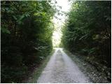 2
2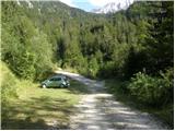 3
3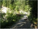 4
4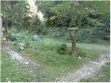 5
5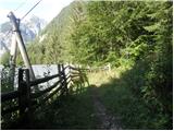 6
6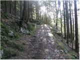 7
7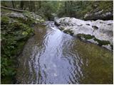 8
8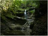 9
9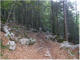 10
10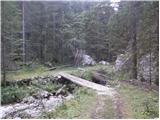 11
11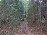 12
12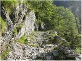 13
13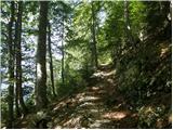 14
14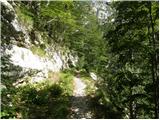 15
15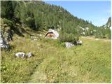 16
16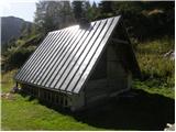 17
17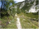 18
18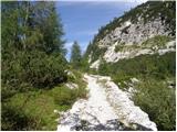 19
19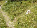 20
20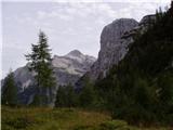 21
21 22
22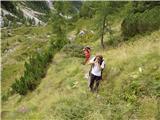 23
23 24
24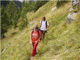 25
25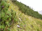 26
26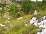 27
27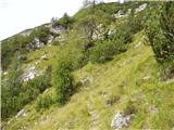 28
28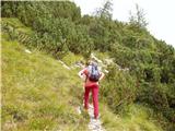 29
29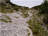 30
30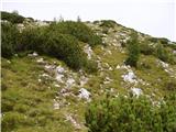 31
31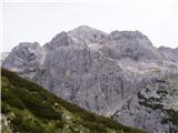 32
32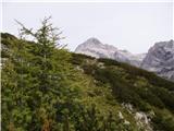 33
33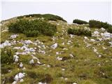 34
34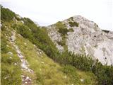 35
35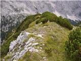 36
36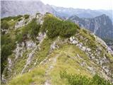 37
37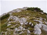 38
38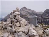 39
39
Discussion about the trip Trenta - Zadnjiški Ozebnik
|
| darinka422. 09. 2020 |
Yesterday from Trenta village. Along the path bypassing the weekend houses. Past interesting waterfalls. At the junction we decided to explore the path further from planina Trebišina which is abandoned. And the path marked on old maps no longer exists. But there's another one longer around the hill. We follow it for a while but return to the main path and continue to the shepherd's hut at Trebiško dol. It started to cloud over. Still, we decided to look for the trail leading to the remains of caverns or whatever is left under the summit of Zadnjiški Ozebnik. We still had about 200m to there when it started drizzling and we decided to descend via Trebišina to Trenta.
|
|
|
|
| darinka49. 10. 2020 |
8. 10 2020 We decided to repeat the tour. This time in beautiful sunny weather. We skipped Planina Trebiščina this time. From the shepherd's hut in Trebiško dol we went straight up the slope as the last one. Off trail. We reached the buildings, or rather what remains of them from the times of the Alpine Wall. I viewed them, took pictures and continued at the right bend, otherwise the trail is still visible, which probably leads to Planina Trebiščina. We had quite a long way to the top of Zadnjiški Ozebnik. Whoever goes there should enter the route into the phone, because it is very poorly traceable in places. But interesting. We saw a herd of chamois. A squirrel flew from the scrub. We were the only ones at the top. We descended to Zadnjiški Dol. Encounter right at the descent with an adult viper. And back home along the same path to the valley. It added up to 16.5 km in elevation and 18 km. Since we went from the village Trenta and bypassed the gravel road and weekend houses, we had to ford the water. Yesterday it had risen quite a bit.
|
|
|
|
| darinka410. 08. 2021 22:37:20 |
From the parking lot in Trenta we set off in the morning across Trebiški Dol. Then off-path to the remains of barracks from the Rapallo border era. Then along an interesting less visible path that runs under the summit of Konj. At least that's what they call it. And the last part of the path on the usual route. At the top we meet local Lojze, who advises us against descending to Planina Trebišina, because it's quite overgrown and we would struggle to get there. Last year Marijana and I turned back because we couldn't find the path further from that planina. So all three of us head down the usual path. To Trenta. And thank him for the info and invitation to Trentarski Pelc. He knows all these paths well. And the last part when Renato and I swam in the cold Soča. I don't know if it had 10 degrees.
|
|
|
|
| darinka418. 05. 2023 23:39:39 |
From the barrier we went to sedlo Dol. There is snow there. Then along a traceable path through scree. And through snowfields which make passages difficult. Snow is melting. Under the summit it's winter idyll. Quite some has fallen in the previous days. At height 2057 m we decided not to go through the narrow section, mainly due to cornices that probably await a slide, to the top. Rumbling of avalanches could be heard around Kanjavec. The path leading to Prehodavci is also snowy.
|
|
|
|
| saram26. 08. 2025 20:51:04 |
Yesterday from the barrier to Dol saddle. Trail without peculiarities. Views excellent. We were alone on the trail and summit. But I must praise the one who nicely cleared the trail. We did a bit too. All praise to those who care that the step is safe.
|
|
|
|
| Darxta8. 09. 2025 14:44:49 |
Two days ago from the top back to the valley via this path. This path is gentler than the one from Zadnjica, but almost half longer!
Water along the path only in the lower third, higher up you hear it but see it only from afar 
|
|
|
To post a comment you must log in:
If you do not yet have a username, you must first
register.