Trebež (Jesenice) - Kozjek (on east ridge)
Starting point: Trebež (Jesenice) (590 m)
| Latitude/Longitude: | 46,4319°N 14,0941°E |
| |
Route name: on east ridge
Walking time: 30 min
Difficulty: easy marked way
Elevation gain: 176 m
Elevation difference along the route: 176 m
Map: Karavanke - osrednji del 1 : 50.000
Recommended equipment (summer):
Recommended equipment (winter): ice axe, crampons
Views: 3.850
 | 3 people like this post |
Access to starting point:
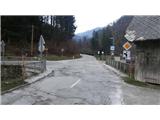
From the highway Ljubljana - Jesenice, take the exit Lipce (Jesenice east), where we drive right towards Jesenice. At the first traffic-light intersection (settlement Slovenski Javornik) we turn right (direction Lj.) towards Koroška Bela. At the next intersection with traffic lights we turn left, and soon once again left towards Javorniški Rovt. After less than a kilometer of driving, we arrive at the settlement Trebež (unmarked), which we recognize by the sharp left turn with an intersection, at which there is a bridge over the stream Javornik. We park at a suitable place nearby (e.g. in the same settlement, about 100 meters ahead on the main road in the direction of Jesenice).
Route description:
From the bridge at the turn, we head onto the side road that leads towards Javorniški Rovt, and walk along it only briefly. After a slight left turn, before the first house on the right, we head onto the forest road on the left side, which ascends far to the left towards the forest. This soon after the barrier (rampa) turns right, a little higher it brings us to a cart track junction on the left, onto which we turn. Here we encounter the first path markings - yellow dots and arrows. The cart track soon crosses a small stream, and brings us to a fork in the cart tracks, where we choose the right one, but immediately after leave it and turn right again onto the marked trail, which takes us onto the ridge of the hill. A pleasant path among pines and birches then after a short ascent brings us to a junction, where we go right and continue briefly along a flatter path towards the north. Soon, after a slight left turn, the yellow markings direct us perpendicularly left, back onto the ridge of the hill (straight - Desni Hlevček, Čopov rovt). On the ridge the path turns right and ascends more steeply westward, towards the summit of the hill. A pleasant and panoramic path among dense birches higher up partly flattens and even descends slightly, before the summit itself it ascends steeply one last time towards the goal. At the summit benches await us, and a nice view of the nearby and distant surroundings: Slovenski Javornik, Lipce, Blejska Dobrava, Mežaklo, Jelovica with Ratitovec and Ljubljana Basin.

The trip can be extended to the following destinations: Jelenkamen
Photos:
 1
1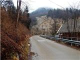 2
2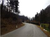 3
3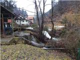 4
4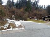 5
5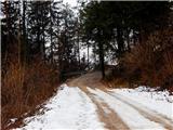 6
6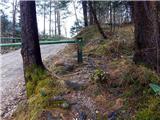 7
7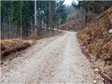 8
8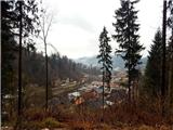 9
9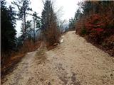 10
10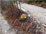 11
11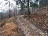 12
12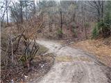 13
13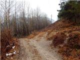 14
14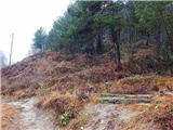 15
15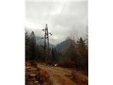 16
16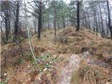 17
17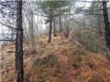 18
18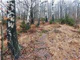 19
19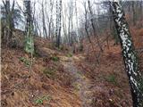 20
20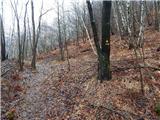 21
21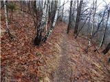 22
22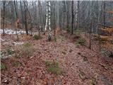 23
23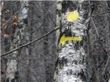 24
24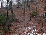 25
25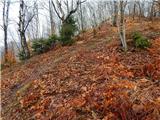 26
26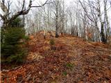 27
27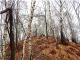 28
28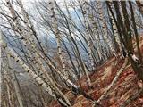 29
29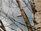 30
30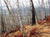 31
31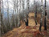 32
32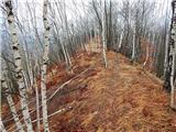 33
33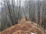 34
34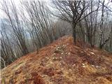 35
35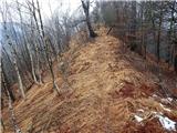 36
36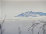 37
37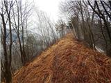 38
38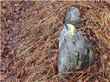 39
39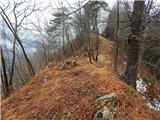 40
40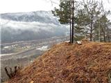 41
41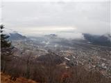 42
42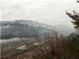 43
43
Discussion about the trip Trebež (Jesenice) - Kozjek (on east ridge)
|
| heinz22. 02. 2016 |
Belska planina is not visible from Kozjek. Majda across that fallen beech where the clay was sinking was particularly awkward before the path renovation (by H. and J.). Almost no one bothered with crossing that obstacle so the path was practically closed. Higher up, in the section between narciso and Mali Jk (as you call it) it was completely hopeless. After the glaze ice storm I walked that lower crossing at most 2x.
|
|
|
|
| Majdag23. 02. 2016 |
... I went once, also from Jesenice to Baba nad Stražo. I had to scramble far below and above to get over the fallen trees. They called me last night and said they would make some kind of footbridge over the clay pit, as steps wouldn't hold. But it's a very nice path, from Jesenice a bit longer than from Trebež, I'll definitely go there many more times..
|
|
|
|
| Majdag29. 02. 2016 |
..Haso and Janko have fixed the most difficult, muddy section of the trail from Jesenice to Kozjek. Done professionally as only path markers experienced in mountain trails know how, thanks..
|
|
|
|
| heinz29. 02. 2016 |
Nice of them! Just to add that this section of the trail you mention is not actually on the trail described above. The trail they repaired is (supposed to be) Šporen (Tomšičeva) - Kalvarija, or one of the variants Šporen - Jelenkamen. Of course, via this and many other trails on the southern slope, you can reach from Murova to Trebež.. 
|
|
|
|
| Anamarija13615. 11. 2020 |
We were today on this path. At the beginning slippery due to moisture, leaves, slippery stones.
Otherwise a nice path, pleasant trail with nice views.
blog
|
|
|
|
| KekecRozle28. 06. 2022 20:10:56 |
Today I found white phone earphones at the top of Kozjek next to the bench.
The owner can find them in the summit log box on the tree 
|
|
|
|
| heinz22. 02. 2023 14:56:21 |
I recommend viewing the map located on Španov vrh, as proof that locals have always called the peak KozjEk and not incorrectly -KozjAk.
(unfortunately I cannot attach photos)
Have a nice day, safe and joyful on all paths!
H.Blagne
|
|
|
To post a comment you must log in:
If you do not yet have a username, you must first
register.