Trebež (Jesenice) - Javornik waterfalls (by road)
Starting point: Trebež (Jesenice) (590 m)
| Latitude/Longitude: | 46,4319°N 14,0941°E |
| |
Route name: by road
Walking time: 30 min
Difficulty: partly demanding unmarked way
Elevation gain: 100 m
Elevation difference along the route: 100 m
Map: Karavanke - osrednji del 1 : 50.000
Recommended equipment (summer): ice axe
Recommended equipment (winter): ice axe, crampons
Views: 7.624
 | 4 people like this post |
Access to starting point:
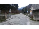
From the Ljubljana-Jesenice highway, take the Lipce exit, where we drive right towards Jesenice. At the first traffic-light junction (settlement Slovenski Javornik), we drive right (direction Lj.) towards Koroška Bela. At the next junction with traffic lights, we turn left, and soon once again left towards Javorniški Rovt. After barely a kilometre of driving, we arrive at the settlement Trebež (unmarked), which we recognise by the sharp left turn in which there is a bridge over the Javornik stream. We park at an appropriate place nearby (also possible in the same settlement about 100 metres further along the main road).
Route description:
From the bridge at the turn, we head onto the side road that leads towards Javorniški Rovt, and walk along it for some time; first past houses and a business building, then past the dam and a few more houses. When we go through the left turn where the end of the settlement is (sign), on the right side we notice a smaller power plant. Here the road starts to ascend. When we go through a slightly larger left turn, on the right we notice a wooden cottage, where we turn right off the road onto a poorly trodden path that leads across a grassy surface. When we cross the small bridge near the road, we turn right and look upwards to the grassy slope along which a shortcut to Javorniški Rovt leads uphill beside the pipeline. Here we immediately turn even further right, first along the streamlet, across partly overgrown terrain towards the bed of the Javornik stream, from where especially after rain we can hear the roaring of the waterfalls. After a gentle descent we come near the bed, where at a suitable spot we carefully approach the lower waterfall, or the point where we can observe two: the lower and the middle waterfall. Due to the moisture of the gully there is a danger of slipping into the stream bed! When we have enjoyed the views, we return to the flat area, and slightly higher along the bed we find a spot where we approach the middle waterfall. Then we return to the grassy slope where the shortcut runs, and climb just a few metres uphill. At the end of the wooden revetment, which prevents the terrain from slipping, we encounter a barely noticeable footpath, along which we finally also reach the upper waterfall, according to some the most beautiful, fan-shaped one.

Photos:
 1
1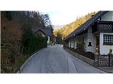 2
2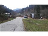 3
3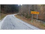 4
4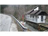 5
5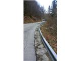 6
6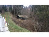 7
7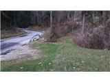 8
8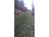 9
9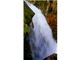 10
10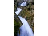 11
11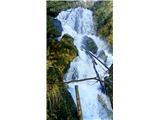 12
12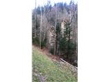 13
13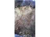 14
14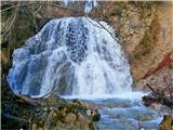 15
15
Discussion about the trip Trebež (Jesenice) - Javornik waterfalls (by road)
|
| Zemlja8. 10. 2019 |
Today I went to see the waterfalls and I can say that the path to the lower two is completely impassable, unless I missed the path 4x. Currently, the upper waterfall also has much less water, but at least it is nicely accessible. 
|
|
|
|
| heinz17. 10. 2019 |
At the lower waterfalls unfortunately there is no path, so you have to make a bit of an effort to bushwhack to the stream bed. Careful of course. The waterfalls are best visited at a suitable high water level, e.g. days after somewhat heavier rain. Good luck!
|
|
|
|
| Jusk10. 02. 2022 18:21:54 |
At picture 8 there is now an info board and an arranged little path to the upper waterfall. Regards
|
|
|
To post a comment you must log in:
If you do not yet have a username, you must first
register.