Trbovlje - Kum (via Čebulova dolina)
Starting point: Trbovlje (250 m)
| Latitude/Longitude: | 46,1263°N 15,0362°E |
| |
Route name: via Čebulova dolina
Walking time: 3 h 30 min
Difficulty: easy marked way
Elevation gain: 970 m
Elevation difference along the route: 970 m
Map:
Recommended equipment (summer):
Recommended equipment (winter): crampons
Views: 54.735
 | 4 people like this post |
Access to starting point:
Railway station in Trbovlje.
Route description:
The path begins at the traffic light at the crossroads in Trbovlje at Cementarna. We go in the direction of Dobovec. After approximately 100 meters, the path branches off from the road towards Kum. We continue on this path for approximately 30 minutes to the beginning of Čebulova dolina, where there is a farm; the path goes left from the hayrack and then at the manure heap and stable, the path turns below the stable, and then at the end of the stable the path goes between this and the other structure on the yard of the house; then the path turns right below the second hayrack through the valley to the asphalt road, where we cross the road and continue the path uphill through the meadow. At the top of this meadow in spring you can see a lot of gentians. Then you reach a macadam road, where there is a crossroads and the path continues further through the valley or right to some farm. We choose the path further through the valley. The path leads us through this valley, where we walk for a very long time among spruces. Then at the end of the valley we turn left, where we walk uphill through the forest to the branch-off to Lontovž (ski slope) or go right onwards to Kum. From this path we arrive already quite under Kum. There we can go around by road or ascend Kum via the meadow.

Photos:
 1
1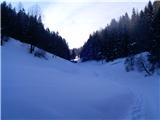 2
2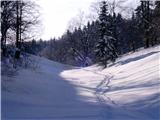 3
3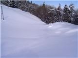 4
4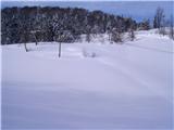 5
5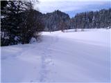 6
6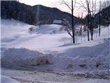 7
7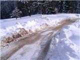 8
8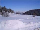 9
9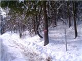 10
10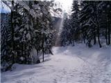 11
11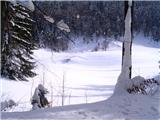 12
12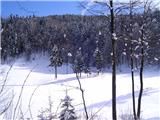 13
13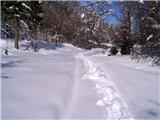 14
14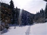 15
15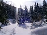 16
16 17
17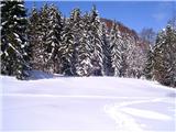 18
18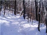 19
19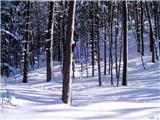 20
20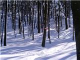 21
21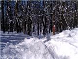 22
22 23
23 24
24 25
25 26
26 27
27 28
28 29
29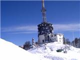 30
30 31
31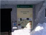 32
32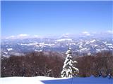 33
33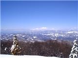 34
34 35
35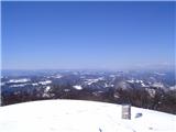 36
36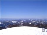 37
37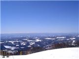 38
38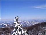 39
39 40
40
Discussion about the trip Trbovlje - Kum (via Čebulova dolina)
|
| MiR3. 11. 2008 |
I suggest adding a description of the path to Kum from the village of Čimerno. A local woman in the village told me it's a 1.5-hour walk. You can also start from the Sopote valley from Zagrad - same starting point as for Nebeška gora. The signpost says 3.5 hours to Kum. Good luck to everyone!
|
|
|
|
| predrag27. 02. 2010 |
Hi! What are the snow conditions like at the moment?
LP Predrag
|
|
|
|
| majdicst25. 04. 2010 |
The description, especially the part where it describes the path around the first farm, is very unclear. When you reach the farm, the sign already directs you right, and then you follow the visible path which actually takes you between the house and the barn, then continue straight up the valley to the chapel (visible from the farm), where you meet the markings again.
Today we walked this path in three hours, with frequent rests (total about 20 minutes), and in the group there were some who don't hike at all. In three and a half hours (or, as Pergar writes in his guide - in four hours), anyone who is averagely physically fit can reach Kum.
|
|
|
|
| jprim27. 04. 2010 |
Today we walked this trail in two and a half hours, but we have to say that the markings are very poor, either almost completely faded or too far apart, so we had to turn our heads quite often to find them, as it was our first time in this area today.
LP!
|
|
|
|
| Matjaz_6529. 05. 2011 |
for a pleasant circular tour it's worth combining the ascent through Škratova dolina with the return through Čebulno 
for the connection between Trbovlje and Zidani Most the train is ideal ... although I used a bike myself ... with which I took about 40 min from Trbovlje to Zidani Most. 
a few more photos
|
|
|
|
| darh27. 07. 2011 |
We went to Kum through Čebulovo dolina at the end of June. The trip was very pleasant, we met almost no one except at the top. A more detailed description is posted here.
|
|
|
|
| KARAMELICA14. 04. 2013 |
For a long time we had been talking about going to Kum. On this side I noticed that you can also reach Kum from the village Čimerno. Although we are from the other end of Slovenia, we decided to try. When we arrived in the village Čimerno, a friendly local woman greeted us first, where we left the car. Then we headed first to Nebeška gora to the wish bell, then along the ridge back to the valley and then up the hill again to Kum. From Kum there is a beautiful view of all parts of Slovenia. But I can't help but also praise the people who take care of the signs and markings, because the path to Kum is super marked, every turn left or right is marked, so from this end from which we went, it's really impossible to miss the path, even though this area is not familiar to us at all. Really all praise, super.
|
|
|
|
| bo_zl3. 08. 2014 |
markers or signs on meadows are very rare, so orientation is difficult. Also the path along the gravel road past the hamlet is poorly marked, better said not at all. At the start the junction is well marked, then no markers. Except one faded. So to supplement the description, walk along the gravel road for quite a long time, no markers, but you are on the right path. At the end marked junction to the left for Kum.
|
|
|
|
| monika7623. 03. 2015 |
Hello,
I'm interested in the following; I'm organizing a hike to this hill for colleagues, but among them is one who cycles more easily (mountain bike) than walks (injured leg). Is this venture suitable for him? Thanks, best regards Monika
|
|
|
|
| alyas23. 03. 2015 |
The ascent from Trbovlje to Kum by bike is not really easy, 1000m elevation gain and 11 km of above-average steepness, which from the ground to the top doesn't ease at all, and the last 2 km below the summit is gravel. For comparison: the more famous climbs to Vršič and Krvavec are easier.
|
|
|
|
| monika7624. 03. 2015 |
Thanks Alyas. Could you perhaps recommend another ascent suitable for both hikers and cyclists?
|
|
|
|
| dejan198425. 03. 2015 |
Ascent length to Kum is 9.8km, average gradient 10.8%, 1000m elevation gain and last km is macadam. Quite a demanding tour this is.
|
|
|
|
| radegunda6. 06. 2015 |
Could someone share summer photos for easier orientation on the path (especially photos at key points where the path is poorly marked)? We don't want to get lost on such a demanding hike 
|
|
|
|
| hribuc856. 06. 2015 |
Radegunda, hello!
No worry about getting lost on the mentioned path. The path through Čebulova dolina branches off the main road Trbovlje-Dobovec (a bit higher from the start of the path the road is closed due to landslide, although on weekends you can reach Dobovec by car) a few 10 meters after the start of the ascent. Then the path goes through the forest and is easy to follow. After about 3/4 hour of walking you reach a meadow, the path continues towards the hayrack and along the cart track past a few houses and a barn on the right. Continue straight past the second hayrack and then through the grassy valley to the chapel. Past the chapel to the third hayrack on the left you reach the road, go about 10 meters to the right along the road and then left back into the hill. First a bit across the meadow, then a bit through the forest and again across the meadow to the gravel road. Follow the markers that direct you left along the gravel and follow it all the way to the end of the valley (wooden church sign). Continue uphill and then right again into the forest (left the gravel continues to the top of the ski slope Lontovž). Then just follow the markers that lead you to the top of Kum. Everything is well marked and no fear of getting lost. If you set off tomorrow you will surely meet some friendly local to ask if you're not sure. Good luck!
|
|
|
|
| Gričnik8. 11. 2015 |
Yesterday did a circular route: Zidani most, via Škratova dolina to Kum and then via Čebuljno dolina to Trbovlje and by train back to Zidani most. Truly wonderful and nicely marked and maintained path. Thanks to all caretakers - Recommend
|
|
|
|
| garmont31. 03. 2019 |
I would complain a bit about the markings of the ascent duration to the top. At Trbovlje bus station it says 2.5 hours. 10 minutes later on the other side of the bridge over Sava it says 3 hours, at the junction a bit higher 3.5 hours.  
|
|
|
|
| geppo31. 03. 2019 |
Of such errors, I noticed quite a few on these new directional metal signs
That's why I prefer to retreat to unmarked areas
|
|
|
|
| B23. 04. 2019 |
The same case is on the ŽP Kresnice - Geoss section. Sometimes according to the signs it seems you're heading towards the bridge and then across the Sava river away from Geoss instead of approaching it...
|
|
|
|
| Tbs11. 05. 2024 20:44:51 |
What is the trail like now?
|
|
|
To post a comment you must log in:
If you do not yet have a username, you must first
register.