Turistična kmetija Perk - Matkova kopa (shepherd-hunting path)
Starting point: Turistična kmetija Perk (1230 m)
| Latitude/Longitude: | 46,4152°N 14,6013°E |
| |
Route name: shepherd-hunting path
Walking time: 3 h 30 min
Difficulty: very difficult pathless terrain
Elevation gain: 727 m
Elevation difference along the route: 1050 m
Map: Kamniške in Savinjske Alpe z Obirjem in Peco
Recommended equipment (summer): helmet
Recommended equipment (winter): helmet, ice axe, crampons
Views: 18.156
 | 4 people like this post |
Access to starting point:
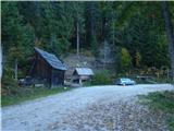
From the Kranjska side over Kranjski Rak or from the Štajerska side past Mozirje we drive through Luče and ahead towards Logarska dolina. At the turn-off for Logarska dolina we continue driving forward towards the border crossing Pavličevo sedlo and about a kilometer higher we turn left over a bridge into Matkov kot. At the smaller power station the macadam starts. On the right is a turn-off towards the tourist farm Gradišnik (homestead of the known Slovenian zitherist Karli Gradišnik). We drive straight ahead on the macadam past farms Kočnar and Matk to farm Perk (smaller sawmill on the right side and enclosure for pigs on the left side of the road). There we kindly ask where we can park, so that our parking does not obstruct their work.
Route description:
We park at the farm Perk or in its vicinity. Our path starts at Perk's sawmill on a forest track right steeply upwards. A little higher we come on the ridge to a marked path-track, which immediately in a short distance turns left twice. Then the path-track directs right straight along the ridge upwards and thereby twice crosses a forest road. Above the second crossing the marked path-track soon turns right, we go straight and immediately again left on a poorly visible path. The path takes us across a small stream after about 100 m to a forest clearing (path disappears here) along which we continue on the right side to Lesnikovo sedlo a little higher. There we come to a forest road, which leads us left across the clearing upwards. Then we turn right upwards on a track to the upper side of the clearing. At the end of the track and clearing begins a nice shepherd-hunting path. A little higher we climb right to Jerebičje (we can also go diagonally, paths then join again). We continue along the ridge of Jerebičje and then descend down to Matkovo sedlo. The saddle is like a long almost flat grassy back, with a smaller decaying hut under the left edge, surrounded by forest. The path is here very poorly visible. At the end of the saddle we climb steeply upwards along a vegetated ridge. The path is again well visible. Soon behind us are also Matkov Grintovec and Jevševec. The ascent to them takes us little time, since they are only a little above the path. The easiest access to them is at their end (not at the beginning), viewed in the direction of travel. A little further the path descends very steeply far down past a precipitous gully on the left, across the clearing past the salt lick to the gully below. Then we cross the gully and climb on the other side steeply upwards. The path ahead is easier, but several times very exposed and dangerous for slipping. Several times we descend a little and climb, which our legs also let us know. After a longer crossing of the dwarf pine-covered slopes of Matkove kope we come to the gully (usually there is a cairn, if not we place one), along which the last part of the ascent to the summit begins. There is no path from here onwards.
The further ascent is hard to describe. While advancing through the gully above it we notice a pointed rocky summit, towards which we must go. From the entry gully we climb to a less pronounced one right under it, and along its (right) edge we ascend to the dwarf pines. Then a few steps again right, a little upwards, then again a little right and up (visible traces of treading - probably hard to believe from a human). Without greater struggle with dwarf pines we are at the lower edge of the scree (for those coming after we place a cairn). From here onwards there are no more major orientation loops. Along the edge of the scree we climb under the walls, where we direct to the right. The easiest approach to the summit of Matkove kope from here indeed runs near the right edge. The nicely visible steep gully left beside it is easiest to tackle straight upwards. When we climb this part the summit of Matkove kope is in front of us.

Along the route: Lesnikovo sedlo (1517m), Jerebičje (1761m), Matkovo sedlo (1623m), Matkov Grintovec (1700m), Jevševec (1730m)
Photos:
 1
1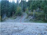 2
2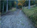 3
3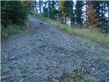 4
4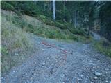 5
5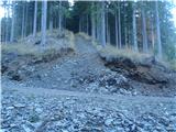 6
6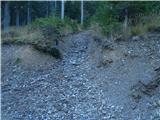 7
7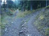 8
8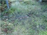 9
9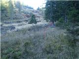 10
10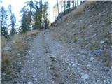 11
11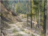 12
12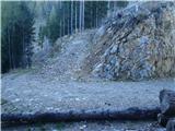 13
13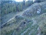 14
14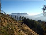 15
15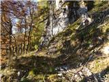 16
16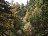 17
17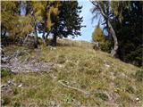 18
18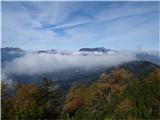 19
19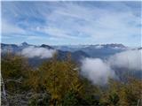 20
20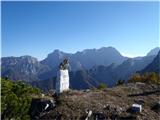 21
21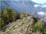 22
22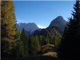 23
23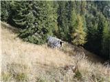 24
24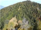 25
25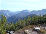 26
26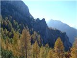 27
27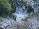 28
28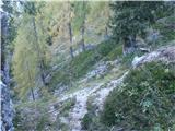 29
29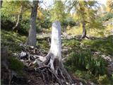 30
30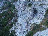 31
31 32
32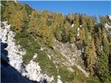 33
33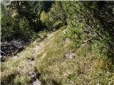 34
34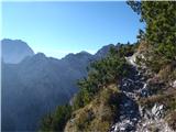 35
35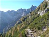 36
36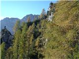 37
37 38
38 39
39 40
40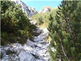 41
41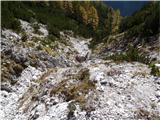 42
42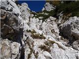 43
43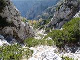 44
44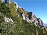 45
45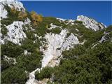 46
46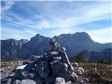 47
47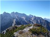 48
48 49
49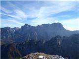 50
50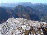 51
51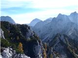 52
52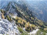 53
53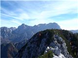 54
54
Discussion about the trip Turistična kmetija Perk - Matkova kopa (shepherd-hunting path)
|
| Klin17. 11. 2010 |
Bold excursion, where few people go. Congratulations
|
|
|
|
| aonuk14. 04. 2011 |
Yesterday 3.4.2011 I went exactly on this variant. I only reached Matkov Grintavec, in some places still a lot of wet snow (sinking up to hips)
Nevertheless very satisfied with the view and nice weather, surely repeat in summer and conquer the summit too.
|
|
|
|
| aonuk126. 09. 2011 |
Yesterday's fourth attempt on Matkova kopa successful, this mountain really made me sweat . Persisted because the summit height is my birth year. . Persisted because the summit height is my birth year.
|
|
|
|
| geppo26. 09. 2011 |
I'm the same year of birth, and I still have this trail on my debt list too...
congratulations
lp
|
|
|
|
| nataša114. 08. 2012 |
My motivation for the tour to Matkova Kopa was not matching the summit height with my birth year, but my friend Marko's suggestion. These turn out to be very attractive variants that greatly contribute to my personal growth through their natural values and laws. This time I truly "fell in love" with this peak, although conquering summits is not always the main motive of our hikes.
The adventure began when we boldly headed from Pavličevo sedlo down the steep slope to Pavličeve stene, followed by a descent to Lesnikovo sedlo, then a relatively short ascent to Jerebičje. There, along the ridge crest, winds a wonderful panoramic path that allows mountain lovers to experience a diverse spectrum of sensory pleasures. Into this biotic diversity obtrusively intrudes black plastic wire, probably leftover from the times when border guards patrolled here. It would be nice if they cleaned it up after themselves.
From Jerebičje we had a wonderful view of Matkova Kopa, which allowed us to make an orientation sketch of possible passages to the summit, as there's no opportunity later. From the ridge we descended again, this time to Matkovo sedlo, always following the border markers that had guided us from the border crossing. From the saddle we headed to Matkov Grintovec and Jerševec, keeping more to the right direction, as we wanted to reach Matkova Kopa from the south side, which is less visited and a big challenge for off-trail enthusiasts. We also reached the double window without trouble, which gave us even more elan. Soon after, Matkov zob rises to our right and we're already under the wall of Matkove Kopa. Climbing poses no problems for us (I, II) except when tackling the scree (III). Then the route veers far right and steeply up the narrow gully to the notch, and we're on the first summit. To the second it's just a "hop" – bravo to everyone who gets up here. It's no easy off-trail.
We intended to descend the "normal" route, which proved more demanding, as neither of us knew where the gully ends – we found some cairns there too – so after a two-hour "pondering" we accepted Marko's suggestion to return the same way we came up. I think I "fell in love" with Matkova Kopa too much, as it just wouldn't let me down to the valley.
Descent without a rope would be very difficult, so it's wise to carry one in the backpack if approaching Matkova Kopa from the north side. Also, without good psychophysical preparation, don't attempt such adventures, as I must admit that without Marko's ability to stay calm, the mountain rescue would have had quite a job with me on Sunday.
This "infatuation" of mine turned into a real adventure, followed by a true Hollywood ending – happy and full of satisfaction. Thanks, Marko!
LPP Nataša
|
|
|
|
| nataša114. 08. 2012 |
It seemed to me that the direction went steeply downwards... but there wasn't enough courage to just go by instinct. It tempted me though, now that I know, to attack the summit from that side too, because then I'd really have a "well-processed Matka" and in that case every bit of info is very welcome. Thanks for the photo sketch. How did it go for you?
|
|
|
|
| geppo14. 08. 2012 |
It was fantastic.
http://www.hribi.net/trenutnerazmere.asp?slo=1&gorovjeid=3&id=1116&stran=2
We descended that central gully looking for passages. Apart from the scorching sun that in the afternoon beat into the gully, there were no problems. It's technically much easier than the approach from the north side. Once you reach the path, just follow it.
Overall it's a wonderful adventure in quite wild terrain.
regards (if you need any more info, just write)
|
|
|
|
| ljubitelj gora17. 05. 2015 |
On Sunday 17.5 at Matkova kopa, start on the Austrian side a little below Pav.sedlo, nice ascent to Matkova kopa. The path has 1-2 snow patches, which are no problem, I had no trouble finding passages. The description, which I only skimmed quickly, is super written.
One picture:
http://shrani.si/f/F/ka/3PgHq07C/img0945.jpg
|
|
|
|
| Picikl12. 06. 2015 |
Yesterday my friend and I stood on the top of Matkova kopa. We only got lost once, otherwise we followed the descriptions that can also be found on the hribi.net site. Excellent tour!
|
|
|
|
| dprapr30. 11. 2018 |
I last talked to the locals about naming the ridge towards Matkova kopa.
Talk was about Lesnikove šrange (Lesnikovo sedlo), Grintovec (Jerebičje), Jevševec (Matkovo sedlo), Veliki zelenici (where the salt hut is). They have no name for "Matkov zob".
Even the neighboring Austrians apparently call Jerebičje Grintovec.
In short, completely different from official maps.
|
|
|
|
| djimuzl30. 11. 2018 |
I noticed that when posting a photo on Facebook, it automatically suggested "Grintouc" as location.
When I investigated further, I found that the description of that location on FB links to Wikipedia where Jerebičje as Grintouc is described in Swedish and Cebuano (Philippines).
https://sv.wikipedia.org/wiki/Grintoutz_(bergstopp)
Interesting.. 
|
|
|
To post a comment you must log in:
If you do not yet have a username, you must first
register.