Starting point: Tominčev slap (730 m)
| Latitude/Longitude: | 46,3966°N 14,2714°E |
| |
Walking time: 3 h
Difficulty: easy unmarked way
Elevation gain: 904 m
Elevation difference along the route: 904 m
Map: Karavanke - osrednji del 1:50.000
Recommended equipment (summer):
Recommended equipment (winter): ice axe, crampons
Views: 10.561
 | 1 person like this post |
Access to starting point:
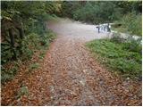
From the Ljubljana–Jesenice motorway, take the Tržič and Ljubelj exit. Follow the road ahead towards the Ljubelj border crossing, but only to Podljubelj. Here, turn right towards Podljubelj and the camp. Soon the road brings us to an intersection, where to the left across the bridge the road towards the camp and Tominčev slap branches off. Take this road, follow it towards the waterfall and park on the parking lot near the waterfall.
Route description:
From the parking lot, continue along a steep macadam road for approximately 20 minutes to the spot where, behind the stream that flows over the concreted road, a wide cart track branches off to the left. Head onto this cart track and follow it for a few tens of metres to the spot where it turns left over the torrent (right private). Then follow the cart track for less than ten minutes to the spot where it brings us to two torrential streams. The path ahead continues between both streams along a partly ruined cart track, which a little higher brings us into the stream bed. Further, ascend up the bed until on the right side we notice a partly ruined cart track along which we continue the ascent. The cart track then crosses the torrent and withdraws to the left. Further on, the cart track brings us to a poorly visible junction of two cart tracks. Take the right one, which ascends an overgrown slope back to the torrent. The cart track then turns into a barely visible footpath, which after a few minutes brings us to the spring, where a pleasant bench stands. Follow the footpath on the ascent, which after a short climb crosses the torrent and then ascends over gravel to the scree on our right side. The path then ascends along the scree to the saddle Vrh Luž, where we reach a marked path. Continue left along the path, which occasionally ascends more steeply. A short descent follows, then the path begins to ascend diagonally across increasingly steep slopes. The steepness of the slopes then eases, and ahead we spot a pasture fence. Cross the fence and just a few metres behind it the path brings us to a cart track, where we continue right to a forest road, up which we ascend to the Koča na Dobrči hut.
From the hut, return a little back to the pasture, where signs for Dobrča direct us across the pasture past houses upwards. The path across the pasture is somewhat less visible but marked. When the path brings us to the edge of the forest, it becomes nicely visible and shortly after crosses a pasture fence. A little higher, the path crosses a cart track and ascends to a junction, where the path from Brezij pri Tržiču joins. The steepness eases here and after a few minutes the path from Lešanska planina also joins from the right. Five more minutes of ascent follow along the forest-covered summit slope of Dobrča, which even at the top obstructs part of the view.

The trip can be extended to the following destinations: Šentanski vrh
Photos:
 1
1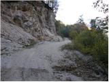 2
2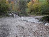 3
3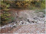 4
4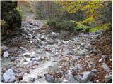 5
5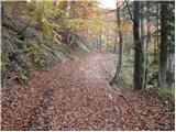 6
6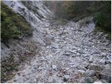 7
7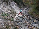 8
8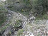 9
9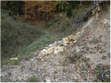 10
10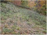 11
11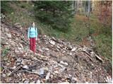 12
12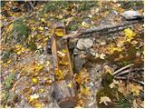 13
13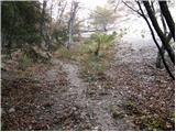 14
14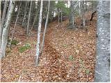 15
15 16
16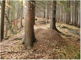 17
17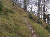 18
18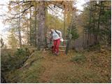 19
19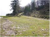 20
20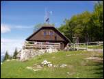 21
21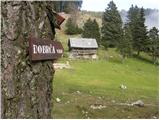 22
22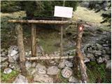 23
23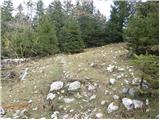 24
24 25
25 26
26
Discussion about the trip Tominčev slap - Dobrča
|
| matjaz125. 04. 2009 |
Hey. I'm wondering if the hut is open over the weekend. Thanks for the info
|
|
|
|
| jozo25. 04. 2009 |
The hut on Dobrča is open on Saturdays, Sundays and holidays.lp
|
|
|
|
| matjaz125. 04. 2009 |
Jozo thanks for the info., if you're up there we'll see each other
|
|
|
|
| jozo25. 04. 2009 |
Hey, tomorrow I have Kriška gora planned, maybe some other time. Take care...
|
|
|
To post a comment you must log in:
If you do not yet have a username, you must first
register.