Tolminske Ravne - Žabiški Kuk (steep path)
Starting point: Tolminske Ravne (924 m)
| Latitude/Longitude: | 46,2294°N 13,7715°E |
| |
Route name: steep path
Walking time: 3 h 15 min
Difficulty: difficult marked way, easy unmarked way
Elevation gain: 920 m
Elevation difference along the route: 970 m
Map: TNP 1:50.000
Recommended equipment (summer):
Recommended equipment (winter): ice axe, crampons
Views: 2.830
 | 1 person like this post |
Access to starting point:
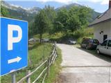
We drive to Tolmin, then we continue driving in the direction of Žabče and Zadlaz (the turn-off from the main road is located on the left bank of the Tolminka). When we arrive in Žabče, at the smaller crossroads we continue slightly right in the direction of the settlement Zadlaz. In the settlement Zadlaz-Žabče the road temporarily descends, where it crosses Zadlaščica over a bridge, then it again starts ascending steeply on a narrow but all the time asphalted road. After approximately 12 km from the main road we arrive at the marked parking lot in Tolminske Ravne, where we park.
Route description:
From the parking lot, we head onto the path in the direction of the Koča na planini Razor mountain hut and Planina na Kalu mountain pasture. Initially, we walk on a cart track that continues from the nearby house and leads us across a scenic meadow. On the other side of the meadow, we cross a grazing fence and the path takes us to a marked junction, where we continue on the lower right cart track (slightly left Planina na Kalu).
Further on, we walk on the cart track that descends slightly to the right, then levels out and continues for a few minutes without major changes in elevation. After the concrete trough, the path splits once again, and we choose the left steep path (the path that continues straight also leads to Planina Razor, but it is longer and technically undemanding).
The path ahead starts ascending again, ascending mostly to the right, only occasionally making a hairpin turn. Higher up, we move onto steeper slopes, a bit further onto an exposed but, apart from the first few steps, well-secured ledge. When the traverse ends, the path temporarily returns to the forest, through which it ascends more steeply, then we step out of the forest and the path levels out. From here, a few more minutes of walking follow with nice views of the mountains rising above the Zadlaščica river basin, and the path brings us past the cheese cottage to the Koča na planini Razor hut.
From the hut, we continue in the direction of Globoko, Vogel, Vrh nad Škrbino... on the path that crosses a strip of forest, then splits on a gentle grassy slope.
From the junction, we continue right (straight to Vrh nad Škrbino and Dom na Komni) and begin to ascend moderately. The path quickly returns to the forest and takes us to the next junction.
Again, we continue right in the direction of Vogel (left Globoko) and gradually begin to ascend more steeply. We quickly leave the forest, then begin ascending on a gradually steeper slope. With nice views on Tolminsko, higher up we reach the southwest ridge of Vrh Krnic, where the path temporarily levels out and turns left. The path ahead ascends diagonally, leading us above Krnica and along the slopes of Vrh Krnic. After crossing a small valley, where an unmarked path branches off to the left leading to the saddle between the mentioned peak and Vogel, the path moves onto the slopes of Vogel, where it ascends diagonally across a steep slope. Higher up, we reach the ridge of Vogel, but we continue right onto an unmarked path that descends in a few steps to the pass between Vogel and Žabiški Kuk. The path ahead leads us for a while along the ridge of Žabiški Kuk, then, when the ridge becomes precipitous, the path veers off to the right side. Further on, we ascend diagonally along the path, where cairns help with orientation. Higher up, we bypass a larger cave on the right side, which is located right by the ridge; behind it on the left is point 1881, the highest point of the Žabiški Kuk ridge, while the summit is a bit further at 1844 meters. After point 1881, the path, which bypasses the highest point, returns to the ridge, along which we continue a moderate descent on the occasionally exposed ridge to the summit at 1844 meters.
Tolminske Ravne - planina Razor 1:15, planina Razor - Žabiški Kuk 2:00.
Description and pictures refer to the condition in 2016 (July).

The trip can be extended to the following destinations: Vogel
Photos:
 1
1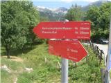 2
2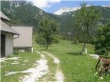 3
3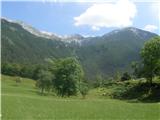 4
4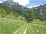 5
5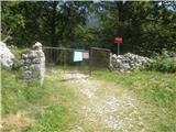 6
6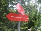 7
7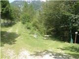 8
8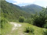 9
9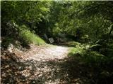 10
10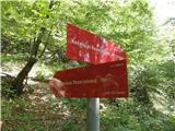 11
11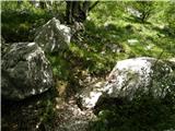 12
12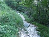 13
13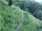 14
14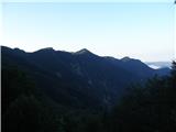 15
15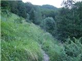 16
16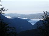 17
17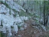 18
18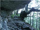 19
19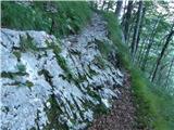 20
20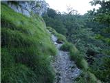 21
21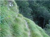 22
22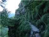 23
23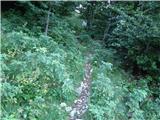 24
24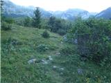 25
25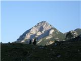 26
26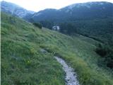 27
27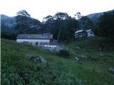 28
28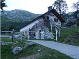 29
29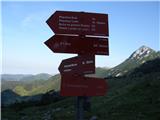 30
30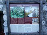 31
31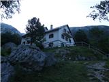 32
32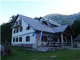 33
33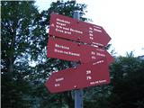 34
34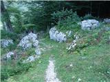 35
35 36
36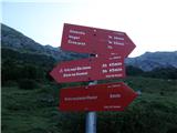 37
37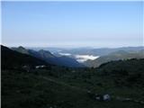 38
38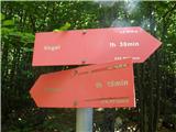 39
39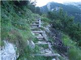 40
40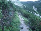 41
41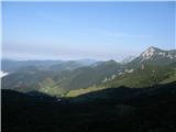 42
42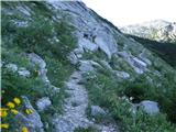 43
43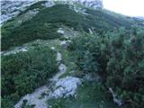 44
44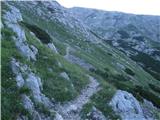 45
45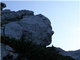 46
46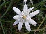 47
47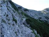 48
48 49
49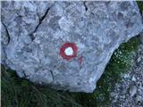 50
50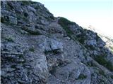 51
51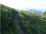 52
52 53
53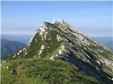 54
54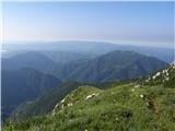 55
55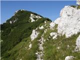 56
56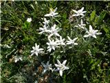 57
57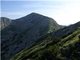 58
58 59
59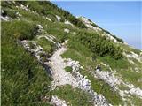 60
60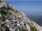 61
61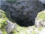 62
62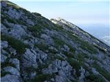 63
63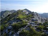 64
64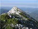 65
65 66
66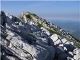 67
67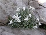 68
68 69
69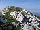 70
70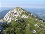 71
71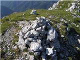 72
72 73
73
Discussion about the trip Tolminske Ravne - Žabiški Kuk (steep path)
|
| alyas10. 08. 2016 |
The path from the saddle between Vogel and Ž.Kuk along the ridge is currently in several places "non-mountaineering marked" with several orange-red arrows, which can certainly help someone in fog, otherwise the path among rocks and scree is lost quite soon, but orientation is not difficult.
In these first August days, there are so many blooming edelweiss on this ridge that you surely haven't seen anywhere else. 
|
|
|
To post a comment you must log in:
If you do not yet have a username, you must first
register.