Tirosek (Nova Štifta) - Planina Travnik
Starting point: Tirosek (Nova Štifta) (556 m)
| Latitude/Longitude: | 46,2702°N 14,7497°E |
| |
Walking time: 1 h 45 min
Difficulty: easy marked way
Elevation gain: 624 m
Elevation difference along the route: 624 m
Map:
Recommended equipment (summer):
Recommended equipment (winter): ice axe, crampons
Views: 4.728
 | 1 person like this post |
Access to starting point:
A) First, we drive to Kamnik, and then we continue driving towards the mountain pass Črnivec and Gornji Grad. When we almost get into the valley of the river Dreta, we turn sharply right in the direction of Šmiklavž, Tirosek and Nova Štifta. We continue driving through Šmiklavž, and at the first crossroad after the mentioned settlement we turn left onto the road in the direction of Menina planina 13.8 km (the sign by the road is currently fallen and lies in the grass - data August 2011). By the road which goes higher into the forest, we then park at an appropriate place.
B) From Vransko or from the Savinjska valley we drive to Gornji Grad, and then we continue driving towards the mountain pass Črnivec and Kamnik. Only a few kilometers after Gornji Grad, still before the road starts ascending steeply, signs for Šmiklavž, Tirosek and Nova Štifta direct us left onto a somewhat narrower local road. We continue driving through Šmiklavž, and at the first crossroad after the mentioned settlement we turn left onto the road in the direction of Menina planina 13.8 km (the sign by the road is currently fallen and lies in the grass - data August 2011). By the road which goes higher into the forest, we then park at an appropriate place.
Route description:
When the road enters the forest, we soon arrive at a junction where a road to the farm Gluk branches off to the right, and we continue straight, still moderately ascending through the forest. A little higher, a marked path from Šmiklavž joins us from the left (we can also start the path in Šmiklavž, but the path from there to the road is harder to follow and entirely overgrown in many places). We continue along the road for a short time, then the blazes direct us right onto a footpath, along which we first ascend through the forest and higher through a partly "abandoned" orchard to the farm Vrtačnik (also possible by road to here).
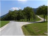
Here we continue right and immediately after the house we leave the road and continue left over the grazing fence onto a cart track. The cart track first ascends somewhat to the left, then, when it turns right, it splits into two parts. At the fork, we continue along the left cart track, thus straight onto the worse and, somewhat higher, also quite overgrown cart track. We then ascend transversely along this cart track, following it to the right bend. In the middle of the bend, we will notice an arrow on a tree that directs us onto the mountain path, which then ascends transversely through dense forest. Higher, the path levels out somewhat and crosses a forest road leading to Menina planina and planina Travnik. We continue through the forest for a short time and then cross the road again; the difference is that now we cross the road leading only to planina Travnik. Higher, we join the road and ascend along it, with increasingly beautiful views, to the shepherd's hut on planina Travnik.

Along the route: Vrtačnik (705m)
Photos:
 1
1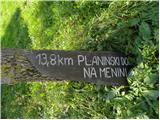 2
2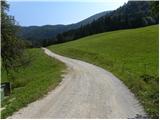 3
3 4
4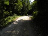 5
5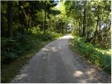 6
6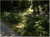 7
7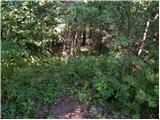 8
8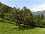 9
9 10
10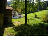 11
11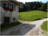 12
12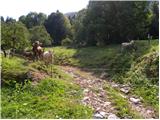 13
13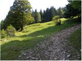 14
14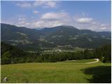 15
15 16
16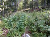 17
17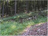 18
18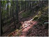 19
19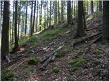 20
20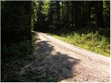 21
21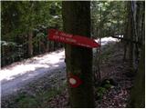 22
22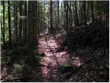 23
23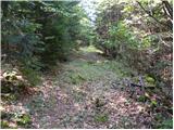 24
24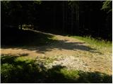 25
25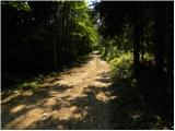 26
26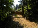 27
27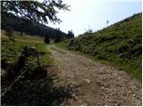 28
28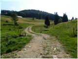 29
29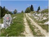 30
30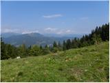 31
31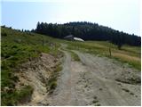 32
32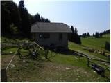 33
33
Discussion about the trip Tirosek (Nova Štifta) - Planina Travnik
|
| Jg19. 09. 2018 |
The path is very overgrown and in places cannot be distinguished from the forest at all. I strongly advise against it. The road path is not much longer, so if anyone plans to do this trip, I highly recommend walking along the road.
|
|
|
To post a comment you must log in:
If you do not yet have a username, you must first
register.