Tinčkova koča - Tomčeva koča na Poljški planini
Starting point: Tinčkova koča (1015 m)
| Latitude/Longitude: | 46,4214°N 14,1988°E |
| |
Walking time: 1 h
Difficulty: partly demanding marked way
Elevation gain: 165 m
Elevation difference along the route: 200 m
Map: Karavanke - osrednji del 1:50.000
Recommended equipment (summer):
Recommended equipment (winter): ice axe, crampons
Views: 5.735
 | 1 person like this post |
Access to starting point:
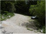
From the Ljubljana–Jesenice highway, take the Lesce exit and follow the road ahead towards Žirovnica and Jesenice. After a few kilometers of driving, we will arrive at a crossroads, where the road to Žirovnica and Moste branches off to the right (from the Jesenice direction, left). Only a few meters ahead, at the next crossroads, we turn left to Moste (right to Žirovnica). Further on, we drive past the monument to the fallen fighters, where the road begins to climb the hill under the railway track. At the top of the hill, we turn right (at the Vila Karin sign), while we continue straight towards Završniško jezero and Valvasorjev dom. The road then flattens and brings us to a crossroads, where the road to Valvasorjev dom branches off to the left, and we continue straight. Further, the road leads past a well-maintained parking lot, and the asphalt road soon becomes macadam. The macadam road, which is asphalted on some steep sections, brings us higher to a smaller crossroads, where we continue straight in the direction of Zelenica and Roblek (the right road leads towards the Kališča saddle). The road then crosses a grazing fence and shortly afterwards brings us to the hut (Pri žagi). We continue driving on the again steeper road, along which we soon notice signs for Poljška planina and Roblek, which direct us sharply right. Because there is no suitable parking spot by the signposts, we drive another 50 meters higher and park in a suitable place by the road.
Route description:
From the starting point, we return along the macadam road to the nearby signposts for Poljška planina and Roblek, from there continuing on the initially parallel mountain path. The path ahead descends to a smaller stream, crosses it, then passes to the western slopes of Begunjščica, where it first crosses moderately steep slopes. We continue the crossing towards the right, where we quickly arrive at very steep slopes, across which we ascend diagonally. The continuation of the path is not the most pleasant, as the poorly maintained path leads us across a very steep slope that is dangerous for slipping (especially when wet). Above the exposed section, the path and slope level out, and we continue crossing. The path, which continues through the forest, gradually passes onto steeper slopes again. A few more minutes of crossing follow, then we pass to the southwestern slopes, where the slope visibly flattens. After a short ascent along a less steep slope, we arrive at a smaller junction, where the path to the NOB monument branches off to the right downward, and we continue straight along the path that moderately ascends through the forest. Higher up, we join a cart track, follow it to the right, and descend to Tomčeva koča on Poljška planina in a few minutes.

Photos:
 1
1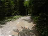 2
2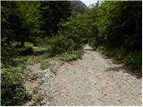 3
3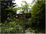 4
4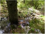 5
5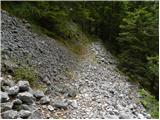 6
6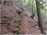 7
7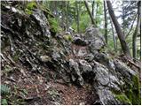 8
8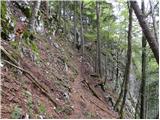 9
9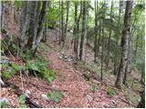 10
10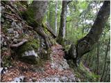 11
11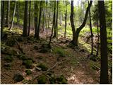 12
12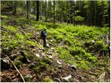 13
13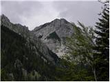 14
14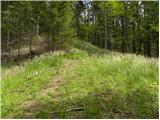 15
15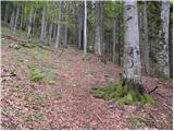 16
16 17
17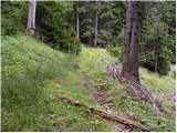 18
18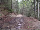 19
19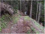 20
20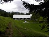 21
21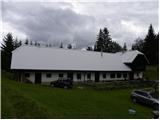 22
22
Discussion about the trip Tinčkova koča - Tomčeva koča na Poljški planini
|
| darh4. 05. 2013 |
We descended from Poljska planina today along the path described here. The path was almost completely dry except for a short unproblematic crossing of frozen snow in the lower part, but just in the area of crossing the slope it was generously covered with leaves, which on the already narrow trail required extra caution. And the "stream" at the bottom of the path is not so innocent in current conditions, although crossing it dry-footed is still completely feasible. More about our entire today's path here.
|
|
|
To post a comment you must log in:
If you do not yet have a username, you must first
register.