Tinčkova koča - Bielschitza/Svačica (via Smokuška planina)
Starting point: Tinčkova koča (1070 m)
| Latitude/Longitude: | 46,4228°N 14,1991°E |
| |
Route name: via Smokuška planina
Walking time: 3 h 30 min
Difficulty: partly demanding marked way
Elevation gain: 883 m
Elevation difference along the route: 1100 m
Map: Karavanke - osrednji del 1:50.000
Recommended equipment (summer):
Recommended equipment (winter): ice axe, crampons
Views: 16.215
 | 3 people like this post |
Access to starting point:
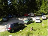
From the Ljubljana - Jesenice highway, take the Lesce exit and follow the road ahead in the direction of Žirovnica and Jesenice. After a few km of driving, we will get to an intersection, where the road to Žirovnica and Moste branches off to the right (from the direction of Jesenice to the left). Only a few meters ahead, at the next intersection, we turn left to Moste (right to Žirovnica). Further, we drive past a monument to fallen fighters, where the road starts ascending the hill below the railway track. At the top of the hill, we turn right (at the sign Vila Karin), we continue towards Završniško jezero and Valvasorjev dom. The road then flattens and brings us to an intersection, where the road towards Valvasorjev dom branches off to the left, and we continue straight on the initially still asphalted road. The road soon becomes macadam, and we follow it to the parking lot near Tinčkova koča. The road in the upper part is often in quite bad condition.
Route description:
From the parking lot, we head onto a wide rocky cart track in the direction of Zelenica and Koča pri izviru Završnice. The cart track, which ascends quite steeply, soon brings us to a junction, where the path to Roblekov dom branches off to the right.
We continue on the cart track, which continues ascending through the forest and brings us after one hour of walking to Smokuška planina, where there are some cottages. We continue straight and the path in a gentle ascent brings us to the other side of the pasture, where Koča pri izviru Završnice stands.
Here we continue left in the direction of Vrtača and Stol on the path, which quickly passes from Smokuška planina into a smaller initially indistinct valley between Srednji vrh on the left and Vrtača on the right. The moderately steep path then brings us after a good half hour of walking from Smokuška planina to the saddle Šija, where the next junction is.
We continue straight (left Srednji vrh, right Vrtača and Stol upper path) on the path, which first slightly descends, then gradually starts to ascend. Here an unmarked path over Zagon joins almost unnoticeably from the left, we continue straight on the path surrounded by lush shrubbery. The relatively gentle path soon brings us into a high-mountain cirque, where the (upper) path from Dom na Zelenici joins from the right. We continue left in the direction of Stol on the path, which steeply ascends for a short time, then brings us into the plateau-like terrain between Svačica and Srednja peč.
Here we continue sharply right in the direction of Celovška koča (straight Stol). The path ahead soon steeply ascends over a short rocky step, then flattens and quickly brings us to the saddle Belščica, where we reach the border ridge.
Again we go right and continue the ascent on the trail ascending a grassy slope surrounded by dwarf pines. We follow this increasingly panoramic path to the summit, where a cross stands.
Starting point - Koča pri izviru Završnice 1:15, Koča pri izviru Završnice - Svačica 2:15.

Photos:
 1
1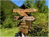 2
2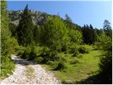 3
3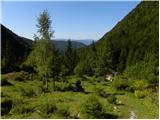 4
4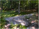 5
5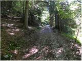 6
6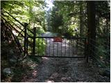 7
7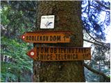 8
8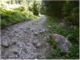 9
9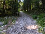 10
10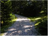 11
11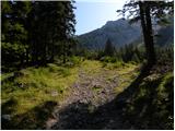 12
12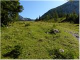 13
13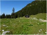 14
14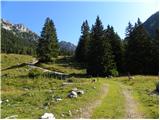 15
15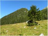 16
16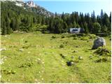 17
17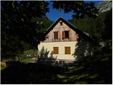 18
18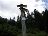 19
19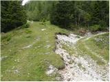 20
20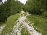 21
21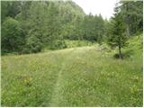 22
22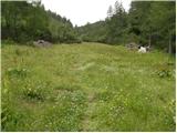 23
23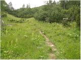 24
24 25
25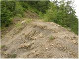 26
26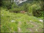 27
27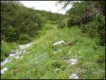 28
28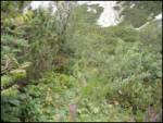 29
29 30
30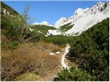 31
31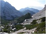 32
32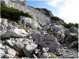 33
33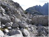 34
34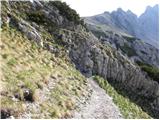 35
35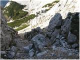 36
36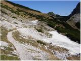 37
37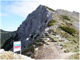 38
38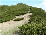 39
39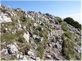 40
40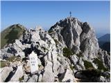 41
41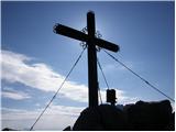 42
42
Discussion about the trip Tinčkova koča - Bielschitza/Svačica (via Smokuška planina)
|
| Gost31. 10. 2007 |
Hidden peak between Vrtača and Stol. For me one of the most beautiful peaks in the Karavanke. Check it out!
|
|
|
|
| andrej jerina29. 06. 2008 |
Yesterday Franci and I did the tour to the mentioned summit. I hope I'm not mistaken, but I think the mentioned summit is Belščica. There's a stamp in the box next to the cross that says Belščica.
Otherwise a fantastic tour and beautiful views, only disturbed me that in our neighborhood there are still people (nationalists who create disputes among people. On one of the border stones embedded on the border between countries, someone took great pains to chisel the initials RS. Sad!
|
|
|
|
| andrej jerina29. 06. 2008 |
I browsed the net a bit and found it. Apparently the Slovenian name for Bielschitza is Svačica. LP Andrej
|
|
|
|
| Lj10. 08. 2008 |
We visited Svačica today from Ljubelj via Zelenica, on the path to Stol to Šija saddle, then on the upper path to Stol and further as described. We returned partially circular i.e. on the lower path to Stol and also visited Koča pri izviru Završnice, which was a pleasant surprise. This variant to Svačica is quite long, but beautiful. It drags on even more because of the abundance of blueberries...
The summit stamp also confused us, as it wasn't clear to us if we were on Svačica or on Belščica? Well, Andrej has already solved the riddle and now we know we didn't miss the goal. Well, Andrej has already solved the riddle and now we know we didn't miss the goal.
|
|
|
|
| Kriška11. 08. 2008 |
I'm curious how long the path from Ljubelj to Svačica took (if you subtract approximately the "stops" due to blueberries)? This variant would suit me better than the much longer drive to the starting point at Tinčkova koča.
|
|
|
|
| Lj11. 08. 2008 |
1. From Ljubelj to Zelenica 1:15 to 1:30 hours (in season, chairlift also runs on weekends, starts at 7:00),
2. From Dom na Zelenici along the upper path to Stol, follow to the right junction for Celovška koča (Klagenfurter Hütte): approx. 2:30 hours,
3. From the junction for Celovška koča to saddle Belščica above Celovška koča almost 1 hour more,
4. from saddle Belščica to Svačica summit less than half an hour
From Ljubelj to Svačica total I estimate at 5:30 hours of moderate hiking.
Good luck and best regards!
|
|
|
|
| heinz19. 07. 2009 |
Easy trail, but probably not for everyone. Some obviously don't dare to approach the very summit (to the cross) before the last ridge under the peak. Experienced/observed today.
I would rather say it's a partially demanding trail, as for example in the gully (rock jump) you need to hold onto some rock.
The ascent to the summit from the Belščica saddle (I think) is not marked at all.
One more thing: after exiting the gully (named rock jump), the trail turns left, at the Belščica saddle (clearly) right, shortly after 2x turns left towards the summit. The first variant is somewhat steeper and runs along the edge or ridge, the second through the scrub.
So, from the Belščica saddle after some 10 m left up the slope.
Regarding beauty, I agree with the first comment: 'one of the most beautiful in the Karawanks'
|
|
|
|
| matjazvalher26. 05. 2012 |
The road to Tinčkova koča is repaired and the access to the parking lot is normal. I would just warn that at the last bend there is a very deep water drainage channel. I recommend that only the driver is in the car.
|
|
|
|
| gorjanci14. 05. 2017 |
How long does it take on foot from the sports park in Završnica valley to Tinčkova koča?
|
|
|
|
| mapi6020. 07. 2020 |
Yesterday we hiked the trail from Tinčkova koča to the hut at the source of Završnica, where we drank excellent coffee, continued to Šija saddle then along the lower trail towards Stol, to Belščica saddle, where additional wonderful views open up, and to the summit of Svačica. Along the way, all kinds of alpine flowers including gentians delighted us, so for me, who likes open trails with a combination of grass, scree, rocks and stones, this is one of the most beautiful trails in the Karavanke.
|
|
|
To post a comment you must log in:
If you do not yet have a username, you must first
register.