Dolina Krma - Veliki Pršivec
Starting point: Dolina Krma (944 m)
| Latitude/Longitude: | 46,3851°N 13,9071°E |
| |
Walking time: 4 h
Difficulty: easy pathless terrain
Elevation gain: 1112 m
Elevation difference along the route: 1120 m
Map: Triglav 1:25.000
Recommended equipment (summer):
Recommended equipment (winter): ice axe, crampons
Views: 21.758
 | 2 people like this post |
Access to starting point:
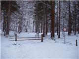
a) Leave the Gorenjska motorway at the Hrušica exit and follow the road towards Kranjska Gora. Just before the village of Dovje, turn left off the main road onto the road to Mojstrana (Vrata, Kot and Krma). Follow the road towards the village of Radovna and the Krma and Kot valleys. The relatively steep road passes the TNP sign, after which it soon levels out and brings us to a junction where a gravel road branches right into the Kot valley. Continue straight on the road, which begins to descend. Midway through the descent, the road to the Krma valley branches right (straight to Radovna). A little further on, we reach the next junction, where we continue right towards Krma. The gravel road then brings us to the Kovinarska koča, and we continue to follow it. The occasionally somewhat rougher road brings us to the parking lot before the barrier.
b) Drive to Kranjska Gora, then continue towards Jesenice. At Dovje, leave the main road and turn right towards Mojstrana and the Vrata, Kot and Krma valleys, following the signs for Krma at subsequent junctions. The relatively steep road passes the TNP sign, after which it soon levels out and brings us to a junction where a gravel road branches right into the Kot valley. Continue straight on the road, which begins to descend. Midway through the descent, the road to the Krma valley branches right (straight to Radovna). A little further on, we reach the next junction, where we continue right towards Krma. The gravel road then brings us to the Kovinarska koča, and we continue to follow it. The occasionally somewhat rougher road brings us to the parking lot before the barrier.
Route description:
From the last parking lot in the Krma Valley, called Pri lesi, continue on the rougher road that continues up the valley and soon brings us to a clearing, where we go around the nearby building on the left. Continue on the gravel path that approaches the torrent and crosses it shortly afterwards. On the other side of the torrent, the path enters the forest and ascends first gently, then quite steeply for some time. Higher up, we pass from the forest into the belt of scrub and bushes, from the path beautiful views open onto the nearby walls of the peaks, which descend more gently towards Pokljuka on the other side.
Higher, at an altitude of just over 1400 m, the path temporarily levels out and brings us to the beautiful grassy plain Vrtača.
After the grassy section, the path resumes ascending on a path that is often quite slippery here, levelling out at the plain Malo polje.
Here the path turns right and forks.
To the left, the path to Bohinjska vrata and Vodnikov dom on Velem polju branches off, we continue straight and easily along the foot of Vernar to the spring with trough.
After the trough, the path forks, we continue straight on the marked path (left unmarked shortcut to planina Zgornja Krma). There follows some moderate, higher up somewhat steeper ascent through sparse, partly larch forest. Higher, the path turns left and levels out, and from the left the aforementioned shortcut joins us.
After the merging of both paths, we quickly reach the shepherd's hut on planina Zgornja Krma, called Prgarca.
From here, the path continues westwards in a moderate ascent and brings us to the last spring along the path, above the spring the path forks again.
To the left, the path continues over Kurica to Konjsko sedlo and further to Dom Planika pod Triglavom, we go right onto the path leading further towards Kredarica and Staničev dom.
Just a few steps further, the "old path" to Kredarica branches left from the usual path to Kredarica.
Here by the path are the only signs for Kredarica in this direction, we continue straight on the easy marked path, next to which there are no signs for Kredarica (September 2025), which brings us a few minutes further to the marked junction where the paths to Kredarica and Staničev dom separate.
The path ahead leads through partly grassy terrain called Murava, later we ascend transversely through increasingly sparse, mostly larch forest. Higher up, the path gradually levels out and brings us to the lower part of Kravja dolina, where first an unmarked path joins from the right, leading past the hunting hut Zgornja Krma, a little higher another unmarked path branches right, leading to the central part of Kravja dolina and further to Veliki Pršivec, remains of a plane from World War II and Rjavina via Temeno.
Continue right on the unmarked track (straight to Dom Valentina Staniča), which ascends a small indistinct valley. The path through the valley leads through scrub and rises only gently, after about 15 minutes we leave it and head right into easier pathless terrain, where we then ascend the moderately steep slope surrounded by scrub (seeking good passages to avoid impassable scrub).
After about 15 minutes of pathless ascent, we reach the summit of Veliki Pršivec, from which an exceptional view opens onto the surrounding mountains.
Krma - Malo Polje 2:05, Malo Polje - Zgornja Krma 0:25, Zgornja Krma - Izvir pod Kurico 0:05, Izvir pod Kurico - razpotje Murava 0:10, razpotje Murava - odcep v Kravjo dolino 0:45, odcep v Kravjo dolino - odcep na Veliki Pršivec 0:15, odcep na Veliki Pršivec - Veliki Pršivec 0:15.

Along the route: Vrtača (1430m), Malo polje (1585m),
Planina Zgornja Krma (1720m), Izvir pod Kurico (1754m), Murava (1790m), Kravja dolina (1905m), Odcep v Kravjo dolino (1986m)
Photos:
 1
1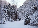 2
2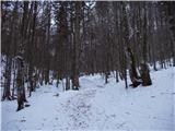 3
3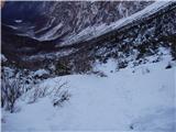 4
4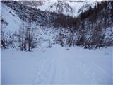 5
5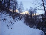 6
6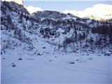 7
7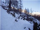 8
8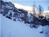 9
9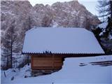 10
10 11
11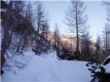 12
12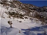 13
13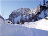 14
14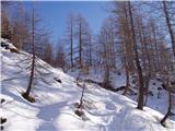 15
15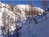 16
16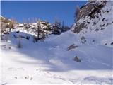 17
17 18
18 19
19 20
20 21
21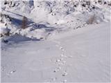 22
22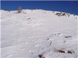 23
23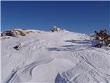 24
24
Discussion about the trip Dolina Krma - Veliki Pršivec
|
| golica22. 07. 2022 15:05:08 |
I'm interested where the parking is... Krma, pri lesi (944 m)? We already parked further from Kovinarjeva koča, is that at the barrier, because some drove even further to a smaller parking? Apparently it's not allowed there. TNP has brought order and we had to drive the car back. Thanks
|
|
|
|
| tango5. 09. 2022 17:38:18 |
Today my wife and I went to V. Pršivec a bit differently. From Mali polje we turned off the marked paths onto the trail leading towards Staničeva koča through Travna dolina and that was definitely a bullseye. The trail is easy to follow, the views paradise-like at the hunting hut breathtaking, as are the mighty larches. Except for the marmot whistles, no one around. I warmly recommend it also to those whose goal is Dovška vratca and then either Rjavina or the Triglav end. We'll repeat it in autumn when the larches are in their finest form.
|
|
|
To post a comment you must log in:
If you do not yet have a username, you must first
register.