Sveta Gora - Frančiškov hrib
Starting point: Sveta Gora (670 m)
| Latitude/Longitude: | 46,00060°N 13,65410°E |
| |
Walking time: 10 min
Difficulty: easy marked way
Elevation gain: -38 m
Elevation difference along the route: 15 m
Map: Goriška - izletniška karta 1:50.000
Recommended equipment (summer):
Recommended equipment (winter):
Views: 3.451
 | 1 person like this post |
Access to starting point:
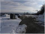
A) We drive to Nova Gorica, then continue driving towards Tolmin and Kobarid. We follow the main road towards Tolmin only to Solkan, where at the traffic-light intersection we continue right in the direction of Sveta Gora and Grgar. The ascending road further leads past the Solkan quarry, then a little higher it turns sharply to the right and brings us to the Skalnica inn, behind which we continue slightly left in the direction of Sveta Gora. Further, we drive on a narrower asphalt road, which we follow to the marked parking lot some 10 meters below the summit of Sveta Gora.
B) From Tolmin or Most na Soči we drive on the main road towards Nova Gorica, then only a little before Nova Gorica, more precisely at the traffic-light intersection in Solkan, we turn left in the direction of Sveta Gora and Grgar. The ascending road further leads past the Solkan quarry, then a little higher it turns sharply to the right and brings us to the Skalnica inn, behind which we continue slightly left in the direction of Sveta Gora. Further, we drive on a narrower asphalt road, which we follow to the marked parking lot some 10 meters below the summit of Sveta Gora.
C) From Goriška Brda we drive to Solkan, where at the first intersection after the new Solkan Bridge we continue straight in the direction of Sveta Gora. The ascending road further leads past the Solkan quarry, then a little higher it turns sharply to the right and brings us to the Skalnica inn, behind which we continue slightly left in the direction of Sveta Gora. Further, we drive on a narrower asphalt road, which we follow to the marked parking lot some 10 meters below the summit of Sveta Gora.
Route description:
From the parking lot, we walk to the nearby stairs, up which with nice views we ascend to the road which leads to the summit of Sveta Gora. When we reach the road, we follow it to the left, and it leads past the nearby inn and church. Behind the church, the road starts to descend gently and brings us to the nearby cemetery, where it ends. We continue on a wide ridge path in the direction of the nearby Frančiškov hrib, which we reach after a few minutes of moderate descent.
Photos:
 1
1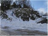 2
2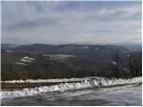 3
3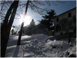 4
4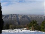 5
5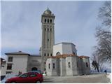 6
6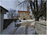 7
7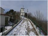 8
8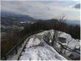 9
9 10
10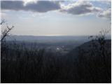 11
11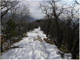 12
12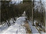 13
13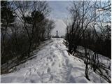 14
14 15
15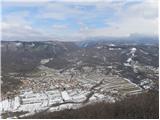 16
16
Discussion about the trip Sveta Gora - Frančiškov hrib
To post a comment you must log in:
If you do not yet have a username, you must first
register.