Starting point: Svečina (293 m)
| Latitude/Longitude: | 46,66545°N 15,58851°E |
| |
Walking time: 40 min
Difficulty: easy marked way
Elevation gain: 128 m
Elevation difference along the route: 160 m
Map:
Recommended equipment (summer):
Recommended equipment (winter):
Views: 210
 | 1 person like this post |
Access to starting point:
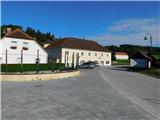
We drive to the roundabout at Pesnica and take the exit for Lenart. We quickly leave the road towards Lenart in the Slovenske gorice and continue right in the direction of Zgornja Kungota and Dolnja Počehova, and still before getting onto the expressway, we go right once again in the direction of Zgornja Kungota. Further on, we drive on the main road to Zgornja Kungota, where in the middle of the settlement we turn right in the direction towards Plač and Svečina. A little further, we leave the road towards Plač and go left towards Svečina; when we arrive in Svečina, we park at an appropriate place in the center of the settlement.
Route description:
From the starting point, we head for the path that leads through the center of the settlement and takes us past the church and a little further across the stream. After the stream, we go left, a little further once again left. After the crossroads, we gradually begin to ascend, after a few minutes of traverse ascent we go slightly left, after a small saddle left onto a side macadam road, alongside which there are signs for viticulture Leber. We continue along the said road, at a small saddle we go right onto a marked cart track. There follows some ascent along the cart track, then the path levels out and leads us past a bench located at a nice vantage point. A little further, at a small crossroads we continue straight on, the path ahead takes us along a macadam road that runs between forest on the left and vineyards on the right. When the road turns right we go straight onto the cart track, along the cart track we ascend to the asphalt road, which we follow left. Along the road we walk only some ten steps more and arrive at the bench and registration box on Čajžič.
Description and pictures refer to the situation in August 2022.

Photos:
 1
1 2
2 3
3 4
4 5
5 6
6 7
7 8
8 9
9 10
10 11
11 12
12 13
13 14
14 15
15 16
16 17
17 18
18 19
19 20
20
Discussion about the trip Svečina - Čajžič
To post a comment you must log in:
If you do not yet have a username, you must first
register.