Suhadolnik - Kokrska Kočna (via Grdi graben)
Starting point: Suhadolnik (901 m)
| Latitude/Longitude: | 46,3352°N 14,5102°E |
| |
Route name: via Grdi graben
Walking time: 4 h 45 min
Difficulty: very difficult marked way
Elevation gain: 1619 m
Elevation difference along the route: 1700 m
Map: Kamniške in Savinjkse Alpe 1:50.000
Recommended equipment (summer): helmet, self belay set
Recommended equipment (winter): helmet, self belay set, ice axe, crampons
Views: 30.325
 | 3 people like this post |
Access to starting point:
From the highway Ljubljana - Jesenice we go to the exit Kranj - east and follow the road ahead in the direction of Jezersko, but only to the village Kokra. In the mentioned village, we will notice a road only a few meters before the road crosses a bridge over the river Kokra, which runs towards Suhadolnik. The turn-off of the road is located when we are on the right side of the river (left bank); the road sign is approximately 7 km. We follow this road to a parking lot, which is located approximately 300 meters before the farm Suhadolnik.
Route description:
At the beginning of the parking lot, we notice hiking signposts, which point us on a road, on which in less than 5 minutes of walking, we get to a smaller crossroad at the farm Suhadolnik. Here we continue on the right road, and we follow it for approximately 5 minutes, or to the spot, where blazes lead on an ascending cart track. Further, for a short time, we are ascending on a cart track, and then blazes point us to the right on a footpath which is moderately ascending through the forest. Higher, we return on a cart track, and which only a few meters ahead brings us to a forest road which we then follow to its end (to here we need approximately half an hour).
At the end of the road marked path splits into two parts. We continue on the left path (right a little easier "Old path"), which is further ascending on a gentle cart track. A little further blazes point us slightly right on torrent deposits of sand, and the path on the other side continues through the forest, where it starts ascending steeper and steeper. Higher, we come to a smaller cave, and the path behind it becomes technically demanding. With the help of steel cables we ascend a level higher, and the path then continues on a steep slope, where occasionally we get help from some iron spikes. Higher, the path turns to the right, ascends diagonally over a steep and mainly in wet for slipping dangerous slopes and then brings us to well-secured passage. With the help of wooden stairs or a ladder and a help from a steel cable, we ascend on the steep slope, which without mentioned fixed safety gear would be very dangerous. Higher, we get some help from some more iron spikes, and the path after that flattens and crosses a short exposed slope, where we get help from a fence. Only a little further, we come to the next ladder, by which there aren't any steel cables, but the passage isn't that difficult. Next follows a short descent into a smaller gully and then we also cross it. On the other side of the gully, we steeply ascend (we get help from some pegs), after that the path slowly flattens and in a few 10 strides of additional walking brings us to the spot, where joins a little easier "old path".
Next follows a short diagonal ascent and the path brings us to a larger plain, where used to be "stara koča" (old mountain hut). Over high grass we walk on the other side of the plain, where we get to a marked crossing. At the crossing, we go left following the signs Dolci and Kokrška Kočna. The path then starts steeply ascending on a poorly beaten footpath over a grassy slope. We soon turn slightly to the left and we cross steep exposed slopes. The path then starts slightly descending and crosses Grdi graben. We start ascending again on a steep slope and then the path brings us on gentle grassy slopes (Srednji Dolci). From the right joins the path from the saddle Kokrsko sedlo, and a few meters later we are again at the crossing. We go left towards the bivouac and Kokrska Kočna, and right leads the path towards a notch Dolška škrbina and then ahead towards Jezerska Kočna or Grintovec. After that, the path crosses scree to the left and it ascends over a short gully.
A little above the gully unmarked path towards Bivak pod Kočno branches off to the left which we can already see and is from the marked path distant only a few minutes of walking. We continue on a marked path right upwards and we soon start ascending on the scree. In the upper part of the scree, the path turns to the left and it brings us in a little more demanding rocky part of the path. Here we again turn slightly to the right and with an easier climbing we are ascending on a slope. The path on this part otherwise isn't secured, but in the rock there is enough holds, so that ascent doesn't cause bigger problems. In the last part towards the summit path becomes even a little steeper and there are also some steel cables for help.

The trip can be extended to the following destinations: Jezerska Kočna
Photos:
 1
1 2
2 3
3 4
4 5
5 6
6 7
7 8
8 9
9 10
10 11
11 12
12 13
13 14
14 15
15 16
16 17
17 18
18 19
19 20
20 21
21 22
22 23
23 24
24 25
25 26
26 27
27 28
28 29
29 30
30 31
31 32
32 33
33 34
34 35
35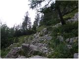 36
36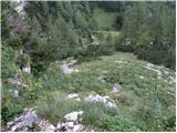 37
37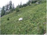 38
38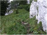 39
39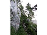 40
40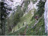 41
41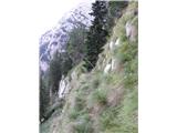 42
42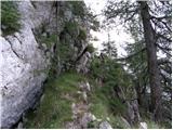 43
43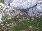 44
44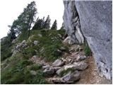 45
45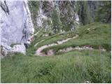 46
46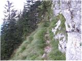 47
47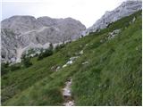 48
48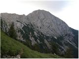 49
49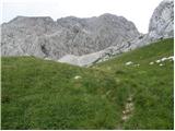 50
50 51
51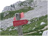 52
52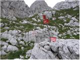 53
53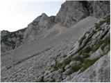 54
54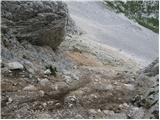 55
55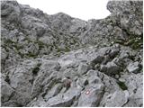 56
56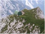 57
57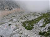 58
58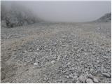 59
59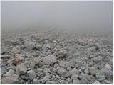 60
60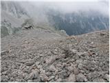 61
61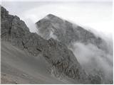 62
62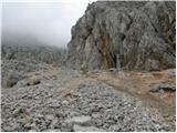 63
63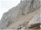 64
64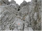 65
65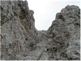 66
66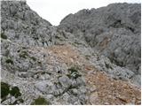 67
67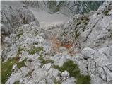 68
68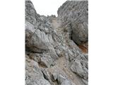 69
69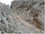 70
70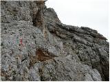 71
71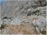 72
72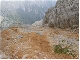 73
73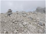 74
74
Discussion about the trip Suhadolnik - Kokrska Kočna (via Grdi graben)
|
| NEIC00815. 08. 2008 |
The trail is little used. In wet conditions there is a risk of slipping on the grassy exposed sections of the trail.
|
|
|
|
| fpetel118. 07. 2009 |
Can you provide a comparison between this path and continuing to Jezerska Kočna via the path from Ravenska koča on Kremžarjeva pot. Thanks!
|
|
|
|
| velkavrh19. 07. 2009 |
Hikers to Kočne most often choose Kremžarjeva pot because it is somewhat shorter and the most common access. As known, from Jezersko to Češka koča where they serve excellently, and from there via Kremžarjeva pot to both Kočne. If deciding to go to Kočna via Grdi graben, turn in Kokra to Suhadolnik farm, leave vehicle there, then via Grdi graben to the wonderful bivouac on Kočna. To reach a hut, on return turn at bivouac to Ovcji čer to Kokrsko sedlo to Cojzova koča. This tour is longer than from Češka koča, but much nicer in my opinion, though little visited. Difficulty similar. Personally much preferable. Worth checking!
|
|
|
|
| fpetel119. 07. 2009 |
Thanks for the info. I know the variant from Češka koča, but I'm a fan of less visited (even unmarked) paths and will definitely hike this one in the next days.
|
|
|
|
| grahlck10. 08. 2009 |
Are there dangerous snowfields on this route?
|
|
|
|
| muša10. 08. 2009 |
On 24.7. I went from Jezersko to Češka koča and then to Jezersko and Kokrska Kočna, then descended to Dolce, continued to Kokrsko sedlo and descended to Kamniška Bistrica. Descent from Kokrska Kočna is very uncomfortable, lots of scree, extreme caution required due to risk of slipping. Good luck.
|
|
|
|
| nata2410. 08. 2009 |
No snow left anywhere on the path. Regards
|
|
|
|
| EUGEN16. 03. 2010 |
At the top in the book it says that this is not Kokrska Kočna. What is the correct name of this peak?
|
|
|
|
| lepenatka16. 03. 2010 |
Kokrska Kočna is certainly the first neighbor of Jezerska. They are connected by a secured path.
The path along the old Suhadolnik upper path is partly poorly secured and crumbly, some additional pitons would be good.....at least a few years ago it was like that. The last part, the secured ascent, is super.
Whoever likes scree fields, rejoice when it's time for that.
|
|
|
|
| lepenatka19. 03. 2010 |
Thanks for the literature, GorazdG.
I think we should take into account the tradition and knowledge of the locals.
I wish you as many beautiful hikes as possible
G
|
|
|
|
| kolpa9. 07. 2011 |
In conditions like on the morning of 8.7.2011, fog and strong wind, it is practically impossible to orient in the upper scree part as there are no marked signs or blazes or they are completely faded. At the entry into the rock however the blazes are renewed and safely lead us to the summit. On complaint at Cojzova koča I was told that they have this part of the path in the "hands" of markacists PD Kranj. The same should be with the management of the Bivouac in Kočni, which after the last snowfall remained without sheet metal roof. I think both mentioned issues should be arranged for the good and safety of hikers. Thanks.
|
|
|
|
| mihaj4. 10. 2014 |
Hello! Today we ascended Kokrska Kočna. The grassy cirques are quite tricky and you need to stay focused. From the bivouac onwards we walked in fog and orientation is difficult. Someone appropriated the stamp at the top. The fixed protections on the ridge between both Kočnas are damaged in some places, but you can still get through without problems. From the lake hut to Škrbina the markings are much better. Nice mountaineering greetings.
|
|
|
|
| soncyka7. 11. 2015 |
Hi. It's been a while since I was last up here, and I plan to go tomorrow. Since snow has already covered the mountain, I'm interested if anyone has been up recently and can tell me about the snow conditions. From the southern direction in the valley, it looks bare. Still, better from first hand.
Thanks and best regards
|
|
|
|
| Lisica8. 07. 2018 |
Today I did the ascent to Kokrska Kočna from the direction of Cojzova koča past the bivouac, continued to Jezersko kočna and descent to Dolce and back via Grdi graben.
The most annoying part of the path was the ascent to K Kočna, specifically in the gully above the scree somewhere from picture 65 onwards. Huge scree, no fixed protection, you're really constantly climbing and looking for handholds and footholds in the rock and avoiding scree, and this section isn't even that short. At the same time, you're on very exposed terrain. In short, this part was pure hell for me 
Back via the much-praised Grdi graben. I don't know why no one likes it, I really enjoyed it. A bit down, a bit up, then down again and up, and I was waiting for that terrible part... but it never came. I would happily repeat Grdi graben. 
|
|
|
|
| coffee8. 07. 2018 |
Fox, in wet/early morning the gully is also pure hell. Because if it sweeps you away there, you don't stop on the wet steep grassy slopes. (c;
|
|
|
|
| Lisica8. 07. 2018 |
Uff, I can well imagine that.  I'd say the same for the upper path to Cojzova koča, which runs parallel for a while (Ovcji cer). I'd say the same for the upper path to Cojzova koča, which runs parallel for a while (Ovcji cer).
|
|
|
|
| dprapr8. 07. 2018 |
That path from the bivouac up to Kokrska Kočna is in dry conditions suitable only for descent. There's nothing to it!
|
|
|
|
| Lisica12. 07. 2018 |
@dprapr I'm glad it's like that for you. Everyone has their own opinion.
In Sidartin's Brezpotja guidebook this path is described as a descent and it says that it's 'one of the most annoying paths in Grintovci', steep and crumbly to the scree.
|
|
|
|
| Lisica12. 07. 2018 |
@dprapr I'm glad it's like that for you. Everyone has their own opinion.
In Sidartin's Brezpotja guidebook this path is described as a descent and it says that it's 'one of the most annoying paths in Grintovci', steep and crumbly to the scree.
|
|
|
|
| J.P.10. 07. 2020 |
Exceptionally beautiful and varied path, also less visited: Suhadolnik-Kokarska Kočna-Jezerska Kočna-Grintovec-Suhadolnik. The path via Taško is currently closed. Walk especially carefully over the grassy section as the risk of slipping there is quite high. Best regards
|
|
|
|
| erikaleon26. 08. 2020 |
Suhadolnik-Kokarska kočna-Jezerska K.-Grintovec-Suhadolnik. Today I walked the mentioned path. At the beginning I missed the junction and went along the road because of the dark. Higher up I wandered through the torrent bed over Taško. Followed some faded markings. Don't go through the torrent bed but stick to the right side. The path is nice except for the upper scree under Kokarska Kočna where without poles I don't know how it would go. Two pegs near the top are pulled out so you have to be careful. Best regards
|
|
|
|
| M E S A2. 06. 2022 22:08:56 |
Today there were no peculiarities on the path. Almost no snow left. The existing fixed protections are mostly in satisfactory condition. Especially in the upper part, the markings need renewal. The scree on the uphill path requires a lot of energy - poles are very helpful.
|
|
|
To post a comment you must log in:
If you do not yet have a username, you must first
register.