Suhadolnik - Kalški greben
Starting point: Suhadolnik (901 m)
| Latitude/Longitude: | 46,3352°N 14,5102°E |
| |
Walking time: 4 h 15 min
Difficulty: very difficult marked way
Elevation gain: 1323 m
Elevation difference along the route: 1350 m
Map: Kamniške in Savinjske Alpe 1:50.000
Recommended equipment (summer): helmet, self belay set
Recommended equipment (winter): helmet, self belay set, ice axe, crampons
Views: 25.487
 | 4 people like this post |
Access to starting point:
From the highway Ljubljana - Jesenice, we take the exit Kranj - east and follow the road ahead in the direction of Jezersko, but only to the village of Kokra. In the mentioned village, we will notice, only a few meters before the road crosses the bridge over the river Kokra, a road that leads towards Suhadolnik. The turn-off of the road is located when we are on the right side of the river (left bank), and the road marker is approximately 7 km. We then follow this road to the parking lot, which is located approximately 300 m before the farm Suhadolnik.
Route description:
At the beginning of the parking lot, we notice hiking signposts that direct us onto the road, along which in less than 5 minutes of walking we arrive at a smaller crossroads by the farm Suhadolnik. Here we continue along the right road, which we follow for another approximately 5 minutes, or until the point where the blazes lead us onto an ascending cart track. Further on, we ascend the cart track for a short time, then the blazes direct us right onto a footpath that moderately ascends through the forest. Higher up, we return to the cart track, which only a few meters further brings us to a forest road, which we then follow to its end (to here we need approximately half an hour).
At the end of the road, the marked path splits into two parts. We continue along the left path (right somewhat easier "Old path"), which further ascends along a gentle cart track. A little further on, the blazes direct us slightly right onto torrent sand deposits, and the path on the other side continues through the forest, where it begins to ascend ever steeper. Higher, we reach a smaller cavity, and the path behind it becomes technically demanding. With the help of a wire cable, we ascend one level higher, and the path then continues along a steep slope, where some pegs occasionally assist us. Higher, the path turns right, ascends transversely over steep and especially slippery when wet slopes, and brings us to an excellently secured passage. With the help of wooden steps or a ladder and the assistance of a wire cable, we ascend the steep slope, which without the mentioned fixed protections would be very dangerous. Higher, a few more pegs assist us, the path then flattens and crosses a short exposed slope, where an emergency fence assists us. Only a little further, we reach the next ladder, next to which there is no wire cable, but the passage is not particularly demanding. A short descent into a smaller gully follows, which we then also cross. On the other side of the gully, we steeply ascend (assisted by some brackets), after which the path gradually flattens and brings us in a few dozen steps of further walking to the place where the somewhat easier "Old path" joins.
A short transverse ascent follows, and the path brings us to a larger plain where the "old hut" once stood. Through high grass, we walk to the other side of the plain, where we arrive at a marked junction.
We continue straight ahead (left Kočna via Grdi graben) along a moderately steep path that further ascends through a belt of scrub. Higher, the path temporarily flattens completely, then brings us among the dwarf pines, where it begins to ascend more steeply. We follow this somewhat steeper path, from which increasingly beautiful views open up, all the way to the Cojzova koča on Kokrsko sedlo.
From the saddle, we continue right along the marked path in the direction of Kalški greben and Krvavec. The path ahead first continues along and beside the ridge, then brings us to a crumbly gully, after which we ascend over a slightly exposed passage. The path ahead ascends more steeply, then transitions to the scree fields of Kalška gora (here at the beginning of the scree fields, we will notice the old climbing path to Kalška gora, which has been abandoned for several years). Crossing the scree fields follows (in early summer, snow patches possible), then the path turns left into the wall, where it ascends very steeply. During the ascent on the relatively crumbly wall, fixed protections (mostly pegs) and numerous holds assist us. The wall higher up flattens somewhat, and the path after a few minutes of further walking brings us to a smaller saddle where there is a junction.
We continue along the right path in the direction of Kalški greben, which along a locally somewhat exposed ridge and with the help of some fixed protections brings us to the most difficult part of the path. The path brings us to an almost vertical wall, which we must climb down with the help of fixed protections. Helmet mandatory, a self-belay kit is also recommended! The path then resumes ascending toward Kalški greben, to which we have approximately half an hour of walking along the panoramic ridge.
Suhadolnik - Kokrsko sedlo 2:30, Kokrsko sedlo - Kalški greben 1:45.

Photos:
 1
1 2
2 3
3 4
4 5
5 6
6 7
7 8
8 9
9 10
10 11
11 12
12 13
13 14
14 15
15 16
16 17
17 18
18 19
19 20
20 21
21 22
22 23
23 24
24 25
25 26
26 27
27 28
28 29
29 30
30 31
31 32
32 33
33 34
34 35
35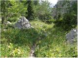 36
36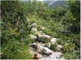 37
37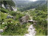 38
38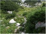 39
39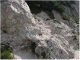 40
40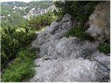 41
41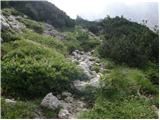 42
42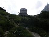 43
43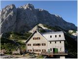 44
44 45
45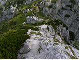 46
46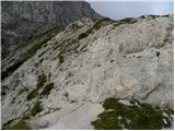 47
47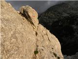 48
48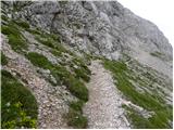 49
49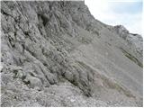 50
50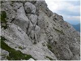 51
51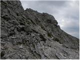 52
52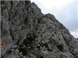 53
53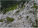 54
54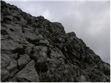 55
55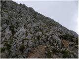 56
56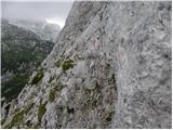 57
57 58
58 59
59 60
60 61
61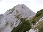 62
62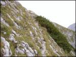 63
63 64
64 65
65 66
66 67
67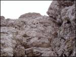 68
68 69
69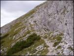 70
70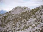 71
71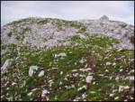 72
72
Discussion about the trip Suhadolnik - Kalški greben
|
| fpetel131. 08. 2008 |
The wall is really steep and exposed. I left the self-belay kit in the car, which I truly regretted while climbing and sweating up this vertical wall (thankfully excellently protected). The trail is otherwise very nice but crumbly and demanding from Zoisova koča onwards.
|
|
|
|
| Damien_8321. 05. 2011 |
Did this tour today, have to say it's very interesting, something new at every step (ladders, fixed cables, pegs) from Zoisova koča it's already adrenaline-fueled.. I went without a via ferrata kit, wished for it most at that vertical wall, but it went fine. Look down as little as possible, watch where you place your foot and what you grab 
|
|
|
|
| velkavrh22. 05. 2011 |
Very nice, long tour, I've already done it both ways. For the return to the valley, it's nice to descend at the saddle between Kalška gora and the end of Kalški greben to the rugged Kalce and you arrive up again at the saddle between Kalški Greben and Korn, descend to the beautiful Planina Dolge njive and below Veliki Zvoh arrive at Krvavec. Of course, you need to have transport arranged at the parking lot on Planina Jezerca. You are allowed to drive there from Cerkelj. I plan to repeat it this season. Damien 83 L.P.
|
|
|
|
| boris122. 05. 2011 |
Hey all mountaineers, I need info if Kalški greben is really that muddy?????? Planning to do the tour end of the week
|
|
|
|
| Damien_8322. 05. 2011 |
The path is dry, except when you cross the scree above Zoisova koča there's a little bit but it can be crossed and at the top just for show, I'd upload a couple of photos but haven't quite figured out how 
|
|
|
|
| metod24. 06. 2012 |
Today the path to Kalški greben was nicely passable and gear impeccable. Only fog blocked the view of Grintavec and Kočna and it was pulling quite well. and it was pulling quite well.
|
|
|
|
| bostjanp24. 06. 2012 |
Also from the direction of Kriške čez ježa and onwards towards the ridge, fog pulled in at times, around noon it lifted a bit and there was even sun on the ridge. Then the cloud fell below 2000m and covered practically all of KSA until 16:00. Otherwise.. the tie was tied solidly, and at the end sprinkled with sun.
|
|
|
|
| ghost13wolf8. 07. 2013 |
Does anyone have info if there are still any snow problems?
|
|
|
|
| gordol29. 08. 2013 |
I was there today, all super, protections are 1A. As mentioned, only that wall (picture 58/59) is not so innocent, it can really surprise someone... SVK really not needed; for the less confident it probably comes in handy on that section.
|
|
|
|
| katja8723. 09. 2013 |
On Sunday, 22.9.2013, we took this trail to the summit.
We did a circular tour: Suhadolnik - Cojzova koča na Kokrskem sedlu (čez Taško) - Kalška gora - Kalški greben - planina Dolga njiva - Kokra (Podbelca).
We had the cars parked at both starting points
The tour lasted 8 hours. Despite occasional cloudiness and fog, we had magnificent views 
The climbing trail itself is not long, but that vertical section is quite adrenaline-pumping. And because of that part, we didn't regret bringing our via ferrata sets :p
You can see photos from the hike on the website of Planinsko društvo Matica Murska Sobota: http://www.mojalbum.com/pdmaticams/20130922-kalska-g-kalski-greben-plezalna-pot/zacetek-poti-iz-suhadolnika-in-pogled-na-kalski-greben/21120041
|
|
|
|
| soncyka17. 10. 2013 |
Hi. Has anyone gone from Zoisova koča to Kalški greben? What's the current snow situation up there? Passable with winter gear or without?
|
|
|
To post a comment you must log in:
If you do not yet have a username, you must first
register.