Suhadolnik - Jezerska Kočna (via Grdi graben and Dolci)
Starting point: Suhadolnik (901 m)
| Latitude/Longitude: | 46,3352°N 14,5102°E |
| |
Route name: via Grdi graben and Dolci
Walking time: 5 h 15 min
Difficulty: very difficult marked way
Elevation gain: 1639 m
Elevation difference along the route: 1700 m
Map: Kamniške in Savinjkse Alpe 1:50.000
Recommended equipment (summer): helmet, self belay set
Recommended equipment (winter): helmet, self belay set, ice axe, crampons
Views: 35.176
 | 4 people like this post |
Access to starting point:
From the Ljubljana - Jesenice highway we take the Kranj - east exit and follow the road ahead in the direction of Jezersko, but only to the village Kokra. In the mentioned village, we will notice only a few meters before the road crosses a bridge over the river Kokra, a road which runs towards Suhadolnik. The turn-off of the road is located when we are on the right side of the river (left bank), the road sign is approximately 7 km. We then follow this road to a parking lot, which is located approximately 300 meters before the farm Suhadolnik.
Route description:
At the beginning of the parking lot, we notice hiking signposts, which direct us to a road, along which in less than 5 minutes of walking we arrive at a smaller crossroads at the farm Suhadolnik. Here we continue on the right road, which we follow for approximately another 5 minutes, or to the spot where the blazes lead us onto an ascending cart track. Further, we ascend briefly on the cart track, then the blazes direct us right onto a footpath which moderately ascends through the forest. Higher, we return to the cart track, which only a few meters ahead brings us to a forest road, which we then follow to its end (to here we need approximately half an hour).
At the end of the road the marked path splits into two parts. We continue on the left path (right somewhat easier "Old path"), which further ascends on a gentle cart track. Somewhat further the blazes direct us slightly right onto torrent deposits of sand, the path on the other side continues through the forest, where it begins to ascend steeper and steeper. Higher we come to a smaller cavity, the path behind it becomes technically demanding. With the help of a steel cable we ascend one level higher, the path then continues on a steep slope, where occasionally some peg helps us. Higher the path turns right, ascends transversely over steep and especially in wet slippery-dangerous slopes and then brings us to an excellently secured passage. With the help of wooden steps or ladder and help of a steel cable, we ascend the steep slope, which without the mentioned safety gear would be very dangerous. Higher some more pegs help us, the path then flattens and crosses a short exposed slope, where an emergency railing helps us. Only a little further we come to the next ladder, next to which there is no steel cable, but the passage is not particularly demanding. Follows a short descent into a smaller gully and we then cross it too. On the other side of the gully we steeply ascend (some brackets help us), then the path gradually flattens and brings us in some 10 steps of further walking to the spot where the somewhat easier "Old path" joins.
Follows a short transverse ascent and the path brings us to a larger plain, where once stood the "old hut". Through high grass we walk to the other side of the plain, where we arrive at a marked junction. At the junction we turn left following the signs Dolci and Kokrška Kočna. The path then begins steeply ascending on a poorly trodden trail over a grassy slope. Soon we turn slightly left and cross steep exposed slopes. The path then begins slightly descending and crosses Grdi graben. We begin ascending again on a steep slope then the path brings us to gentle grassy slopes (Srednji Dolci). From the right the path from Kokrskega sedla joins us, a few meters later we are again at a junction. We turn right, left leads the path to the bivouac below Kočna and Kokrski Kočni. We ascend over a grassy slope, which then brings us to scree along which we ascend for quite some time. At the end the path on the scree turns slightly left and brings us to rocks. Follows a short ascent slightly right to Dolška škrbina (2317m – the lowest point between Kočna and Grintovec). At the notch there is also a junction, where we turn left towards Kočna (right Grintovec). The path then leads us along the northern side of the ridge and soon brings us again to a junction. This time we turn left (straight down Češka koča, right Grintovec) and continue the ascent on the path which quickly brings us to one of the most interesting passages in Slovenian mountains. The path brings us to a pot-bellied passage through which we have to crawl. The ceiling above us is so low that there is no other way (watch your head). The path ahead transitions to a short scree after which we step onto a steeper path, where some pegs and steel cables help us. This increasingly scenic path we then follow to the slightly spacious summit.

Along the route: Dolška škrbina (2317m)
The trip can be extended to the following destinations: Kokrska Kočna
Photos:
 1
1 2
2 3
3 4
4 5
5 6
6 7
7 8
8 9
9 10
10 11
11 12
12 13
13 14
14 15
15 16
16 17
17 18
18 19
19 20
20 21
21 22
22 23
23 24
24 25
25 26
26 27
27 28
28 29
29 30
30 31
31 32
32 33
33 34
34 35
35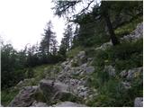 36
36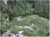 37
37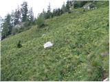 38
38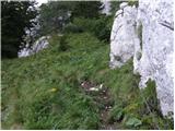 39
39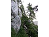 40
40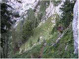 41
41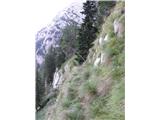 42
42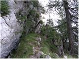 43
43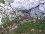 44
44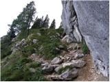 45
45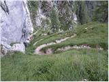 46
46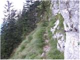 47
47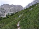 48
48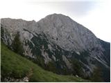 49
49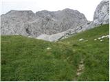 50
50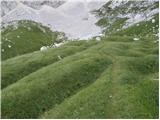 51
51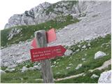 52
52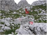 53
53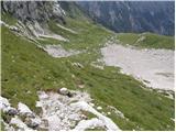 54
54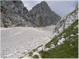 55
55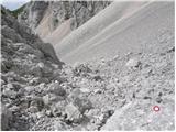 56
56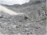 57
57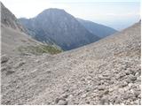 58
58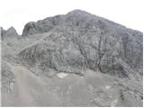 59
59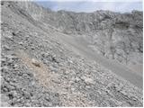 60
60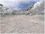 61
61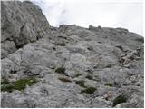 62
62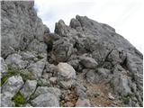 63
63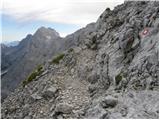 64
64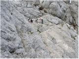 65
65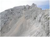 66
66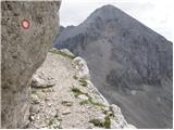 67
67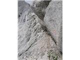 68
68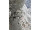 69
69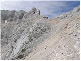 70
70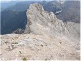 71
71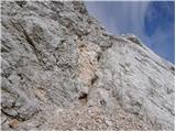 72
72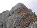 73
73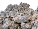 74
74
Discussion about the trip Suhadolnik - Jezerska Kočna (via Grdi graben and Dolci)
|
| nata244. 08. 2009 |
If I go alone to Jezerska Kočna, is it possible to pass the belly passage with a backpack? Best, Nataša
|
|
|
|
| anemona4. 08. 2009 |
With a backpack it is possible to pass the belly passage by pushing the backpack in front of you or pulling it behind. Not such a problem. Bigger issue to me is that you plan to go alone on a demanding path where you really need to watch every step. Perhaps even more via Hudi graben (very narrow trail, slippery grassy ledges, brittle rocks in soil, exposed, fixed cables partly in grass) than in the rock which is also friable and full of scree. With my husband we did the route Suhadolnik-Kokrsko sedlo-Grintovec-Jezerska Kočna-via Dolce-Hudi graben-Suhadolnik, on Saturday 1 August. Good luck and best, Anemona
|
|
|
|
| lynx4. 08. 2009 |
Well done, vetrnica! How long did it take you?
|
|
|
|
| anemona4. 08. 2009 |
We stayed overnight. Friday evening Kokrsko, Saturday morning at 6:30 we started towards Grintovec and returned via Kočna, Dolce and Hudi graben to the car at Suhadolnik around 15:30 (including stops at summits and lunch at Dolcih). I'm medium pace/slow type, on scree cautiously slow. Saturday approx. 1000 m ascent and approx. 1800 m descent (including intermediate descents) is enough for my knees. Also: the trail is exemplarily marked. Where there are safety aids, all are ok (only at the first smooth rock on descent from Grintovec we really missed one additional peg by the chain). Regards!
|
|
|
|
| fpetel14. 08. 2009 |
I went up from Suhadolnik via Grdi graben and Dolce. Because fog was descending and complicating orientation on the scree - second picture in the seventh row - below Kokrska Kočna (up at over 2200), I turned back and returned via Ovnov čer to Kališče. Does the continuation go over rocks or scree? (markings in this section very sparse, practically no path. The rest is orientationally undemanding) I plan to repeat the trail (hopefully this month)
|
|
|
|
| anemona4. 08. 2009 |
When you reach the fork at picture 2 row 7, you're at ca. 1900m. Just below the upper edge of the picture, in the middle, you can see the oval Bivak v Kočni (you couldn't see it due to fog). Left fork goes into scree towards the bivouac and Kokrska Kočna. Right fork (compass directly north) along the gentle rocky path (Srednji Dolci) towards Jezerska Kočna. This right well-marked path leads to the entry on the scree, which goes up to the entry of the climbing section. It is also very well marked (of course hard to mark on scree). We went in the opposite direction. Smart that you turned back towards Kokrsko sedlo. Regards!
|
|
|
|
| grahlck10. 08. 2009 |
Are there any snowfields on this route that could be dangerous? Is there any snow at all?
|
|
|
|
| nata2410. 08. 2009 |
I was there on Saturday and there is no snow on the route anywhere anymore. Regards, Nataša
|
|
|
|
| pbrgle122. 08. 2010 |
Yesterday my father and I went down this path. I wouldn't recommend it for descent as even after such a demanding descent there's still a good hour's ascent to Cojzova koča.
The path is quite demanding and dangerous due to the narrow and untrodden trail, slippery grass and wet ground. In many places on the path I missed pegs and cables.
|
|
|
|
| Mirko018. 10. 2010 |
Over the weekend, solid weather is forecasted. What are the dangers on this path in this part of the year?
Thanks and have a nice day
|
|
|
|
| Maja_C8. 10. 2010 |
I went on this path last year at the end of September. As pbrgle 1 already wrote, the path is dangerous due to slippery grass and mud (upper photos in rows 11 and 12). Last year it was also quite wet in this section, so I was more careful, and there were no problems. Otherwise, it's a really nice hike, and given the name, I expected a really ugly ravine, but it wasn't!
|
|
|
|
| myuser21. 07. 2014 |
Hi, if anyone found black sunglasses on the path to Kočna (quite near the top) on 20.7.2014, I would be grateful if they would contact me and possibly send them to my home address.
Thanks
|
|
|
|
| mornar15. 08. 2020 |
Soon I plan to go to Jezerska Kočna, but regarding this path, I'm interested if anyone has recently been in these parts. I'm curious about its traceability and whether the path is harder than from Česka koča, where I've already been twice. L.P.
|
|
|
|
| jax15. 08. 2020 |
Well, what can I say. As the name suggests, the path is ugly. First off, crossing those grasses towards Grdi graben is one of the more psychotic things you'll encounter on marked paths. The path is marked and traceable, but not very frequented. Then towards Dolce it's better, Dolce is an extremely nice spot, perfect for a rest, then you continue towards Dolška škrbina and before it there's another very demanding passage through an unsecured steep gully. From there onwards to the summit there are no more difficulties, although you have to scramble a bit in one place.
So - if you ask me, Kremžarjeva is easier. It might be steeper, but somehow you can manage on that scree, whereas Grdi graben is really nasty. And a place like that gully below Dolška škrbina, I don't remember on the northern side. But it can be done. And yes, ascent to Kokrska Kočna, crossing to Jezersko and descent here is a decent circular tour. Although in this case I'd almost advise you to add Grintovec too. It's another 200m of ascent, but you avoid the descent through Grdi graben and add another peak. Winning combination.
|
|
|
|
| mornar15. 08. 2020 |
Yes, thanks for the reply. L.P.
|
|
|
|
| cen6. 09. 2021 21:28:14 |
Over Grdi greben it's not really a path but more a goat track.. someone determined should widen it a bit. 
When returning downhill over the bulging passage, another tip: don't let the backpack slide down that slope because it can tip to the wrong side at the end and fly into the depths. Lower it controlled to the bottom or have someone from below catch it if you're in a group. From above you can see some gear has already ended up down there.
|
|
|
To post a comment you must log in:
If you do not yet have a username, you must first
register.