Studenice - Boč (by road)
Starting point: Studenice (260 m)
| Latitude/Longitude: | 46,2999°N 15,6138°E |
| |
Route name: by road
Walking time: 2 h
Difficulty: easy marked way
Elevation gain: 718 m
Elevation difference along the route: 750 m
Map: Posavsko hribovje Boč - Bohor 1:50.000
Recommended equipment (summer):
Recommended equipment (winter):
Views: 12.959
 | 2 people like this post |
Access to starting point:
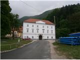
A) From the direction of Ljubljana we leave the highway in Slovenske Konjice and through Žič, Loč and Zbelovo we get to the center of Poljčane. In the center, we turn right in the direction of Studenice and after about three kilometers we reach Studenice, where we continue right across the bridge over the river Dravinja into the main part of the settlement. In front of the monastery complex we safely park.
B) From the direction of Maribor we leave the highway in Slovenska Bistrica, where signs direct us to Poljčane. In the center, we turn left in the direction of Studenice and after about three kilometers we reach Studenice, where we continue right across the bridge over the river Dravinja into the main part of the settlement. In front of the monastery complex we safely park.
C) From the direction of Ptuj, Kidričevo through Ptujska gora, Majšperk and Makole we get to Studenice, where we continue left across the bridge over the river Dravinja into the main part of the settlement. In front of the monastery complex we safely park.
Route description:
After a short tour of the central part of Studenice, we continue left from the monastery complex past the parish house. In the passage/underpass between the parish house and the Studenice winegrowers' association we continue upwards along a cart track beside the stone wall and nuns' cemetery. We soon reach the source(s) of the Topli studeniški stream left of the path and cross the stream on a narrow footbridge. We continue upwards, now on the old Roman road which through long centuries has retained the original form of the basic path higher up to Boč. At the exit onto the forest road we turn left, right leads the road to the settlement Podboč or Zgornje Poljčane.
We follow the forest road and at the first major junction/turnoff we continue right, left leads the road in the direction of Makole. Further on we reach the log cabin of hunters LD Poljčane at Golnik right by the road. We continue on the road and soon come again to a junction where we continue right, left: Formila clearing, partisan hospital on Boč, mountaineers' hut on Boč... We follow the road further from bend to bend... and reach the entrance or fence of the RTV tower on Boč.
We continue slightly downhill and soon descend to the mountain path from Poljčane towards the tower on Boč. Further along the path beside the military area we soon reach the goal of the route... a few final meters along the summit ridge. A short ascent up the stairs to the tower. A beautiful view in all directions is the final reward of the decision for the described excursion.

Photos:
 1
1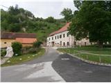 2
2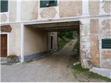 3
3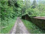 4
4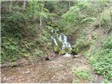 5
5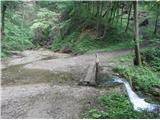 6
6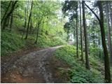 7
7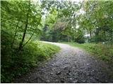 8
8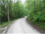 9
9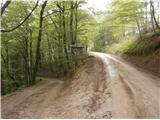 10
10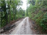 11
11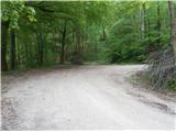 12
12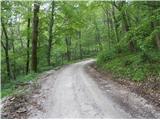 13
13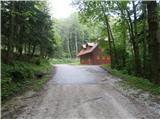 14
14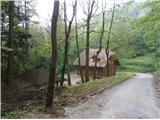 15
15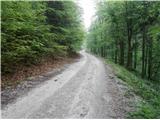 16
16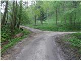 17
17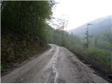 18
18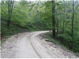 19
19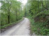 20
20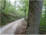 21
21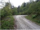 22
22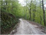 23
23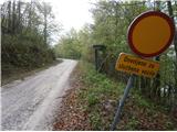 24
24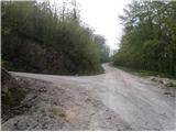 25
25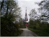 26
26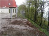 27
27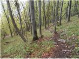 28
28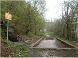 29
29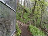 30
30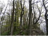 31
31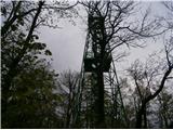 32
32
Discussion about the trip Studenice - Boč (by road)
|
| jprim8. 05. 2014 |
Nice, you managed to get this trail from Studenice into the trail descriptions, ...
Is this the only variant from this starting point, since it goes along the road it's really better for cyclists and cars.
|
|
|
|
| klm10. 05. 2014 |
Brunny (and others who might know the answer):
As a local, you're probably familiar with the climbing approach from the path past Belunjače cave, marked with fluorescent green color and arrows. Below the arrows, on the continuation of the ascent with lines, there are also dots: sometimes two, at one place only one, at several places three. What do they mark? Perhaps the whole thing? Initially I thought it was the difficulty level, since the start of the ascent is really II., then only I., but I think it doesn't reach III. anywhere. Otherwise, really nice, exposed passage.
|
|
|
|
| bruny10. 05. 2014 |
In February, my colleague and I did a rappel from the tower there. I noticed the markings and my colleague told me that they will equip the wall for a climbing approach - via ferrata. Probably something similar to Skala above Slovenske Konjice, I don't know!? Maybe Gonžarjeva peč. On Boč they often have training from PZS and it's probably necessary. Definitely an enhancement and added value. I don't have more info, maybe someone who knows something will chime in, but I think ,,it's the real deal,,. Best regards
|
|
|
|
| klm10. 05. 2014 |
Thanks for the info, Bruno. Best, Klemen
|
|
|
|
| bruny12. 05. 2014 |
There was no problem getting the path from Studenice  "into" the official paths. That's why some delay, because the variant is more or mainly road-based. Well, forest roads in the Boč area are quite visited by recreation seekers, cyclists, runners, more and more hikers... "into" the official paths. That's why some delay, because the variant is more or mainly road-based. Well, forest roads in the Boč area are quite visited by recreation seekers, cyclists, runners, more and more hikers...
Somewhere this should be the only official path from Studenice upwards, higher into the world of Boč. In "Boč conditions" I presented quite a few unofficial paths, even more "steep" ones and perhaps someone else. The problem or perhaps luck is that these paths are not marked. Since they are not official, they won't be included among the paths from my side. And that's right, Boč is a sensitive ecosystem - also a landscape park, some rare animal and plant species thrive and fight for daily survival on these karst-like soils... Regards
|
|
|
|
| klm12. 05. 2014 |
This described approach is distinctly running or cycling, a good 10 km long.
But as you said Bruny, there are some more, I wouldn't say "sharp", but rather lonely, remote paths, where you encounter a herd of mouflons or hear wild cats, etc. Between the described approach along the forest road and the classic approach via Baba, there are quite a few such nice more or less visible little paths. Boč thus reveals itself in a different guise, so you always rediscover it with pleasure.
|
|
|
|
| jprim14. 05. 2014 |
@klm
Are you sure about mouflons, we only encountered ibex. about mouflons, we only encountered ibex.
LP!
|
|
|
|
| klm14. 05. 2014 |
Ibex?
There are definitely none in the Boč area. Surprisingly many people don't distinguish ibex from chamois!
Mouflons 100%, from a distance of approx. 30 m. Occasionally one finds even a goldenhorn...
|
|
|
|
| bruny15. 05. 2014 |
Mouflon is somewhat similar to a sheep and is not a native species of game in Slovenia. It was introduced in the sixties and seventies of the last century. Specifically on Boč in 1972/73 and the settlement on Boč was one of the more successful ones in Slovenian territory. On the fortieth anniversary of the settlement, they received some new animals from Slovakia to refresh the blood on Boč. Of course, today or in the present time there would be no settlement, non-native species are not introduced according to new guidelines and back then it was of course a different time and view on hunting expertise. Mouflons mainly encroached on the chamois' space. Of course, in those times besides expertise a political decision or at least consent was always needed.
A look into history...in those times almost every important politician and also director was a hunter, today it's somewhat different after the era of tennis, golf is in the forefront. Tito according to data was never on Boč meanwhile Slovenian leading cadres of that time participated in hunts in the narrower and wider area of Boč. Best regards
|
|
|
|
| jprim17. 05. 2014 |
Yep, I admit I goofed it, how could I mistake an ibex for a chamois, ...(beer???)
We met chamois
|
|
|
|
| bruny5. 10. 2014 |
Today descended the described path... about 750 elevation meters from Studenice, the slopes on the described path were negative today, also negligible 35 positive on the section between the viewpoint and the RTV tower.
|
|
|
To post a comment you must log in:
If you do not yet have a username, you must first
register.