Starting point: Strmec (1520 m)
| Latitude/Longitude: | 46,3902°N 13,9675°E |
| |
Walking time: 2 h 30 min
Difficulty: easy marked way
Elevation gain: 494 m
Elevation difference along the route: 630 m
Map: TNP 1:50.000
Recommended equipment (summer):
Recommended equipment (winter): ice axe, crampons
Views: 24.437
 | 1 person like this post |
Access to starting point:
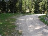
From the highway Ljubljana - Jesenice we take the Lesce exit and follow the road in the direction of Bled, there at the traffic-light crossroads signs for Pokljuka direct us to the right. This road, which in the lower part takes us through some villages and later starts to ascend more steeply, we follow to Mrzli Studenec (mountain pasture, which is located a good 50 meters behind the crossroads, where the road to Bohinj branches off left downwards). In the middle of the mentioned mountain pasture, from the main road a road branches off to the right, which leads to Medvedova konta, Pri Rupah and mountain pasture Javornik. Here we turn right and follow the road to the next crossroads, where we continue right in the direction of Medvedova konta (straight to mountain pasture Javornik). The road ahead after a shorter ascent descends and brings us to the next crossroads, where we continue perpendicularly left. Then at the first right branch-off we turn right. Soon another road branches off sharply to the right, here we go straight and only about 100 m behind that at the crossroads sharply right. Now we drive approximately 3 km to the first turn-off to the left. Here we turn left and drive to the parking lot, where signs direct us to the mountain pasture Klek. We park on a smaller parking lot by the road.
Route description:
From the parking lot, we return a few meters back, then we head onto the footpath in the direction of Lipanca, Klek and Debela peč. The path ahead runs along a cart track that brings us past the watering place for animals to the first shepherd huts on mountain pasture Klek. From the mentioned huts, a beautiful view opens up across the entire mountain pasture, and we continue the path slightly to the right and descend diagonally to the second part of the mountain pasture, where a few more shepherd dwellings stand.
We continue on a poorly visible path, which already after a few dozen steps of further walking enters a larch forest. Here the trail becomes more distinct again, and we follow it in the direction of Lipanca. There follow some shorter ascents and descents along an occasionally poorly visible little trail again. After approximately 30 minutes of walking from mountain pasture Klek, we will arrive at a marked junction, where we continue right in the direction of Debela peč (slightly left Lipanca and Debela peč past Spodnjih Brd). At the junction the trail disappears completely for a short time, but if we continue in the direction indicated by the signpost, we quickly find it again. Ahead the path begins to ascend moderately through increasingly sparse (mostly) larch forest. Just a little further we enter a small valley, along which we ascend to the place where signs for Debela peč direct us sharply left. The path ahead enters a belt of dwarf pines, through which we climb below the ridge of Klečica (the actual peak of Klečica is located further to the right). Just a few dozen meters before the mentioned ridge, the marked path turns left and begins to descend diagonally towards the southwest. During the descent, a wonderful view of Debela peč opens up to us several times. The path ahead crosses the dwarf pine-covered slopes for some time longer, then turns right and begins to ascend very steeply. After a short ascent we reach the ridge again, from which a nice view opens up towards Radovna.
On the ridge the path turns left and retreats from it into the dwarf pines, through which the path continues to ascend very steeply. Higher up the path levels out and brings us to a panoramic and in places also sheer ridge (the path runs somewhat below the ridge, so there is no major risk of slipping). The path ahead descends slightly, then brings us to the upper edge of a V-shaped gully. We continue along the marked path, which leads us further along the ridge of Debela peč; the latter brings us to the panoramic summit after less than 5 minutes of further walking.

Photos:
 1
1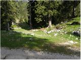 2
2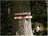 3
3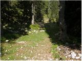 4
4 5
5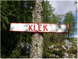 6
6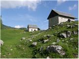 7
7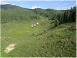 8
8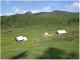 9
9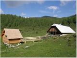 10
10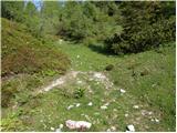 11
11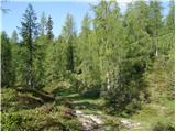 12
12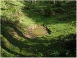 13
13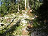 14
14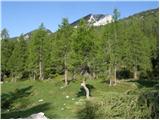 15
15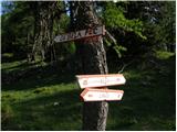 16
16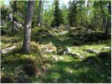 17
17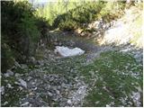 18
18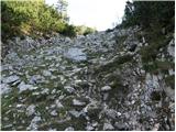 19
19 20
20 21
21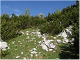 22
22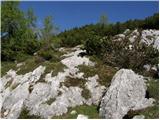 23
23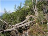 24
24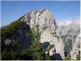 25
25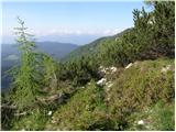 26
26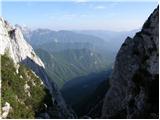 27
27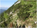 28
28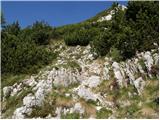 29
29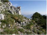 30
30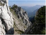 31
31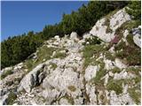 32
32 33
33 34
34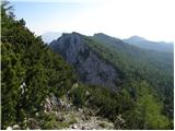 35
35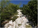 36
36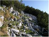 37
37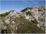 38
38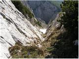 39
39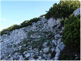 40
40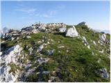 41
41 42
42
Discussion about the trip Strmec - Debela peč
|
| mcdragon5. 09. 2013 |
I often use the hiking instructions from Hribi.net but on this trip I had some trouble with orientation.
First it took me to Mrzlem Studencu. There are two turnoffs to the right, one after the other. You have to take the second one. Medvedja konta is not (at least now) on the road sign there, but on the next junction where you have to turn right.
The path along the road after that sharp left turn is simple, just follow the road to the sign for Debela peč. The instructions about those other roads only confused me as I didn't see them.
Finally, just to clarify the part of the path in Kleška planota. It's described a bit more accurately in the photos, but not in the text. Namely "we follow it towards Lipance" on the path, at least now, it's not obvious where to go. The markers suddenly end. Only after I had wandered the entire plateau did I realize that you have to cross the valley diagonally, about 50-100 meters to the right of the upper shepherd's hut.
All this wandering took me more than an hour and a half and in the end I was also attacked by numerous gadflies that were very aggressive, so I'll have to finish the path another time.

|
|
|
|
| lepenatka1. 10. 2018 |
Yesterday was just the right day for wandering the Pokljuka trails. Finally!
To Debela peč via the path described above.
Very nice, well-marked and solitary. At least to the summit.
For me the nicest path to Debela peč.
At the top, however, a crowd and real summer weather.
Then via the "classic" to Lipanca for coffee and beer, back past the dilapidated hunting hut. A bit on our own to the marked lower path to Planina Klek.
Perhaps the description of the road to the parking lot could mention the sign for Pod Klekom.
Nicely spent day.
|
|
|
|
| lepenatka14. 08. 2022 19:00:56 |
After a long time, again the desire to visit this path.
Unfortunately, a barrier and traffic ban towards Planina Klek stopped us.
Shame. No one wanted to trudge 4 km along the road to the starting point and we went another way
|
|
|
To post a comment you must log in:
If you do not yet have a username, you must first
register.