Strma Reber - Loška stena
Starting point: Strma Reber (993 m)
| Latitude/Longitude: | 45,5545°N 14,7274°E |
| |
Walking time: 1 h 30 min
Difficulty: easy marked way
Elevation gain: -118 m
Elevation difference along the route: 150 m
Map:
Recommended equipment (summer):
Recommended equipment (winter): ice axe, crampons
Views: 9.700
 | 1 person like this post |
Access to starting point:
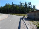
A) First, we drive to Ribnica, and then we continue driving towards Kočevje. After Dolenja vas we continue right in the direction of Grčarice, Gotenica and Kočevska Reka. In Kočevska Reka we continue right in the direction of Borovca pri Kočevski Reki, mountain pass Strma Reber and Osilnice. In Borovec we once again continue right, and then past hamlet Ravne in a few kilometers we get to mountain pass Strma Reber, which is situated at an altitude of 993 m. From the mountain pass a short descent follows, and then we get to a larger parking lot, where on the left side we notice also map of Kočevska mountain trail and mountain signposts for Firstov rep and Cerk. From the crossroad, where we leave the main road Ribnica - Kočevje, there is approximately 30 km of relatively nice asphalt road.
B) From Kočevje we drive towards the border crossing Petrina, and then at the end of the settlement Štalcerji we continue right towards Kočevska Reka. In Kočevska Reka we continue left in the direction of Borovec pri Kočevski Reki, mountain pass Strma Reber and Osilnice. In Borovec we continue right, and then past hamlet Ravne in a few kilometers we get to mountain pass Strma Reber, which is situated at an altitude of 993 m. From the mountain pass a short descent follows, and then we get to a larger parking lot, where on the left side we notice also map of Kočevska mountain trail and mountain signposts for Firstov rep and Cerk. From the crossroad, where we leave the main road Kočevje - Petrina, there is approximately 18 km of asphalt road.
C) From Osilnica or Sel pri Osilnici we continue in the direction of the settlements Žurge, Padovo pri Osilnici, Zgornji Čačič and mountain pass Strma Reber. Further, we drive on at first slightly winding, and higher serpentine road, which after nineteen marked hairpin turns brings us to a crossroad, which is located only a few hundred meters before the mountain pass Strma Reber. At the crossroad there is a large macadam parking lot on both sides of the road, a "cottage" in which there is sand for spreading (sand for the purpose of road maintenance workers), on it a map of Kočevska mountain trail. We park on the mentioned parking lot. From the center of Osilnica to the starting point is 8.5 km.
Route description:
From the parking lot, we continue towards the east, on the road in the direction of Cerk and Firstov rep. The path leads us on the forest road, from which already after a few minutes a marked path branches off to the right.
We continue on the marked path (it is also possible to continue on the unmarked road, since the marked path after some time returns to the mentioned road, and the path along the road is also a little shorter), which passes into a dense forest. Through the forest we first start moderately ascending, carefully following the blazes, since otherwise the easy-to-follow path is relatively poorly trodden. When the path a little higher flattens, on the left side we bypass the indistinct peak Luknja (1079 m), to which we can ascend on easier pathless terrain in a few minutes; otherwise we continue on the marked path, which as mentioned bypasses the peak on the left side. Next follow a few shorter ascents and descents, then a somewhat longer descent, which ends when we reach the macadam road.
When we reach the road we continue right (left marked path to Cerk and the road by which we can return to the starting point) in the direction of Firstov rep. On the road we ascend slightly to moderately, walking along it to its end or turning point.
On the left side of the turning point we notice signs for Firstov rep and for the first time also for Loška stena, which direct us onto a cart track that gradually starts descending. When after a few minutes the cart track ends, on the left we notice a salt lick for wildlife, but we continue straight down on the marked footpath, along which in a few steps we arrive at the registration box on Firstov rep.
From the registration box we continue the descent on the marked path in the direction of Loška stena. A fairly scenic path, from which nice views open up onto nearby walls, towers and hills, leads us along the edge of the cliffs, to which the path withdraws to the right side, so there is no major slipping hazard, except of course if we go to the edge for a nice view. A little lower the path passes into the forest and flattens. A short ascent follows, then an easy descent to the precipitous edge of the summit of Loška stena, from where a really nice view opens onto the Zgornja Kolpska dolina and surrounding hills.
Ravne - Firstov rep 1:25, Firstov rep - Loška stena 25 minutes.
Description and pictures refer to the condition in the year 2015 (August).

Photos:
 1
1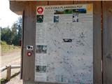 2
2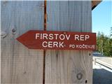 3
3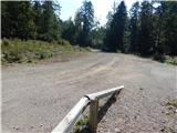 4
4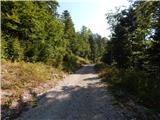 5
5 6
6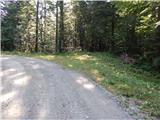 7
7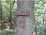 8
8 9
9 10
10 11
11 12
12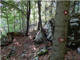 13
13 14
14 15
15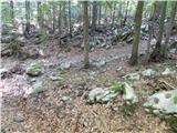 16
16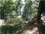 17
17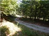 18
18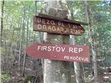 19
19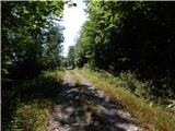 20
20 21
21 22
22 23
23 24
24 25
25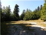 26
26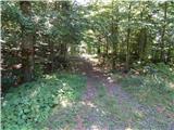 27
27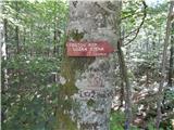 28
28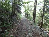 29
29 30
30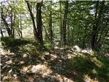 31
31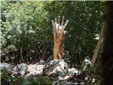 32
32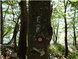 33
33 34
34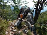 35
35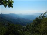 36
36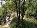 37
37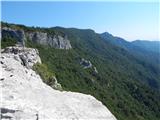 38
38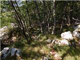 39
39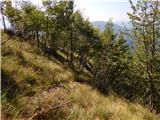 40
40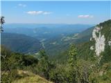 41
41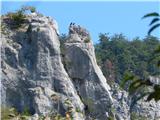 42
42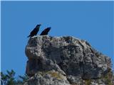 43
43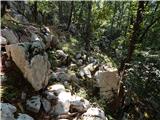 44
44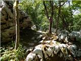 45
45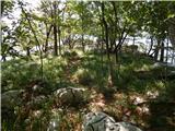 46
46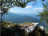 47
47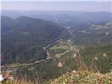 48
48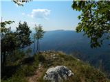 49
49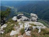 50
50 51
51
Discussion about the trip Strma Reber - Loška stena
To post a comment you must log in:
If you do not yet have a username, you must first
register.