Štore - Old Castle of Celje
Starting point: Štore (240 m)
| Latitude/Longitude: | 46,2213°N 15,3215°E |
| |
Walking time: 1 h 30 min
Difficulty: easy marked way
Elevation gain: 167 m
Elevation difference along the route: 330 m
Map: Posavsko hribovje Boč - Bohor 1:50.000
Recommended equipment (summer):
Recommended equipment (winter):
Views: 3.233
 | 3 people like this post |
Access to starting point:
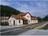
Štore is accessible ideally with the help of the railway. At the end, from the castle you descend on the Pelikanova pot path to the bridge over Voglajna and on the path under the railway you return to Celje... On the road... you leave the highway in Celje and in the center of Celje you go towards Štore or Šentjur. You park the car near the railway station Štore, where there are enough parking spaces available and there is also the beginning of the marked mountain path.
Route description:
Combination of the most "right" mountain path from Štore past Marija on Celje hills to the juncture with the most "left" mountain path from Celje over the castle on Grajski hrib to Celje hills, which is also the initial part of Celje mountain trail.
The beginning of the path is at the railway station in Štore. We go through Voglajna, where a signpost immediately points us to the right and then soon straight practically through the area of old Štore iron works. On the asphalt road, we continue along Bojanski jarek to another crossing, where we continue straight, left path "over Žlajfa". Soon the road turns sharply left a little uphill, flattens again at the sports field and behind some terraced houses we turn left on the forest road which passes into a forest path. The path branches off to the left "via Bojanski graben", while we continue right upwards. From the right soon joins the path from Celje and Teharje.
At the juncture with the path from Celje, Teharje we go right or a little downwards towards the castle or Celje. The path is very well marked, and unfortunately it mainly runs on asphalt paths. We mainly walk through the settlement Osenca, above the path, there are also two smaller local peaks Gorica and Osenica a little above the path on the right. The only path which branches off is a marked mountain path towards Teharje. The entire route goes among houses or homesteads and friendly locals are always ready for a friendly conversation.
The distance of the path is around 6000 meters, 330 positive altitude meters and 190 negative altitude meters.

Photos:
 1
1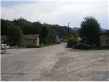 2
2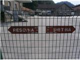 3
3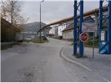 4
4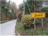 5
5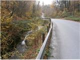 6
6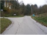 7
7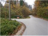 8
8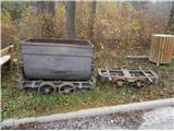 9
9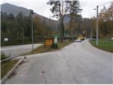 10
10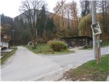 11
11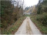 12
12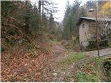 13
13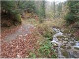 14
14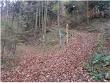 15
15 16
16 17
17 18
18 19
19 20
20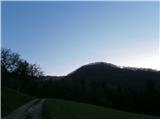 21
21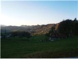 22
22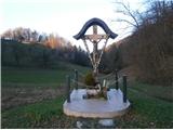 23
23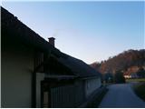 24
24 25
25 26
26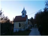 27
27 28
28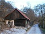 29
29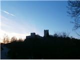 30
30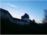 31
31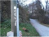 32
32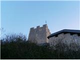 33
33
Discussion about the trip Štore - Old Castle of Celje
|
| bruny26. 02. 2014 |
In the evening hiking activity, I slightly upgraded the above-described route... From Štore according to the description to the intersection with the Celjska planinska pot – picture no. 18 and extension under Srebotnik to the chapel carved into the wall at Marija. From there back along the path described and since the time was not yet late, at picture no. 25 right down to the bridge over Voglajna between the Teharje settlement and Teharska cesta, to the starting point of the hiking trail from Teharje. Extended further to the center of the settlement and from there immediately back to picture no. 25 and nicely along the described route to the old Celje castle, descent along the Pelikanova pot and across the third bridge in the activity over Voglajna near the confluence with Savinja along the path between Savinja and the railway to Celje...
Since there was still some time before the train departure, there was no choice but to the right bank of Savinja and along the steep/hiking path to Miklavški hrib and back down. Extension to the railway station and return home to Poljčane by train.
Yes, a real evening activity... an interesting connection of Štore, Teharje and Celje in what I would call an "M" combination. I knew the entire route, but walked it in this combination for the first time. Several sections were unknown to my buddy – especially the central part. Night orientation was not a problem, some barking of dogs at the owners' courtyards and it was quite pleasant. The paths are well passable except from Teharje at the beginning of the more substantial ascent, a bit above the NOB monument some beeches have fallen, which somewhat obstruct the passage.
Route:Štore - Teharje - Celje, 26.02.2014
|
|
|
|
| bruny16. 04. 2016 |
Along the described path today a short activity in the lowest world of Celjsko hribovje above the left bank of the Voglajna river. In pleasant spring colors. Distance and elevation meters still hold, signage excellent...There was also an addition on the right bank of Savinja. To the right bank across the bridge to Polulah. About the addition perhaps more in Conditions...
|
|
|
To post a comment you must log in:
If you do not yet have a username, you must first
register.