Starting point: Stepani (175 m)
| Latitude/Longitude: | 45,5501°N 13,8575°E |
| |
Walking time: 50 min
Difficulty: easy marked way
Elevation gain: 199 m
Elevation difference along the route: 210 m
Map: Primorje in Kras 1:50.000
Recommended equipment (summer):
Recommended equipment (winter):
Views: 5.470
 | 1 person like this post |
Access to starting point:
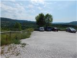
From the highway Ljubljana - Koper we go to the exit Črni Kal, and then at the first turn-off we turn right in the direction of the settlement Stepani. After a good 100 meters from the crossroad, we get to a larger asphalt parking lot, which is situated at the beginning of the settlement Stepani.
Route description:
From the parking lot, we return a little back, and then we continue on the asphalt road which continues parallel with the highway, and at first from there a nice view opens up towards Črni Kal and Kraški rob and the upper part of the village Stepani with a church. Further, the road leads us a little higher from the highway, so that we have a view of the viaduct Črni Kal and village Osp with the wall Osapska stena and Socerb a little higher, and in front of us, we see transmitters on Tinjan and part of the church of St. Michael. At the first smaller crossroad, we continue slightly right, and after a light descent through the overpass we cross the highway. On the other side of the highway, the road turns left and it starts to ascend more noticeably. Also at the next crossroad we choose the right road, and the asphalt ends a little further and we continue on a macadam road which ascends through the distinctive Primorska landscape. The path ahead leads us through a few partly already overgrown meadows, and higher through a pine forest, where at the crossroad we continue right in the direction of Tinjan. Next follows a few minutes of a gentle diagonal ascent towards the right, and then we get to a crossing of five cart tracks, where from the right side, the path from Osp joins, and we continue on the left upper cart track (bad road).
A little further, we join a wider road, where a circular path from Dekani leads, and on the mentioned road we walk to a crossroad near the water supply structure. At the mentioned crossroad, we leave the road and we continue straight on the path which continues by the mentioned building. A little higher we reach another road, where we continue sharply left (a few steps right is a nice viewpoint, from where we can see Trieste, Socerb castle, Osp with the wall Osapska stena, etc.). About a minute ahead, we reach an asphalt road, on which then with nice views of the surroundings we quickly reach the church of St. Michael, which is situated on the hill Tinjanski hrib.
Description and pictures refer to the condition in the year 2016 (July).

The trip can be extended to the following destinations: Ankaran
Photos:
 1
1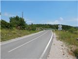 2
2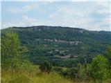 3
3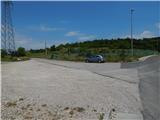 4
4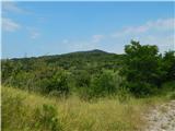 5
5 6
6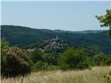 7
7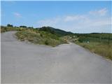 8
8 9
9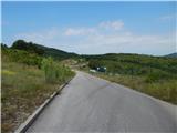 10
10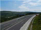 11
11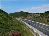 12
12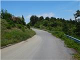 13
13 14
14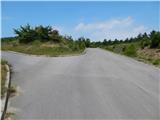 15
15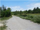 16
16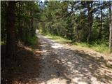 17
17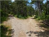 18
18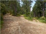 19
19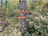 20
20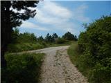 21
21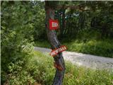 22
22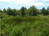 23
23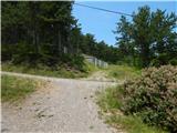 24
24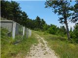 25
25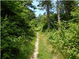 26
26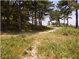 27
27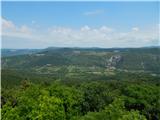 28
28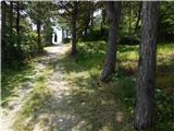 29
29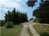 30
30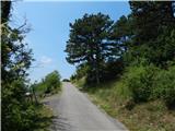 31
31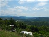 32
32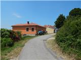 33
33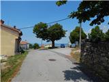 34
34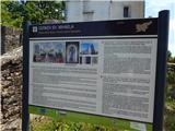 35
35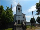 36
36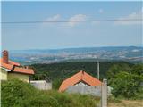 37
37
Discussion about the trip Stepani - Tinjan
|
| irena.brescak7. 01. 2020 |
Due to construction of access paths for the 2nd railway track, the route of the previous path on the other side of the motorway is interrupted and rerouted to the right along the asphalt road to the markers, where the path turns uphill. On signposts from Stepani, apart from markers, there is no Tinjan inscription.
|
|
|
To post a comment you must log in:
If you do not yet have a username, you must first
register.