Steljnik - Stene svete Ane
Starting point: Steljnik (615 m)
| Latitude/Longitude: | 45,7501°N 14,7628°E |
| |
Walking time: 1 h 20 min
Difficulty: easy marked way
Elevation gain: 349 m
Elevation difference along the route: 349 m
Map:
Recommended equipment (summer):
Recommended equipment (winter):
Views: 4.876
 | 1 person like this post |
Access to starting point:
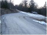
First, we drive to Ribnica (to here from Ljubljana or Kočevje) and then we continue driving past the company Inles, where we also cross the railway track. Just a little after the track we will notice the first signposts for Sveta Ana. Further, we ascend on a relatively nice macadam road which brings us higher to the waste dump, where there is a junction. We continue right (left - Sveta Ana from the farm Seljan) and we follow the road ahead past the waste dump to the next junction by which we park.
Route description:
From the crossroad, we continue in the direction of Sveta Ana on the road which ascends through the forest. After a good 5 minutes of walking, a road branches off to the right, which leads towards Črni vrh, and we continue straight ahead, also on the road which continues ascending through the forest.
Only a few meters before the next crossroad, a marked footpath which leads towards Sveta Ana turns left into a dense forest and starts moderately ascending. After a short ascent, a light descent follows and the path gets very close to the forest road which we recently left.
We continue in the direction of Sveta Ana on a cart track which further ascends diagonally towards the west. Further, the path from the farm Seljan joins from the left side, and we continue past the little church on a panoramic grassy slope to the mountain hut.
From the hut, we continue in the direction of Grmada and Stene svete Ane on the path which continues through the forest. A relatively gentle path soon brings us to the spot where a footpath branches off left upwards, which in a few steps brings us to the top of Stene svete Ane.
If we want to go to the nearby vantage point as well, we continue on the path which bypasses the peak and a little further brings us to a marked junction, where we continue right in the direction of Razgledišče (left - Grmada). From the junction to the viewpoint, we have only a minute of easy walking.
In snow and ice, there is a danger of slipping from the viewpoint.

Photos:
 1
1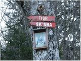 2
2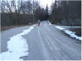 3
3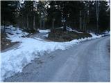 4
4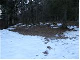 5
5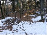 6
6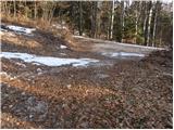 7
7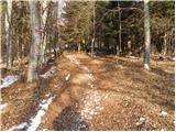 8
8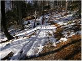 9
9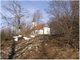 10
10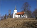 11
11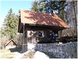 12
12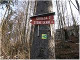 13
13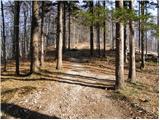 14
14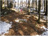 15
15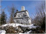 16
16 17
17 18
18
Discussion about the trip Steljnik - Stene svete Ane
To post a comment you must log in:
If you do not yet have a username, you must first
register.