Stara Fužina - Planina Blatce
Starting point: Stara Fužina (600 m)
| Latitude/Longitude: | 46,2903°N 13,8868°E |
| |
Walking time: 55 min
Difficulty: easy marked way
Elevation gain: 288 m
Elevation difference along the route: 300 m
Map: TNP 1:50.000
Recommended equipment (summer):
Recommended equipment (winter): ice axe, crampons
Views: 1.890
 | 1 person like this post |
Access to starting point:
We drive to Bohinjska Bistrica, then we continue driving in the direction of Bohinj Lake. In Ribčev Laz, from the intersection at the beginning of Bohinj Lake, we continue right in the direction of Srednja vas, Studor and Stara Fužina. The road then leads us over a bridge and past the church of St. John the Baptist, a few hundred meters further and we already arrive in Stara Fužina. In Stara Fužina we first drive past Pension Lipa, Triglav apartments, bus station, Mercator store, and then we arrive at the intersection by a chapel, where we continue on the left road in the direction of the parking lot, Korita Mostnice, Hudičev most and mountain paths on the mountain pasture Blato and Vogar and the path into the Voje Valley. From the intersection some ascent follows, when the settlement ends, we arrive at the paid parking lot, where we park.
Route description:
At the beginning of the parking lot the signs for Korita and waterfall Mostnice point us to the right on a wide path, on which in a few minutes we get to Hudičev most. We continue right (straight Korita Mostnice and Voje) over the bridge, after the bridge we go left on a footpath in the direction of Uskovnica. Already immediately when we leave the road, the path starts to ascend steeply through the forest. After a few minutes we cross a newer cart track, and then we continue ascending relatively steeply. Higher the steepness starts gradually decreasing, and the path brings us into a smaller valley, where the path entirely flattens and brings us out of the forest on the upper edge of the mountain pasture Blatce.
Here to the left continues a marked path towards Uskovnica, and we continue straight to the nearby cottages on the mountain pasture.
The description refers to the condition in 2018 (June), and the pictures are from various periods.

Along the route: Hudičev most (610m), Preval (893m)
Photos:
 1
1 2
2 3
3 4
4 5
5 6
6 7
7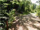 8
8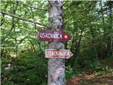 9
9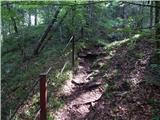 10
10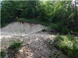 11
11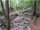 12
12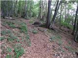 13
13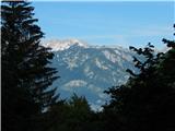 14
14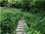 15
15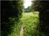 16
16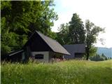 17
17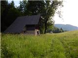 18
18
Discussion about the trip Stara Fužina - Planina Blatce
To post a comment you must log in:
If you do not yet have a username, you must first
register.