Star maln - Koča na Planini nad Vrhniko
Starting point: Star maln (386 m)
| Latitude/Longitude: | 45,9565°N 14,2489°E |
| |
Walking time: 1 h
Difficulty: easy marked way
Elevation gain: 347 m
Elevation difference along the route: 347 m
Map:
Recommended equipment (summer):
Recommended equipment (winter): ice axe, crampons
Views: 69.507
 | 1 person like this post |
Access to starting point:
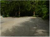
From the highway Ljubljana - Koper we go to the exit Vrhnika, and then we continue driving on the old road towards Logatec. At the last traffic light in Vrhnika, we recognize it by a nearby bank and pharmacy, we turn right and then in the next crossroads, we follow the road in the direction of Stari Malen. The road soon loses the asphalt covering and further leads us through the valley of Bela. We then follow the relatively gently sloping road all the way to the parking lot near the Koča v Starem Malnu.
From Logatec, we drive on the old road towards Vrhnika. Only a little after the road towards Zaplana branches off to the left, we will get to a less noticeable crossroad, where a road branches off to the left towards the village Strmica. In the mentioned village, we continue right and further we drive on the road which starts descending steeper towards the valley of Bela. After a short descent, we get to a smaller crossroad, where from the right the road from Vrhnika joins. We park on a large parking lot by the already mentioned crossroad.
Route description:
From the parking lot, we continue on a gently sloping macadam road, on which past the mill wheel, in less than 5 minutes of walking, we get to the Koča v Starem Malnu.
From the cottage, we continue in the direction of Lintvern and Planina and for a short time, we still continue on the road, and then it changes into a well-maintained footpath which continues along the stream Bela. After that, the path over a small bridge crosses Bela and then starts moderately ascending. We continue the ascent on the right bank of the stream, on a quite slippery path, by which a little higher we get help from a short steel cable (undemanding). The path then returns to the right side of the stream, where then in a few minutes of a diagonal ascent brings us to Lintvern (source of Bela).
At Lintvern, the path turns sharply to the right and after a short ascent, it brings us to a smaller vantage point, where we also step on an indistinct forested ridge. We for some time continue the ascent on the mentioned small ridge and then we cross two successive cart tracks. In both cases we continue in the direction of Planina, on the path which higher a few times quite steeply ascends. Higher, the path slightly flattens and in a few minutes of additional walking brings us to the Zavetišče na Planini nad Vrhniko, by which there is a good 20 m high lookout tower.
Description and pictures refer to the condition in June 2010.

Along the route: Koča v Starem Malnu (400m)
Photos:
 1
1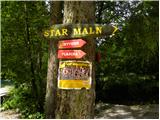 2
2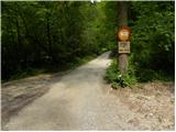 3
3 4
4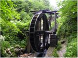 5
5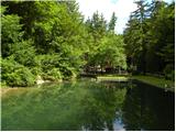 6
6 7
7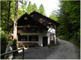 8
8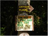 9
9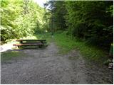 10
10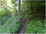 11
11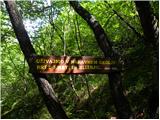 12
12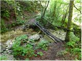 13
13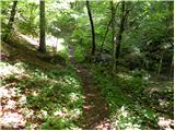 14
14 15
15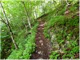 16
16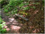 17
17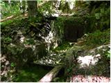 18
18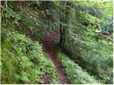 19
19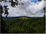 20
20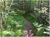 21
21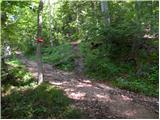 22
22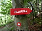 23
23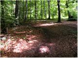 24
24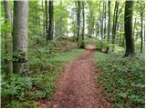 25
25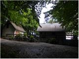 26
26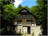 27
27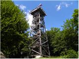 28
28 29
29
Discussion about the trip Star maln - Koča na Planini nad Vrhniko
|
| lynx.attentus6. 10. 2013 |
Today, my brother and I did a circular tour from the tank road, past Stari maln, Lintvern, to the top of Planina and past Špica back to Vrhnika.
Crossing the Bela gorge can be very demanding in snow and ice. Otherwise, a nice tour, and the forest road doesn't drag on for so long.
|
|
|
To post a comment you must log in:
If you do not yet have a username, you must first
register.