Stahovica - Kamniški vrh (circular path)
Starting point: Stahovica (443 m)
| Latitude/Longitude: | 46,2668°N 14,6036°E |
| |
Route name: circular path
Walking time: 2 h
Difficulty: partly demanding marked way
Elevation gain: 816 m
Elevation difference along the route: 816 m
Map: Kamniške in Savinjske Alpe 1:50.000
Recommended equipment (summer):
Recommended equipment (winter): ice axe, crampons
Views: 34.555
 | 3 people like this post |
Access to starting point:
In Kamnik we continue towards Kamniška Bistrica. After the village Godič we come to Stahovica, where we park. We can also arrive by bus, which runs from Ljubljana or from Kamnik.
Route description:
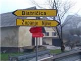
In Stahovica we go over the bridge, which is about 50 meters before the crossroad and the bus stop, along the asphalt road in the direction of Županje Njive. We get to a signpost, where the red mountain sign already points to Kamniški vrh and Bistričica. We follow the blazes, which lead us through the villages, then on a cart track and again on the asphalt road. Pay attention to the ventilation openings on hayracks and farm buildings. Soon we get to a signpost, which from the road directs us onto a footpath into a steep slope. When it ends, we continue through a grassy valley, after which the cart track brings us to the village Slevo. Through the village, and past the monument to the fallen partisans in the battle with national traitors, we continue to a pasture meadow. Here the path splits. The left one leads to Kamniški vrh or Krvavec over the mountain pasture Osredek and is approximately half an hour longer. We take the right path, which is at first gentle, later a steep ascent begins. We arrive at the saddle between Planjava and Kamniški vrh. Along the wide ridge we follow the right path to the summit. On the return we can, instead of the steep descent, return to Stahovica also over the mountain pasture Osredek.
On the saddle between Planjava and Kamniški vrh we go straight along the ridge and follow the marked path. At Osredek pay attention to go on the path that leads downhill from the hill – it is marked, but it is not labeled with a sign!

Photos:
 1
1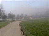 2
2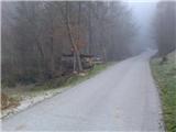 3
3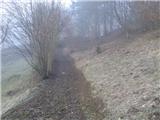 4
4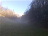 5
5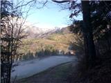 6
6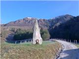 7
7 8
8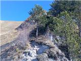 9
9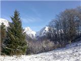 10
10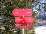 11
11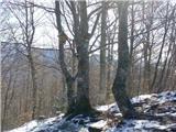 12
12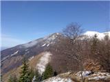 13
13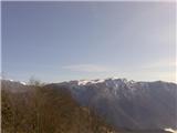 14
14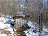 15
15 16
16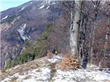 17
17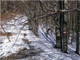 18
18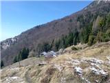 19
19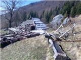 20
20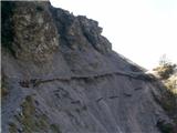 21
21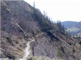 22
22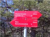 23
23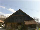 24
24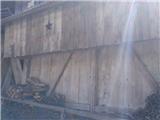 25
25
Discussion about the trip Stahovica - Kamniški vrh (circular path)
|
| Kriška5. 04. 2010 |
Please don't mind me, the author of the description, but for this path I would need some additional information:
- where in Stahovica should we park and in which direction from the parking lot should we go?
- How much of it is walking on asphalt road through villages (which ones?)?
- I don't know the place Stahovica, is there only one intersection and bridge there?
- Why should we pay attention to the ventilation lines on hayracks?
|
|
|
|
| ziga.subic5. 04. 2010 |
- From Kamnik drive along the main road towards Kamniška Bistrica. When the village of Godič ends, the village of Stahovica begins. Directly after the "Stahovica" traffic sign on the left side there is a parking lot (in front of the shop and inn). Right next to this parking lot there is a turn-off for the direction Županje Njive (the parking lot is at the edge of the intersection).
- Walking along the asphalt road (some gravel too) takes 25 minutes, going through Županje Njive and Bistričica, but not through the entire village, but several times through parts of the village.
- This intersection is the first one. Orient yourself by the inn and shop, right after the Stahovica sign. There is probably another bridge.
- The lines on the hayracks are not important for orientation, I mentioned them because they seemed interesting to me due to the different shapes in which they appear 
|
|
|
|
| Kriška6. 04. 2010 |
Many thanks, this trip will be on the schedule soon .
|
|
|
|
| ziga.subic6. 04. 2010 |
You're welcome. I hope you'll have a pleasant trip
|
|
|
|
| pohodnik2426. 10. 2010 |
Does anyone know the current conditions regarding the path to Kamniški vrh, since the path goes through Županje njive onwards on the sunny side probably no snow yet?
|
|
|
|
| tol26. 10. 2010 |
View from Kamnik reveals:
no snow.
|
|
|
|
| pohodnik2426. 10. 2010 |
Thanks for the information.
|
|
|
|
| bostjanp15. 01. 2012 |
Today was a beautiful day for a good excursion, circular path, to Kamniški vrh from Stahovica. There were quite a few ascenders from various starting points, some quick chats and also good advice for the return path to the starting point. May there be more such days this year like today.
|
|
|
To post a comment you must log in:
If you do not yet have a username, you must first
register.