Stahovica - Dom na Kisovcu
Starting point: Stahovica (430 m)
| Latitude/Longitude: | 46,2668°N 14,6036°E |
| |
Walking time: 2 h 30 min
Difficulty: easy unmarked way
Elevation gain: 845 m
Elevation difference along the route: 850 m
Map: Kamniške in Savinjske Alpe 1:50.000
Recommended equipment (summer):
Recommended equipment (winter): ice axe, crampons
Views: 18.242
 | 1 person like this post |
Access to starting point:
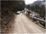
From Kamnik we drive to Stahovica, where at the crossroads we turn left towards the mountain hut Dom v Kamniški Bistrici and the cable car to Velika planina. We follow this road for only a few meters to the spot where a macadam road branches off to the right. Here we park on a smaller parking lot by the road or on one of the nearby parking lots.
Route description:
From the parking lot, we continue on the road which in a moderate ascent through the forest runs towards Primož. On the road where occasionally nice views open up, at the first crossroad we follow left. We follow the road ahead to a sharp left turn from which a wide cart track towards St. Primož branches off. The turn-off is marked! The path ahead ascends a little more steeply and brings us to the chapel. Behind the chapel, the path flattens and after a shorter crossing brings us to a pleasant well. A wide path again ascends a little and past another chapel brings us to a crossing, where we continue left in the direction of Velika planina (straight 5 minutes St. Primož). The path ahead starts to ascend more steeply, at first by the edge of the clearing and then through the forest, where after a few minutes of ascent we come to the next crossing. From the right joins the path from St. Primož, and left upwards continues a marked path towards Velika planina. Here we continue straight, on the other side of the ridge in the direction of the mountain hut Dom na Kisovcu. The path ahead is not marked! We continue the ascent on the path which in a gentle ascent crosses in parts quite steep slopes. After approximately 20 minutes of walking from the spot when we left the blazes, the path starts to ascend steeply. A relatively steep path brings us out of the forest only a few dozen meters before the mountain hut Dom na Kisovcu. From here to the mountain hut follows only a short light descent.

Photos:
 1
1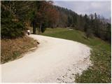 2
2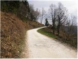 3
3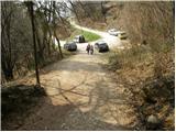 4
4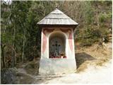 5
5 6
6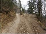 7
7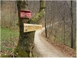 8
8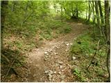 9
9 10
10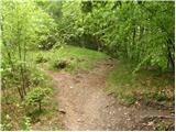 11
11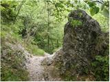 12
12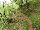 13
13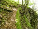 14
14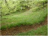 15
15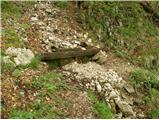 16
16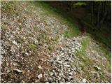 17
17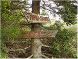 18
18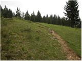 19
19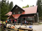 20
20
Discussion about the trip Stahovica - Dom na Kisovcu
|
| Kokta10. 06. 2012 |
Nice path past Sv. Promož, via Lepe ključe to Dom na Kisovcu.
|
|
|
|
| mado11. 12. 2023 11:27:55 |
The path is in poor condition from Sv. Primož towards Kisovec, lots of fallen trees and in some parts landslides have carried away parts of the path. Not for children.
|
|
|
To post a comment you must log in:
If you do not yet have a username, you must first
register.