SSK Sam Ihan - Veliki vrh (Križentaver)
Starting point: SSK Sam Ihan (294 m)
| Latitude/Longitude: | 46,133°N 14,6178°E |
| |
Walking time: 20 min
Difficulty: easy unmarked way
Elevation gain: 125 m
Elevation difference along the route: 125 m
Map: Ljubljana - okolica 1:50.000
Recommended equipment (summer):
Recommended equipment (winter):
Views: 2.060
 | 2 people like this post |
Access to starting point:
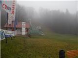
We leave the Štajerska motorway at the Domžale exit, then follow the signs for Krumperk Castle. We park just a short way past the motorway, in the parking lot by the SSK Sam Ihan ski jumping hills.
Route description:
At the end of the ski jumping centre, at the spot where there is a no-parking sign by the macadam road, we head onto the footpath, which enters the forest and begins to ascend moderately. Higher up, the path splits several times but rejoins higher up again, and it does not matter which directions we choose; the important thing is only that we ascend. After about 15 minutes of ascent, a marked path from Domžale joins us, and we continue the gentle to moderate ascent, which ends at Veliki vrh.
Description and pictures refer to the condition in 2018 (January).
Photos:
 1
1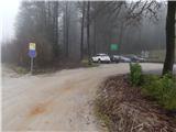 2
2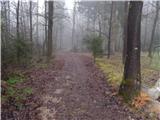 3
3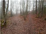 4
4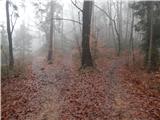 5
5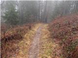 6
6 7
7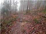 8
8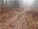 9
9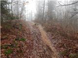 10
10 11
11 12
12
Discussion about the trip SSK Sam Ihan - Veliki vrh (Križentaver)
|
| mukica17. 01. 2018 |
Every morning we go with our dog Lord to Križentaver, during the week from the ski jump and back to Ihan, on weekends from home to the summit and back, sometimes extending past Tabor to Miklavž or Dobovlje to Okl on Goropeče and Ajdovščina, a loop that takes just under 3h...
|
|
|
To post a comment you must log in:
If you do not yet have a username, you must first
register.