Srednji Vrh - Kresišče (via Grajšca)
Starting point: Srednji Vrh (960 m)
| Latitude/Longitude: | 46,4894°N 13,8371°E |
| |
Route name: via Grajšca
Walking time: 2 h 50 min
Difficulty: easy unmarked way
Elevation gain: 879 m
Elevation difference along the route: 925 m
Map: Kranjska Gora 1:30.000
Recommended equipment (summer):
Recommended equipment (winter): ice axe, crampons
Views: 20.440
 | 3 people like this post |
Access to starting point:
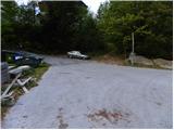
From the Ljubljana - Jesenice highway, take the Jesenice - west (Hrušica) exit and continue driving towards Kranjska Gora. When we arrive in Gozd-Martuljek, turn right towards Srednji Vrh and drive up the narrow and steep road to the mentioned settlement. When the road flattens a little, we will come to a crossroad of several roads and a turning area. Here we park in an appropriate place by the crossroad.
Route description:
From the turning point at Srednji Vrh, we continue north, where we soon arrive at a small crossroads. From the crossroads, we continue along the lower right road, closed to public traffic by a traffic sign. The road first descends slightly, then begins to ascend gently past a few houses, beyond which the asphalt ends. At two successive smaller crossroads just above the village, we continue left, then for some time follow the gently ascending road that crosses a large number of torrents, gullies and streams. In the lower part of the path, a few views open up on the Martuljek mountain group, then the road enters the forest. For the first hour of walking, the road ascends gently to moderately, then levels out and even descends slightly a few times. In the last part of the ascent along the road, the forest thins out and the path leads us to the Hladnik hunting hut, located in the middle of a large meadow.
Beyond the hunting hut we continue left, but the path soon brings us to an unmarked junction. Here we continue right into the forest and ascend further along a relatively steep cart track. Slightly higher we arrive at the next junction of cart tracks, where we take the right one, which continues traversing up to the right. The said cart track soon levels out completely and leads us to a small valley where we cross Hladnik stream. Immediately after the stream we turn left and ascend moderately beside it for a while, then the path enters dense forest where it begins to ascend steeply. After about 15 minutes of steep ascent, when the trail leads us out of the forest, it levels out and gradually fades on the grassy slopes of Grajšca. In places the poorly visible path, running through or beside the valley, leads higher past an animal watering place, and the valley forks into two parts just above the said watering place.
We continue along the left considerably longer and gentler valley, which gradually turns further left. Here, if we are quiet enough and a little lucky, we may spot a marmot.
At the start of the upper part of Grajšca we should pay attention, as a nice passage opens on the right towards the ridge between Maloško poldne and Kresišče. At a suitable spot, leave the path leading to Trupejevo poldne and head right onto easily passable pathless terrain, over which we ascend to the saddle between the aforementioned peaks in about 5 minutes.
Upon reaching the saddle, we join the marked Austrian path and follow it right towards Kresišče / Schwarzkogel (left Maloško poldne and Ostra peč).
Initially we still ascend through sparse forest, higher it is replaced by dwarf pines and increasingly beautiful views open up, especially on the Julian Alps. In the final part the path leads us onto grassy slopes followed by a short ascent to the summit.

Along the route: Lovska koca (1280m), Grajšca (1760m)
Photos:
 1
1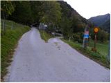 2
2 3
3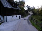 4
4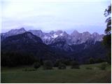 5
5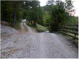 6
6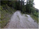 7
7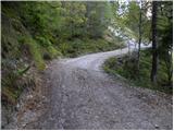 8
8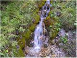 9
9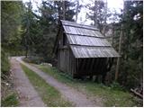 10
10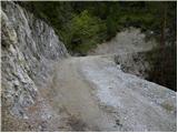 11
11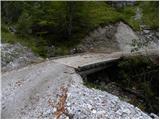 12
12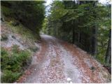 13
13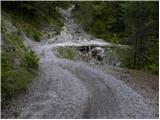 14
14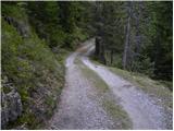 15
15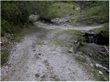 16
16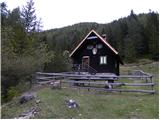 17
17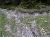 18
18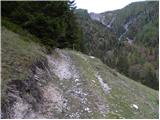 19
19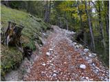 20
20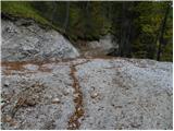 21
21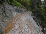 22
22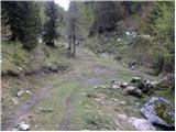 23
23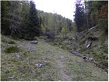 24
24 25
25 26
26 27
27 28
28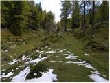 29
29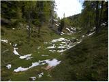 30
30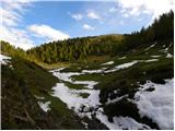 31
31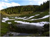 32
32 33
33 34
34 35
35 36
36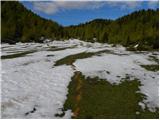 37
37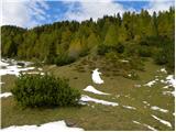 38
38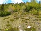 39
39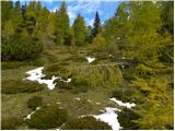 40
40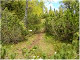 41
41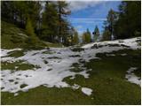 42
42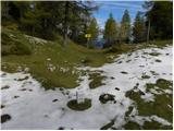 43
43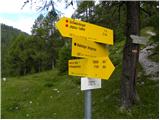 44
44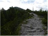 45
45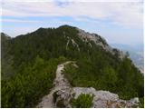 46
46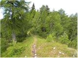 47
47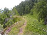 48
48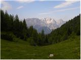 49
49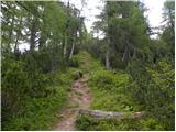 50
50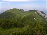 51
51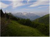 52
52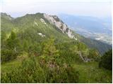 53
53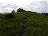 54
54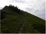 55
55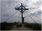 56
56 57
57
Discussion about the trip Srednji Vrh - Kresišče (via Grajšca)
|
| Biser gora21. 03. 2008 |
Kresišče is a beautiful, little-visited viewpoint in the Karavanke. I recommend a circular route. Ascent past Železnica and descent via Grajšco, in between we also climb to Trupejevo poldne.
|
|
|
|
| Otto26. 06. 2010 |
Yesterday I wandered around there and missed the path. Instead of Srednji vrh I ended up in Belci.
Otherwise super experience from Trupejevo poldne over Maloško to Kresišče.
Also no excessive crowds. Met only two.
|
|
|
|
| Flora124. 10. 2010 |
Yesterday we did the route from the village Srednji vrh, hunting hut, Kresišče, along the ridge to Maloško poldne, to Trupejevo poldne and down along the stream to the hunting hut and to the village Srednji vrh. Cold, but not as much as last week, windy. The path on the ridge is snowy in places, caution needed, otherwise beautiful ambiance with yellow larches and snow. Hunters were shooting again.  At Kresišče we still met people, further along the ridge and to the hunting hut no one. At Kresišče we still met people, further along the ridge and to the hunting hut no one.
|
|
|
|
| Flora124. 10. 2010 |
village Srednji Vrh 
|
|
|
|
| klm24. 10. 2010 |
The locals are all real "hunters". I don't know how many times it has happened to me that I set out before dawn to the peaks above Srednji Vrh, when before or on the courtyard of one of the huts I spotted or almost stepped on a shot chamois, less often roe deer.
|
|
|
|
| Flora125. 10. 2010 |
Yes, when we were talking at the hunting hut, they did mention chamois. And I thought they were joking. 
|
|
|
|
| klm25. 10. 2010 |
..then Austrian tourists come for chamois goulash....local specialty...
|
|
|
|
| katty12. 09. 2011 |
Yesterday hiked this trail. We started at the small hunting hut in Srednji Vrh (picture 5), continuing the trail to the right. The cart track is quite steep at the beginning, we walk it for about 20-30 min. We cross a small stream, where we refresh ourselves on the way back. Here the path narrows into a nice trail winding through the forest. After about 15 min we reach the wonderful Planina Grajšco, where our eyes and soul rest looking at the Julian Alps with Triglav and Špik in the lead. The view is truly magnificent. There we strengthen ourselves a bit with blueberries, then continue towards Kresišče, which we actually thought was Trupejevo poldne. We reach the saddle from which a view opens to Vrbsko jezero and the Drava river valley. The view is truly magnificent. To reach the summit, we need another 20 minutes or so. There a large cross awaits us, a summit book without a stamp and a very pleasant bench. Here the view is truly phenomenal. We sign in (as the first of the day) and head towards Trupejevo poldne. We walk along the SLO-AUT border. The path first ascends (on the right there is another summit with a large cross), then descends and finally we walk on the flat.
As for hunters - these days they are especially active, as they are looking for a bear that is rampaging around here and killing small livestock and cattle. We met two who were looking for both small livestock and cattle as well as the bear.
In short, I advise everyone heading to these parts in the near future to be especially careful.
Good luck and best regards, Katy
|
|
|
|
| Flora129. 11. 2011 |
Katty, that peak with the big cross is Maloško poldne.
|
|
|
|
| Flora130. 11. 2011 |
Ojstra peč = Nordgipfel,
Mallestiger Mittagskogel = Maloško poldne
The inscriptions on the picture are mixed up.
|
|
|
|
| misika30. 11. 2011 |
The Austrians also have this inscription on the cross on Ostra peč - Mallestiger Mittagskogel..
Maloško poldne is nearby, but the peak is a small meadow on which there is a border stone.
|
|
|
|
| ljubitelj gora12. 05. 2013 |
I returned via this path, photo 26 up to here from Srednji Vrh is a forest road, newly built and continues. Here the stream is also crossed, there's a log. Otherwise, the path from Srednji vrh drags on quite a bit and is rather long, I recommend a visit.
|
|
|
|
| fpetel117. 05. 2015 |
A few years ago I went along this path to Kresišče and then past Maloško poldne and Trupejevo poldne. Then to Blekova planina and down. I've walked a large part of the Slovenian hills, but this end is exceptionally beautiful to me - from the ridge there's a nice view of Koroška and Martuljek hills, beautiful nature and peace. Let's hope it stays that way.
|
|
|
|
| zajko11. 12. 2016 |
Yesterday in wonderful sunny and warm weather along the described path to Kresišče, then to Ostra peč and Maloško poldne to the saddle between Trupejevo poldne and Bela peč in the valley past the hunting hut to Srednji vrh. Nice tour, total ascent 1200 m and 6 hours walking.
|
|
|
|
| keti130. 03. 2017 |
Has anyone been to Kresišče in the last few days? Is there still any snow in the Hladnik stream valley?
|
|
|
|
| ločanka31. 10. 2017 |
This Kresišče is an exceptional viewpoint, I didn't know before, I convinced myself up there, the views are really magnificent. Probably the Austrians know this better, as I only met them on the ridge path. Really wonderful places!
|
|
|
|
| tango16. 02. 2019 |
Magnificent day to visit this area. Truly wonderful views of the Julian Alps, Western Julian Alps and across to the Austrian side and Drava with a backdrop of snow-covered peaks. Access is unproblematic, would be much easier with snowshoes (from the hunting hut onwards), but it was good training for strengthening the shoulder girdle. At the top four ski tourers and two hikers with snowshoes on their feet and us two, who watched them a bit enviously. But we enjoyed immensely. Tomorrow you still have time to go up, you won't regret it!
|
|
|
|
| tango19. 10. 2020 |
The forecast was favorable and with my wife we decided on Maloško poldne and Murnovc, but it was anything but nice. Fog started at Grajšica, even more towards Maloški, so we stuck to the trail to Kresišče. From the saddle onwards, about half a meter of snow, strong wind on top, zero views. Great for exercise, not to mention the air, and when the sun shines the larches will glow with joy.
|
|
|
|
| Fulcrum1. 10. 2023 10:52:16 |
From the place where we cross the stream (picture 25) to the beginning of the Grajšce pasture (picture 29), the path is now routed along a new gravel road/track, the old forest path is abandoned and overgrown.
When we reach the border ridge (picture 44), it's only half an hour to the top, although the Austrian signpost says 1 hour. If we go left from there, we're at Maloški poldnev in a good quarter of an hour.
|
|
|
|
| tango29. 12. 2025 17:53:34 |
It's been quite a while since we were at Kresišče and the nice warm weather in higher areas really called for a visit. We didn't regret it, the path is good, then classic from Grajšče onwards, as the footprints were quite deep and predecessors had nicely packed the snow, and although little snow, sometimes it sank up to their butts. The trampled path leads directly to the saddle (picture 48), just like we always go with my wife, from the saddle still unproblematic ascent to the top. Sunny, beautiful day, wonderful views, met no one, only a herd of chamois came rushing from the direction of Maloški poldneva and continued towards Velika Trati.
|
|
|
To post a comment you must log in:
If you do not yet have a username, you must first
register.