Spominski park taborišča Mauthausen Ljubelj - Sveta Ana (Ljubelj)
Starting point: Spominski park taborišča Mauthausen Ljubelj (930 m)
| Latitude/Longitude: | 46,4299°N 14,2689°E |
| |
Walking time: 20 min
Difficulty: easy unmarked way
Elevation gain: 102 m
Elevation difference along the route: 102 m
Map: Karavanke - osrednji del 1:50.000
Recommended equipment (summer):
Recommended equipment (winter): ice axe, crampons
Views: 924
 | 1 person like this post |
Access to starting point:
We leave the Gorenjska motorway at the Podtabor junction, from there we continue driving towards Tržič and border crossing Ljubelj. Further on, we drive past the turn-off to Tržič and continue driving towards the border crossing Ljubelj. After the last tunnel (we recognize it by the fact that after the tunnel there are steep scree slopes) before the border crossing, we soon arrive at a longer left bend, in the middle of which one of the paths towards the mountain pasture Korošica branches off to the right (starting point at the roadside hut). From here we continue on the main road, then quickly arrive at the parking lot by the memorial park Ljubelj, where we park. At the starting point there are also the adrenaline park Ljubelj and guesthouse Karavla Koren.
Route description:
From the parking lot, we head on the path in the direction of Korošica, which leads past part of the memorial park Ljubelj. Above the park the path goes into the forest, then after a few minutes it splits, and we choose the left cart track, which leads towards the church of St. Ana, the right cart track leads towards Korošica (the junction is not marked). A little further, we cross the main road towards Ljubelj, then the path quickly brings us out of the forest, to the upper right edge of a larger pasture. Along the pasture we ascend moderately with nice views on the eastern part of Begunjščica and the ridge of Ljubeljščica, then we cross another strip of forest. When we step out of the forest again, only a few minutes of light to moderate ascent separate us from the church of St. Ana.
Description and pictures refer to the condition in the year 2017 (February).
Photos:
 1
1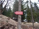 2
2 3
3 4
4 5
5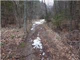 6
6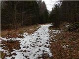 7
7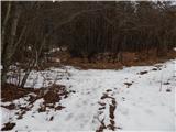 8
8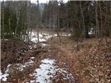 9
9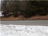 10
10 11
11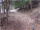 12
12 13
13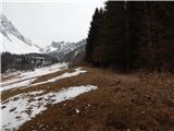 14
14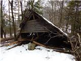 15
15 16
16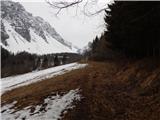 17
17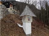 18
18 19
19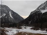 20
20
Discussion about the trip Spominski park taborišča Mauthausen Ljubelj - Sveta Ana (Ljubelj)
To post a comment you must log in:
If you do not yet have a username, you must first
register.