Spodnje Sleme - Govca (Olševa)
Starting point: Spodnje Sleme (1254 m)
| Latitude/Longitude: | 46,4385°N 14,7392°E |
| |
Walking time: 3 h
Difficulty: easy marked way
Elevation gain: 675 m
Elevation difference along the route: 705 m
Map: Kamniške in Savinjske Alpe 1:50.000
Recommended equipment (summer):
Recommended equipment (winter): ice axe, crampons
Views: 49.459
 | 2 people like this post |
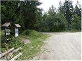
Access to starting point:
A) We drive to Luče (to here from Mozirje or from Kamnik over the Volovljek pass (Kranjski Rak)), then continue driving towards Logarska dolina. In the village Solčava we leave the main road towards Logarska dolina and continue driving right in the direction of Podolševa, Spodnje Sleme pass and Črna na Koroškem. Further on the road loses the asphalt surface, and after a few kilometres at the junction in Podolševa we turn right towards Črna na Koroškem. The road, which further mainly ascends transversely, brings us after some time to the Spodnje Sleme pass. We park at a suitable place on the mentioned pass.
B) We drive to Črna na Koroškem (to here from Ravne na Koroškem or from Šoštanj over the Spodnje Sleme pass), then continue driving towards Luče. Initially still an asphalt road, higher up it becomes macadam and brings us to the junction of several roads on the Spodnje Sleme pass. We park at a suitable place on the mentioned pass.
Route description:
From the starting point on the Spodnje Sleme pass we head onto the narrow road following the Olševa signs. Initially we walk along the road, then the markers lead us transversely into the forest, where we continue very briefly on the forest path. The path then returns to the road, and we walk along it for about half an hour, i.e., to the junction on Zgornje Sleme.
We continue on the marked path in the direction of Olševa, which quickly brings us to a pasture along which we then ascend. Initially we ascend along the pasture fence, then the path turns slightly to the right and through the forest begins to ascend somewhat more steeply. Further on we ascend steeply for quite some time, then, when we emerge from the forest just below Lepi vrh (1616 m), it levels out and transitions to a moderate and panoramic ridge.
From Lepi vrh onwards we walk along the panoramic ridge, the path is gentle, so we can peacefully observe the peaks above Logarska dolina and Robanov kot. Further the path leads us over the indistinct summit Odenični hriber (1863 m) and the somewhat more pronounced Gladki vrh (1850 m), where the path from Podolševa joins from the left.
A short descent follows and we arrive at a small saddle, where the path to the Planinski dom on the Kumer farm branches off to the right downwards, and we continue straight in the direction of Govca.
The path ahead continues along the left, mostly southern side of the ridge, where it crosses some steeper and at two points also exposed slopes (especially in wet conditions and snow risk of slipping). Further on the slope levels out somewhat, the path ascends somewhat more steeply. With nice views towards the mountains above Logarska dolina we quickly reach a kind of side ridge, along which we ascend in a few minutes to the main ridge of Olševa. Here the path turns left and after some 10 steps of further walking brings us to Govca.

Along the route: Zgornje Sleme (1308m), Odenični hriber (1863m), Gladki vrh (1850m), Visoka peč (1849m)
Photos:
 1
1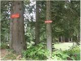 2
2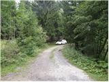 3
3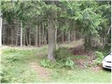 4
4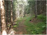 5
5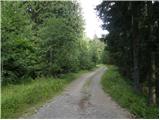 6
6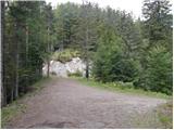 7
7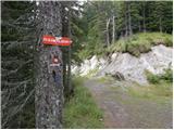 8
8 9
9 10
10 11
11 12
12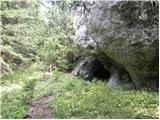 13
13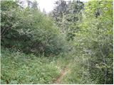 14
14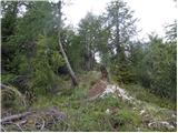 15
15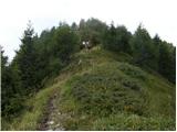 16
16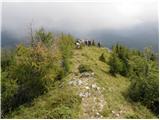 17
17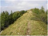 18
18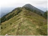 19
19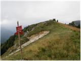 20
20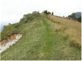 21
21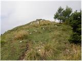 22
22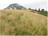 23
23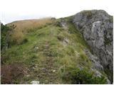 24
24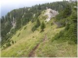 25
25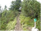 26
26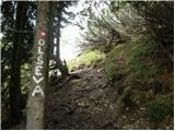 27
27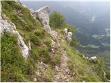 28
28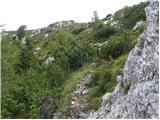 29
29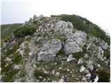 30
30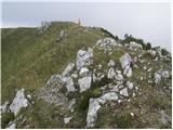 31
31 32
32
Discussion about the trip Spodnje Sleme - Govca (Olševa)
|
| MBrando17. 11. 2011 |
Yesterday I was with my boyfriend on Govca. SO BEAUTIFUL that I won't spoil the impressions with a description. You know, my mountain souls, what I mean and what such walks can offer you...ahh <3
No snow, nothing frozen, so hurry up, enjoy "up there"!
|
|
|
|
| Alni1. 07. 2012 |
Today on this path to Olševa-Govca
For approach from Luče, useful note: last part road gravel - ca. 7 km. Road well maintained, mostly not too narrow.
Path very nice, views wonderful. Just very hot day today.
Cheers!
|
|
|
|
| brina18. 09. 2012 |
A beautiful sunny day enriched us with wonderful views. Here and there still some patches of snow.
|
|
|
|
| franjo6615. 05. 2014 |
What are the conditions like?
|
|
|
|
| Janezs15. 05. 2014 |
The path was already completely bare, there were no major obstacles on the path either, but now there is some new snow. LP.
|
|
|
|
| denist10. 12. 2016 |
There was no stamp at the summit
|
|
|
|
| Misantrof10. 12. 2016 |
Did you perhaps look for it in the box?
|
|
|
|
| Misantrof10. 12. 2016 |
The stamp is namely concreted into the rock, unless someone walks in the mountains with an angle grinder.
|
|
|
|
| denist11. 12. 2016 |
I looked in the box, and checked that rock behind, found nothing.. probably overlooked it.. no problem
|
|
|
|
| garmont12. 12. 2016 |
The stamp is still on a 20cm long iron rod attached to the middle of the rock. I really don't understand how you didn't see it? 
|
|
|
|
| denist12. 12. 2016 |
I didn't know that was the stamp haha haha
|
|
|
|
| mornar22. 05. 2018 |
What are the conditions like for Olševa from Spodnje Sleme? Best regards.
|
|
|
|
| Janezs22. 05. 2018 |
After double-checking, this path is normally walkable. Best regards.
|
|
|
|
| BaroA9. 07. 2019 |
Hi, does anyone know if the path from Sleme is all okay after the recent storms?
|
|
|
|
| branco3. 08. 2019 |
The trail is normally passable also from Sleme
|
|
|
|
| Carpfreak17. 09. 2019 |
Hi. Does anyone know if the path from Spodnje Sleme is normally passable?? Thanks
|
|
|
|
| mornar8. 07. 2020 |
Is the trail normally passable after the recent bad weather? Best regards.
|
|
|
|
| Janezs9. 07. 2020 |
Leave the car at the lower ridge and head carefree to Govca. The path is nicely cleared and marked. The same also from the north side - from Govševa planina. Best, J.
|
|
|
|
| mornar12. 05. 2025 06:14:13 |
Please provide information on the passability of the trail from Sleme to Govca and descent past the sinkhole to Rogarja. Thank you for the information and best regards.
|
|
|
|
| plaNinaPirsMajcen13. 11. 2025 14:58:22 |
Hi,
the path is well marked, you can also park at Zgornje Sleme (if you have less time). There's space for a few cars. Apart from one higher ditch on the road, the macadam is solid.
Along the path, it's worth visiting the small cave or hollow located under the ridge of Olševa, just before the path from Zadnji travnik joins.
Some of our impressions in video form:
https://youtu.be/t5KWqKT78TY?si=CaliJ7_O--hjhil-
Best, Nina
|
|
|
To post a comment you must log in:
If you do not yet have a username, you must first
register.