Spodnje Gorje - Planina Obranica
Starting point: Spodnje Gorje (620 m)
Walking time: 1 h 5 min
Difficulty: easy unmarked way
Elevation gain: 415 m
Elevation difference along the route: 415 m
Map: TNP 1:50.000
Recommended equipment (summer):
Recommended equipment (winter): ice axe, crampons
Views: 6.784
 | 3 people like this post |
Access to starting point:
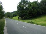
From the highway Ljubljana - Jesenice we take the exit Lipce, where we turn left in the direction of "Blejska Dobrava and Spodnje Gorje". Soon, when we drive into the railway underpass, we are at the next crossroad, where we go to the right - Bled, Kočna. Initially, the serpentine road ascends straight towards the west and soon in the left bend reaches the top or the settlement Kočna. When we drive through it, we drive another 3 km, after which by the road in front of the settlement sign Spodnje Gorje we notice a wooden sign with the inscription Gorje - welcome... Here, nearby, we park.
Route description:
Right before the wooden sign we step onto a grassy path that leads right uphill through a meadow. A little higher we notice a low hunting observation post. Beside it leads a cart track, which we follow; it soon takes us towards the northwest (right) into the forest.
The cart track, which becomes rutted and muddy, first ascends towards the northeast, later for some time also towards the southwest. When the steepness eases, we come to a junction, where we choose the right (or straight ahead) direction. Here we first walk on a slightly overgrown cart track, which ascends ever more steeply and develops a gravelly surface. When the steepness eases, the path first turns slightly left and then sharply right towards the north, where it levels out completely. At the next junction we continue right uphill; later, due to fallen trees, we leave the cart track for a while and walk alongside it on the right. When we return to it, we step out of the forest onto a gently sloping meadow covered with spruces, passing a hovel after which we re-enter the forest after some time. There follows some more ascent in switchbacks, after which we come to a gate with an inscription. We enter the mountain pasture, and after some 10 m we come to a stone ruin, where we first head right uphill to the panoramic summit, and from there on to the shepherd's hut, which is located on the western edge of the mountain pasture.

Photos:
 1
1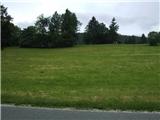 2
2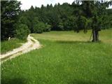 3
3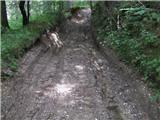 4
4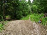 5
5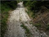 6
6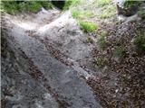 7
7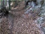 8
8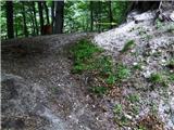 9
9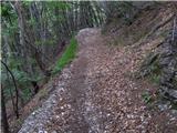 10
10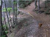 11
11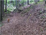 12
12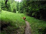 13
13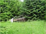 14
14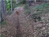 15
15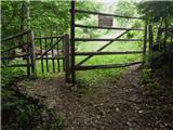 16
16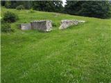 17
17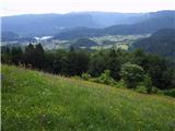 18
18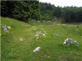 19
19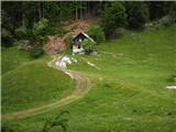 20
20
Discussion about the trip Spodnje Gorje - Planina Obranica
|
| gorazdr31. 10. 2011 |
Today I went on this trail. No more fallen trees but the trail itself is quite widened and newly churned up because they were obviously hauling timber. Just before the summit the logging road ends and no markings are visible. You need to turn left up the gully, after about 300m the remnants of markings are visible again.
I planned to return via Babe but couldn't find the path, so I went back to the logging road the same way. Before the start of the logging road, the gully descending on the left side seemed fine for descent. ...
|
|
|
|
| gorazdr31. 10. 2011 |
Descent down that gully turned out to be a bit more demanding than desired because there are at least 30 fallen trees in it, uprooted with roots, so some climbing over obstacles was needed. Just before the bottom there's a particularly steep and slippery section but it was successfully overcome with one scramble.
|
|
|
|
| heinz31. 10. 2011 |
Of course, towards the summit the logging road turns into a path (13th picture), the entire trail is actually unmarked (easy path).. Regards!
|
|
|
|
| heinz13. 07. 2013 |
Now the entire path from the bottom to the alpine pasture has been turned into a scree track. For a shortcut, we choose only the section in pictures 13-15 (Na Pesku). The landslide in pic.14 is no longer there.
|
|
|
|
| Jusk16. 10. 2019 |
Today on this path for afternoon hike. Since it rained this morning most of the path is quite muddy. From Obranica continue past snow cave to Škrbina (nicely arranged new viewpoint) and on to Zakop, from there by road back to Gorje. Nice circular path
|
|
|
|
| Jusk13. 01. 2020 |
Today again on this trail to Obranica, trail dry and no problem I finally checked out Snežna jama, passed by many times. Worth visiting, nice inside
|
|
|
|
| heinz13. 03. 2020 |
Since the last time I went on this path, it has changed quite a bit. Due to logging and timber hauling, they widened the entire path into a track leading from the starting point all the way to the pasture. On the pasture, everything is as before, so still nice. Best regards! H
|
|
|
To post a comment you must log in:
If you do not yet have a username, you must first
register.