Spodnje Dobeno - Rašica (Vrh Staneta Kosca)
Starting point: Spodnje Dobeno (400 m)
| Latitude/Longitude: | 46,1456°N 14,5369°E |
| |
Walking time: 50 min
Difficulty: easy marked way
Elevation gain: 241 m
Elevation difference along the route: 260 m
Map: Ljubljana - okolica 1:50.000
Recommended equipment (summer):
Recommended equipment (winter):
Views: 8.230
 | 2 people like this post |
Access to starting point:
From the road Trzin - Mengeš, we drive to the settlement Loka pri Mengšu, and then we follow the signs for Dobeno. When we get to Dobeno, at the first houses we notice signposts for Rašica and mountain hut Mengeška koča. We park at an appropriate place near the mountain signposts.
Route description:
From the starting point, we go on a marked path in the direction of Rašica and mountain hut Mengeška koča na Gobavici, and after a short ascent, we reach an asphalt road which we follow to the left. The path ahead leads us past a few more houses, and then blazes lead us right on a cart track, where we cross a lane of forest. At the crossing of cart tracks we continue on the left and then we walk by the edge of the forest to a marked crossing, where we go on the left path in the direction of Rašica (right Mengeška koča).
We continue in the direction of Rašica and for some time walk on the road. From the road at first to the right, the path branches off towards Selo, and a little further another path on Rašica, which we higher join.
On the part, where the path branches off to the left towards Zgornje Dobeno, we continue right in the direction of Rašica. Next follows some ascent and from the right at first joins the already mentioned path on Rašica, and a little higher we join the ridge path which leads from the mountain hut Mengeška koča.
We continue left, again in the direction of Rašica and we follow the marked path in a gentle to moderate ascent to few minutes distant Vrh Staneta Kosca, where there is a lookout tower, and a few 10 strides lower also the mountain hut.
Description and pictures refer to a condition in the year 2018 (April).

Photos:
 1
1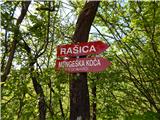 2
2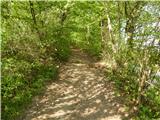 3
3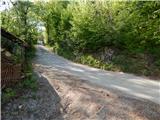 4
4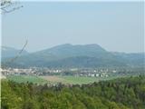 5
5 6
6 7
7 8
8 9
9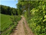 10
10 11
11 12
12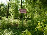 13
13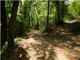 14
14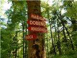 15
15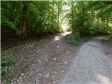 16
16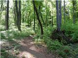 17
17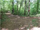 18
18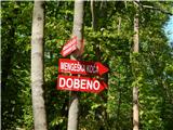 19
19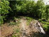 20
20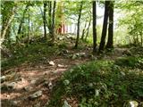 21
21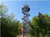 22
22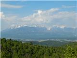 23
23 24
24
Discussion about the trip Spodnje Dobeno - Rašica (Vrh Staneta Kosca)
To post a comment you must log in:
If you do not yet have a username, you must first
register.