Spodnja Kokra - Mali Grintovec (via Baba)
Starting point: Spodnja Kokra (530 m)
| Latitude/Longitude: | 46,30270°N 14,47540°E |
| |
Route name: via Baba
Walking time: 4 h 55 min
Difficulty: easy unmarked way, easy marked way
Elevation gain: 1283 m
Elevation difference along the route: 1385 m
Map: Karavanke - osrednji del 1:50.000
Recommended equipment (summer):
Recommended equipment (winter): ice axe, crampons
Views: 1.060
 | 1 person like this post |
Access to starting point:
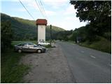
From the Ljubljana - Jesenice motorway, take the Kranj - east exit and continue following the road towards Jezersko. Just a few kilometres after the turn-off for Preddvor, on the right side of the road, we will spot a transformer station and a parking lot next to it, where we park. There are also signposts for the Dom Čemšenik here.
Route description:
From the parking lot, first carefully cross the road, then head onto the footpath towards Dom Čemšenik. The wide path ascends barely noticeably to the Polajnar farmstead, where we step onto the road and follow it to the right.
The road steeply ascends right after the house, but slightly higher it loses its asphalt surface. Further ahead, the road levels out and turns slightly to the left, approaching the Čemšeniški stream closely. A bit further, we cross the mentioned stream and immediately after it reach a marked junction, continuing on the left road towards Dom Čemšenik. The road then begins to ascend more steeply again and brings us to Dom Čemšenik after less than 30 minutes of further walking.
From Dom Čemšenik, continue behind the hut on a clearly visible but unmarked path that enters the forest, starting gently at first then becoming steeper. The path soon leads to a modest viewpoint, where it turns slightly right and ascends laterally. Higher up, it brings us to the main ridge (view over the Gorenjska plain), ascending even more steeply and reaching a flatter section with a wooden hut (weekend cabin) after a few minutes.
Just before the hut, the path turns right, leading after a few more steps to the logbook box on Baba.
From the logbook box, continue on the well-traceable trail along the occasionally scenic ridge, offering initial fine views towards Cjanovca, Kočna, Grintovec, Kalški greben and surrounding hills. The path initially follows the left side of the ridge, then after an indistinct saddle crosses to the right (eastern) slopes of Potoška gora. A short lateral ascent follows, then we join the marked path from Dom Čemšenik.
Continue upwards, arriving relatively quickly at the saddle between Potoška gora (left) and the subpeak of Javorov vrh (right).
At the saddle is a marked junction; continue right (left to Potoška gora, slightly left to Planinska koča Iskra na Jakobu (descent possible via one of these paths)) towards Javorov vrh. The path follows the wooded ridge, detouring the indistinct subpeak to the right. A gentle ascent follows with some views, then it re-enters the forest and forks.
Here, go left towards Srednji vrh, Kališča and Storžič (straight to Javorov vrh 15 min) on the path that soon reaches a pleasant spring after a few steps. A 30-minute traverse of slopes below Javorov vrh follows, ending at the saddle between it and Cjanovca.
At this marked junction, go left towards Hudičev boršt (straight to Srednji vrh and Cjanovca, sharp right to Javorov vrh) on the path traversing leftward slopes, with occasional short ascents and descents. About 15 minutes from the last junction, exit the forest onto grassy slopes of Zaplate, continuing the traverse. The technically easy path leads over occasionally steeper slopes, slippery when wet in spots. Near the end before the forest, a fixed rope helps; after it, the path flattens. Entering the forest, it's a short walk to the shelter.
From the shelter, head west to quickly reach the spring in Hudičev boršt, then a marked junction; go straight (left downhill Mačenska pot to Mače). A short grassy slope traverse follows, then into forest to the next junction.
Now go right towards Cjanovca, Srednji vrh and Mali Grintovec (straight to dom na Kališču and a path down to Mače) on a path steeply ascending through forest. The steep path leads higher to a small valley where forest thins and path levels. After minutes in the valley, it turns right, steeply ascends to the hut on Dolga njiva.
At the junction, take the less used trail horizontally behind the hut (up the valley side). It gently ascends Dolge njive valley, reaching a saddle with next junction after 20 minutes. Go left signed Mali Grintovec (right Srednji vrh). Moderately ascend overgrown slope to ridge where path from Kališča and Bašeljski vrh joins. Continue right to summit in minutes.
Izhodišče - Dom Čemšenik 0:50, Dom Čemšenik - Baba 0:45, Baba - Volčje jame 0:25, Volčje jame - razpotje pod Javorovim vrhom 0:10, razpotje pod Javorovim vrhom - Sedlo nad Skodovnjekom 0:15, Sedlo nad Skodovnjekom - razpotje Skodovnjek 0:10, razpotje Skodovnjek - Zavetišče v Hudičevem borštu 0:30, Zavetišče v Hudičevem borštu - razpotje pod Dolgo njivo 0:10, razpotje pod Dolgo njivo - Planina Dolga njiva 0:55, Planina Dolga njiva - sedlo nad Dolgo njivo 0:20, sedlo nad Dolgo njivo - Mali Grintovec 0:25.

Along the route: Dom Čemšenik (835m),
Baba (1098m),
Baba (1119m),
Planina Dolga njiva (1128m), Vrnitev na markirano pot (1198m), Volčje jame (1245m), Razpotje na grebenu Javorovega vrha (1291m), Izvir pod Javorovim vrhom (1322m), Sedlo nad Skodovnjekom (1336m), Razpotje Skodovnjek (1348m),
Zavetišče v Hudičevem borštu (1328m), Izvir v Hudičevem borštu (1328m), Razpotje pod Dolgo njivo (1282m),
Planina Dolga njiva (1600m), Sedlo nad Dolgo njivo (1709m), Razpotje pod Malim Grintovcem (1791m)
Photos:
 1
1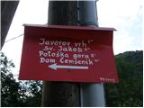 2
2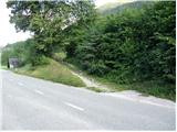 3
3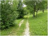 4
4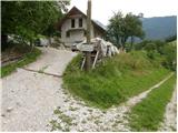 5
5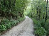 6
6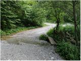 7
7 8
8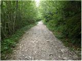 9
9 10
10 11
11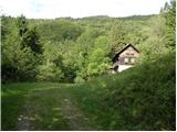 12
12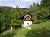 13
13 14
14 15
15 16
16 17
17 18
18 19
19 20
20 21
21 22
22 23
23 24
24 25
25 26
26 27
27 28
28 29
29 30
30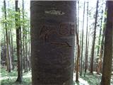 31
31 32
32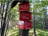 33
33 34
34 35
35 36
36 37
37 38
38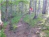 39
39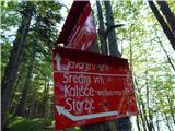 40
40 41
41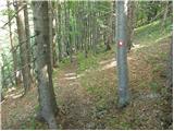 42
42 43
43 44
44 45
45 46
46 47
47 48
48 49
49 50
50 51
51 52
52 53
53 54
54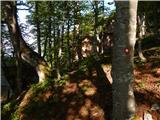 55
55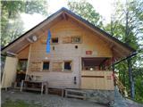 56
56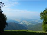 57
57 58
58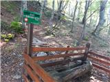 59
59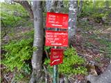 60
60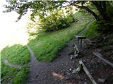 61
61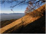 62
62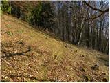 63
63 64
64 65
65 66
66 67
67 68
68 69
69 70
70 71
71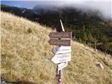 72
72 73
73 74
74 75
75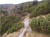 76
76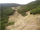 77
77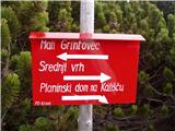 78
78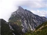 79
79 80
80
Discussion about the trip Spodnja Kokra - Mali Grintovec (via Baba)
|
| anjam9. 09. 2015 |
I pass by often, never met a living soul. Nice peak 
|
|
|
|
| Kranj10. 09. 2015 |
Well yeah there are some of us who know this route That's probably why it's not so crowded peak
|
|
|
To post a comment you must log in:
If you do not yet have a username, you must first
register.