Starting point: Spodnja Kokra (530 m)
| Latitude/Longitude: | 46,3027°N 14,4754°E |
| |
Walking time: 3 h 45 min
Difficulty: easy marked way
Elevation gain: 1290 m
Elevation difference along the route: 1290 m
Map: Karavanke - osrednji del 1:50.000
Recommended equipment (summer):
Recommended equipment (winter): ice axe, crampons
Views: 12.129
 | 2 people like this post |
Access to starting point:
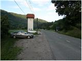
From the Ljubljana - Jesenice highway we head to the Kranj - East exit and follow the road ahead in the direction of Jezersko. Only a few kilometers after the turn-off for Preddvor we will notice a transformer on the right side of the road and a parking lot by it, where we park. Here are also signposts for the mountain hut Dom Čemšenik.
Route description:
From the parking lot we first carefully cross the road, then we head on a footpath in the direction of the mountain hut Dom Čemšenik. The wide path ascends barely noticeably to the homestead Polajnar, where we step onto the road, which we follow to the right.
The road steeply ascends just after the house, but a little higher loses the asphalt covering. Further the road flattens and turns slightly to the left, where it comes very close to the Čemšeniški potok stream. A little further we cross the mentioned stream and immediately after it we come to a marked junction, where we continue on the left road in the direction of the mountain hut Dom Čemšenik. The road then starts to ascend more steeply again and brings us to the mountain hut Dom Čemšenik after less than 30 minutes of further walking.
From the mountain hut Dom Čemšenik we continue in the direction of Javorov vrh (on the sign Javorjev vrh) on the path that goes into the forest after a few meters. The initially moderately steep path soon brings us to a torrent gully, along which we then ascend for some time. Higher the path turns right and ascends even more steeply. We follow this relatively steep path, which runs through dense forest the whole time, all the way to the junction on the saddle between Potoška gora on the left and Javorov vrh on the right.
We continue right (left Potoška gora and Sveti Jakob) on a moderately steep path that after a short ascent brings us to the southwestern ridge of Javorov vrh, from which some views open towards Cjanovca. The path goes only a little further again into the dense forest, where we come to the next well-marked junction.
Here we continue left in the direction of Srednji vrh, Kališče and Storžič (straight Javorov vrh 15 minutes) on the path that after a few more steps brings us to a pleasant spring. Next follows a half-hour crossing of the slopes below Javorov vrh, which ends on the saddle between the mentioned peak and Cjanovca.
We continue straight in the direction of Cjanovca and Srednji vrh (left Hudičev boršt, sharply right Javorov vrh) on the path that starts ascending more steeply along and beside the eastern ridge of Cjanovca. Higher the path brings us out of the forest onto slopes covered with dwarf pines, and we continue on an increasingly steep and in places very panoramic path. The path, from which beautiful views open onto Kočna, Grintovec, Kalški greben and Gorenjska, slowly turns slightly to the left. We then follow this increasingly panoramic and relatively steep path all the way to the summit of Cjanovca, on which stands a bench and a smaller cairn.
Spodnja Kokra - Dom Čemšenik 50 minutes, Dom Čemšenik - Cjanovca 2:55.

The trip can be extended to the following destinations: Srednji vrh
Photos:
 1
1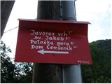 2
2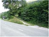 3
3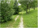 4
4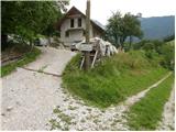 5
5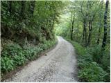 6
6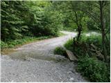 7
7 8
8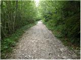 9
9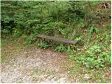 10
10 11
11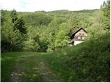 12
12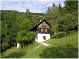 13
13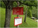 14
14 15
15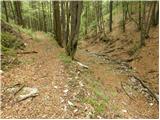 16
16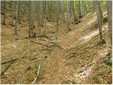 17
17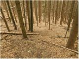 18
18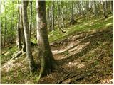 19
19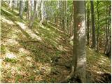 20
20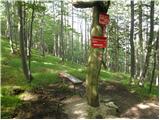 21
21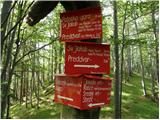 22
22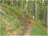 23
23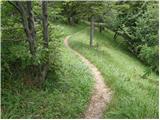 24
24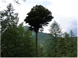 25
25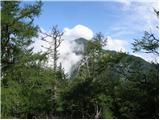 26
26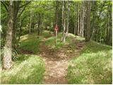 27
27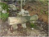 28
28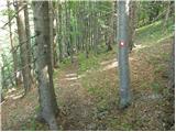 29
29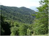 30
30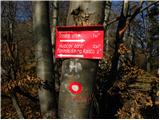 31
31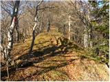 32
32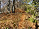 33
33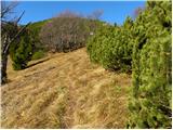 34
34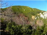 35
35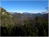 36
36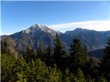 37
37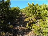 38
38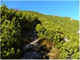 39
39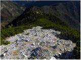 40
40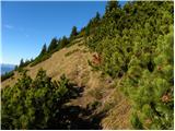 41
41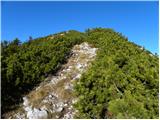 42
42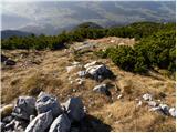 43
43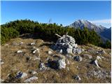 44
44 45
45
Discussion about the trip Spodnja Kokra - Cjanovca
|
| Branee9. 07. 2011 |
Hi
Yesterday I did the mentioned route, it's nice but I don't know how you meant the description as easy. Definitely not for someone not used to hiking 4 hours uphill, especially that part through the torrent gorge is quite killer.
Anyway, I enjoyed it, while my girlfriend's legs gave out, and she trains basketball professionally 
|
|
|
|
| limona24. 08. 2011 |
While waiting for the birth of our second grandchild, we set off from Sp. Kokra towards Cjanovca. On the way, we made a detour to Javorov vrh (I have a question: why does the modest one have two stamps, but Cjanovca none?) and then from Cjanovca to Srednji vrh. Four hours through beautiful forest and mostly soft path. The trail is correctly marked as easy, since there are no exposed or technically demanding sections anywhere. However, one must be aware of 1350m elevation gain (to Srednji vrh) or perhaps another 100m more if going via Javorov vrh. The trail is excellently marked, but in some places scree almost completely overgrows the path and it really needs to be trimmed.
|
|
|
|
| Branee5. 08. 2011 |
Yes it's nice up there (when you come out of that torrent gully, it looks like it's not from our planet  ) only the views are not that great if you take this path to cjanovca(zaplato) ) only the views are not that great if you take this path to cjanovca(zaplato) 
|
|
|
|
| domenc15. 03. 2014 |
Hi,
tomorrow I plan to go to Cjanovca from Jakob, and I'm wondering what the trail is like. Are crampons and gaiters enough or do I need an ice axe too (beginner on such snowy trails - do you recommend any other trails to try out crampons, gaiters, etc.)?
thanks, best regards domenc
|
|
|
To post a comment you must log in:
If you do not yet have a username, you must first
register.