Spodnja Idrija - Gradišče (above Spodnja Idrija) (via Trnje)
Starting point: Spodnja Idrija (305 m)
| Latitude/Longitude: | 46,0323°N 14,0257°E |
| |
Route name: via Trnje
Walking time: 2 h 15 min
Difficulty: easy unmarked way
Elevation gain: 693 m
Elevation difference along the route: 693 m
Map: Idrijsko in Cerkljansko 1: 50.000
Recommended equipment (summer):
Recommended equipment (winter):
Views: 4.811
 | 1 person like this post |
Access to starting point:
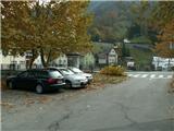
From Ljubljana, we drive towards Idrija. When we come to Idrija at the second traffic-light crossroads, we turn right towards Spodnja Idrija (4 km). At the beginning of Spodnja Idrija before the bridge, which crosses the river Idrijca at the store, we turn right onto the parking lot at the culture house (a larger parking lot). We can also cross the bridge, turn right and park right by the main road (a smaller parking lot).
Route description:
From a smaller parking lot by the main road and bridge over Idrijca we go on the asphalt road towards Pustota. After two sharp turns we come to a crossroad, where a sign for street Pot v Trnje points us left. On the left we are accompanied by hill Kopa, on the right there are remains of a swampy meadow with a small hayrack.
On the saddle between Kopa and Kazinski Grič there is a signpost. We continue right, past the hydropower plant Pečnik and a newer house, when soon behind it, we go left through a meadow to another newer house, and next to it again left on a cart track (above the cart track there is a fruit dryer with a projecting roof to store flax), which runs further to homestead Trnovše from the year 1798, extended in the year 1854. At that time they moved the old portal on the upper side, above the new entrance there is a niche for the statue of the Holy Family. A few meters above the homestead we notice a signpost and we continue on a cart track. After 5 minutes at the left turn we come to a crossroad, where we leave the cart track and we go right on a forest path. Higher, we go past the abandoned quarry, where they used to break stones, and soon after that again right on a poorly visible footpath (we can continue also on a well-visible path, longer path), both paths bring us to a thick spruce.
From here we go upwards towards the ridge, where after a few meters of walking, at the end of the ridge we already notice the Chapel of the Mother of God. Chapel of the Mother of God (renovated in the year 2000, Marjan Peternelj) stands on the shortest and oldest connection between Spodnja Idrija and Ledine, in a straight line between the churches in Ledine and Spodnja Idrija. We go far left behind the chapel (also the right or straight path would join higher up, both paths) and we steeply ascend past the hayfield named Zgor v gmajn to the homestead Žorgovše (a nicely renovated homestead, which stands alone, with a nice vantage point by the thick linden tree - Debela Lipa). We continue upwards on a cart track past Pečniški malni (first mentioned in the Loški urbar in the year 1318), where there is a water catchment. Just by the cart track before the first catchment there is a built bench for resting.
The cart track still leads upwards, when we come to an extensive meadow, we go left through the meadow and higher we come to an asphalt road. Here again to the left direction along the road (right along the road we would come to Ledine), to the branch-off to the right on a marked cart track, when we are already below the foot of Gradišče. After one hundred meters of walking we go again left (right marked cart track). We follow the cart track (right above we notice a water reservoir) to the hairpin turn to the right and after a few meters further, we direct ourselves left on a poorly visible path. Later the path becomes better visible, leading always upwards. Just below the summit a short steep ascent and before us is Gradišče with a transmitter.

Along the route: Domačija Trnovše (400m), Kapela Matere Božje (600m), Pečniški malni (660m)
Photos:
 1
1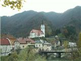 2
2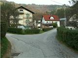 3
3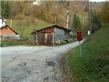 4
4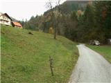 5
5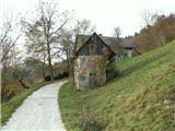 6
6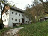 7
7 8
8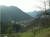 9
9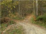 10
10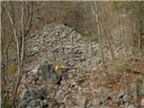 11
11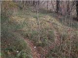 12
12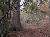 13
13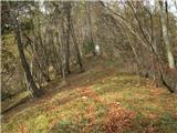 14
14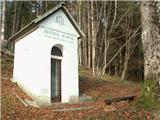 15
15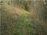 16
16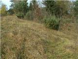 17
17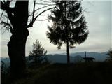 18
18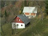 19
19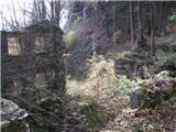 20
20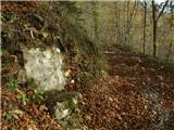 21
21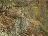 22
22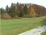 23
23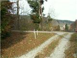 24
24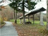 25
25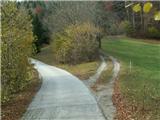 26
26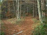 27
27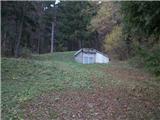 28
28 29
29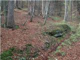 30
30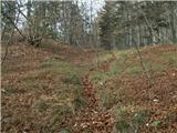 31
31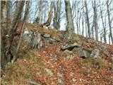 32
32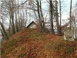 33
33
Discussion about the trip Spodnja Idrija - Gradišče (above Spodnja Idrija) (via Trnje)
To post a comment you must log in:
If you do not yet have a username, you must first
register.