Izvir Hublja - Otliški maj
Starting point: Izvir Hublja (250 m)
| Latitude/Longitude: | 45,9043°N 13,9114°E |
| |
Walking time: 1 h 25 min
Difficulty: easy unmarked way
Elevation gain: 597 m
Elevation difference along the route: 600 m
Map: Goriška 1:50.000
Recommended equipment (summer):
Recommended equipment (winter):
Views: 4.960
 | 1 person like this post |
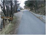
Access to starting point:
We drive on the highway from Razdrto towards Nova Gorica or vice versa and take the exit Ajdovščina. Then at the intersection (first traffic light) we continue straight in the direction of Col and Idrija. At the second traffic light we turn right, again in the direction of Col and follow the road only a few dozen meters to the spot where we cross the river Hubelj. Immediately after the bridge we turn left in the direction of the source of Hubelj (by the road we notice tourist signs). We follow this road to the parking lot at the source of Hubelj.
Route description:
Near the parking lot, we notice the beginning of the path towards Otliško okno. The path first ascends stairs and then goes into the forest, where it moderately ascends for some time. The path then slightly descends and brings us to a panoramic slope from where a nice view opens towards the slopes of Čavna. The path then goes into the forest and quickly brings us to a bird house by which we notice a thermometer. Only a few meters ahead there is a pleasant bench by the path. Further on, the path starts to ascend and leads us past the spot where the story about the origin of Otliško okno is written. The path then becomes steeper and steeper and soon brings us to rocky slopes. The path step by step becomes more panoramic and varied. A little higher, the path brings us below Otliško okno, which we already see on the right side. Only a little further we notice the sign for Malo Otliško okno. Malo okno is only 10m distant from the path and is worth seeing. The path ahead passes into an indistinct gully in the middle of which during Christmas time we notice a nativity scene. At the top of the gully we come to the chapel where there is a logbook box and a stamp. Here we continue left in the direction of Predmeja on the path which crosses a shorter stretch of forest and then brings us to unvegetated slopes. We follow this path only a few minutes to the spot where an unmarked path branches off to the left, which after about five minutes of moderate ascent along the ridge brings us to the top of Otliški maj.

Photos:
 1
1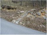 2
2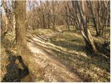 3
3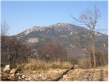 4
4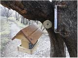 5
5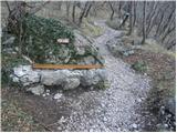 6
6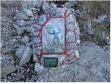 7
7 8
8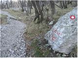 9
9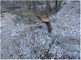 10
10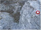 11
11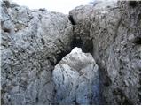 12
12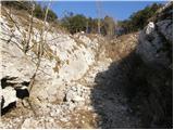 13
13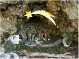 14
14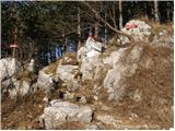 15
15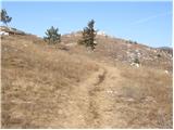 16
16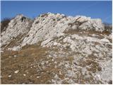 17
17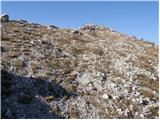 18
18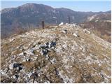 19
19
Discussion about the trip Izvir Hublja - Otliški maj
To post a comment you must log in:
If you do not yet have a username, you must first
register.